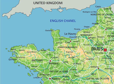
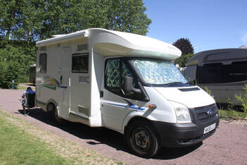
Brittany and Normandy 2023
We made the decision for our next trip not to drive so far. On our continental trip last year we had covered a lot of miles and diesel was expensive, especially in Germany. John’s back was much better following his operation last December, but his left knee was troubling him and long drives, especially if traffic was bad, resulting in a lot of gear changing, caused him pain.
So we decided to stick to northern France. Brittany was somewhere we had not been before and we’d often said we would like to go there.
A week before setting out we had a bit of a panic. John switched on the motorhome engine and the engine warning light came on and stayed on. Marshalls Ford Transit Centre in Cambridge diagnosed the exhaust gas recirculating valve and fortunately were able to replace it before our trip!
Tuesday 13th June
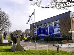
We packed the motorhome in the morning, then after lunch we set off towards Dover. Unfortunately Fiona was in London for work so we couldn’t meet up at The Valiant Sailor. We headed to Manston, west of Canterbury, and stayed overnight at the Spitfire museum, located on a former WW2 airfield (Britstop). Unfortunately it was just closing when we arrived and we shall have to leave before it opens tomorrow morning. Hopefully we can return sometime as it looked very interesting.
A pleasant spot and a quiet night.
Wednesday 14th June
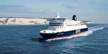
We drove to Dover to catch the 12.50 DFDS ferry to Calais. Smooth crossing. From Calais we took the coastal road south to Wissant aire – very crowded but we found a space. The weather was very warm, around 30° C.
We drove to Dover to catch the 12.50 DFDS ferry to Calais. Smooth crossing. From Calais we took the coastal road south to Wissant aire – very crowded but we found a space. The weather was very warm, around 30° C.
|

|
Thursday 15th June
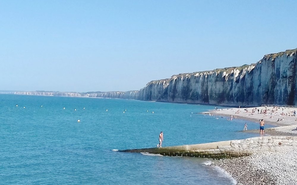
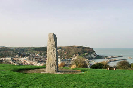
We followed the coastal road to Dieppe and then headed to the beach resorts south - narrow, twisty roads, crowded small seaside towns with no suitable parking. Eventually we found parking below the cliffs in St. Valery-en-Caux.
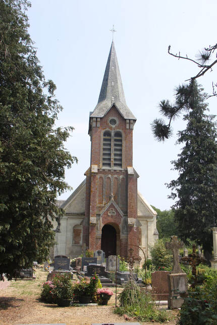
In June 1940, the 51st (Highland) Infantry Division was attached to French 10th Army and after a fighting retreat from the Somme the greater part of the division was forced to surrender, having been cut off at St Valery-en-Caux on the Channel coast. Many of the soldiers escaped and many died climbing down the cliffs to reach the boats sent to rescue them.
Monuments on either side of the deep ravine where the town is situated are a stark reminder of the brutality of war.
We followed the coastal road to Dieppe and then headed to the beach resorts south - narrow, twisty roads, crowded small seaside towns with no suitable parking. Eventually we found parking below the cliffs in St. Valery-en-Caux.
In June 1940, the 51st (Highland) Infantry Division was attached to French 10th Army and after a fighting retreat from the Somme the greater part of the division was forced to surrender, having been cut off at St Valery-en-Caux on the Channel coast. Many of the soldiers escaped and many died climbing down the cliffs to reach the boats sent to rescue them.
Monuments on either side of the deep ravine where the town is situated are a stark reminder of the brutality of war.
|
|
Friday 16th June
Despite being packed in like sardines, the overnight aire de camping car was quiet! Fortunately by the time we left the motorhome next door had gone making getting out a little easier.
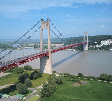
After stopping to buy food we headed towards Caen. Traffic was light and we made good progress. We had to pay a €3.40 toll for the Pont de Tancarville crossing the river Seine.
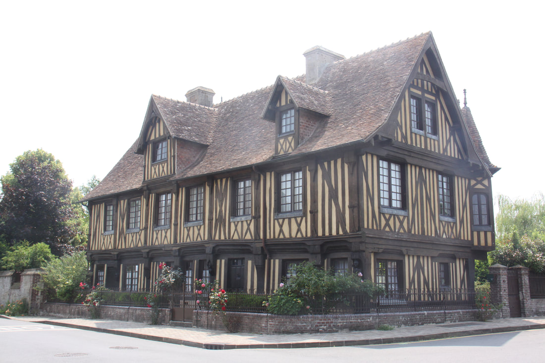
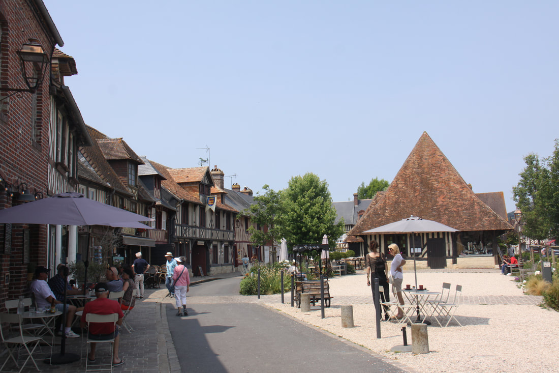
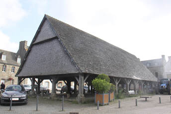
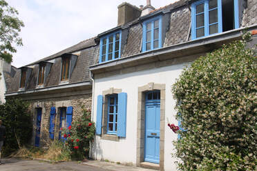
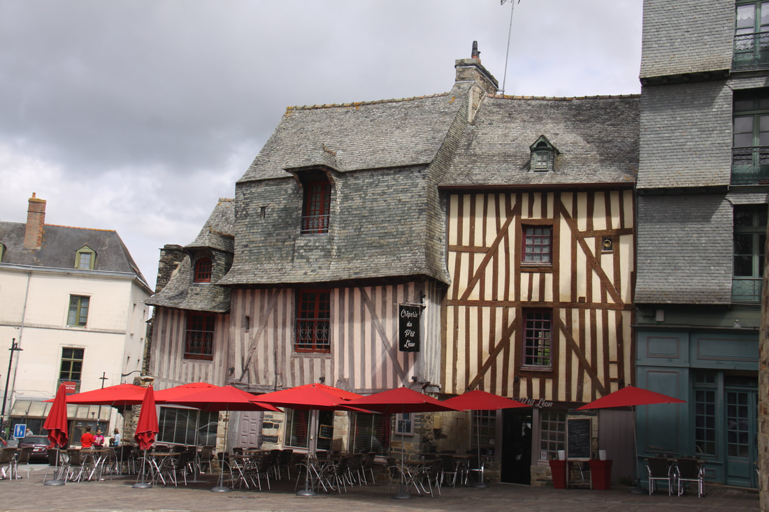
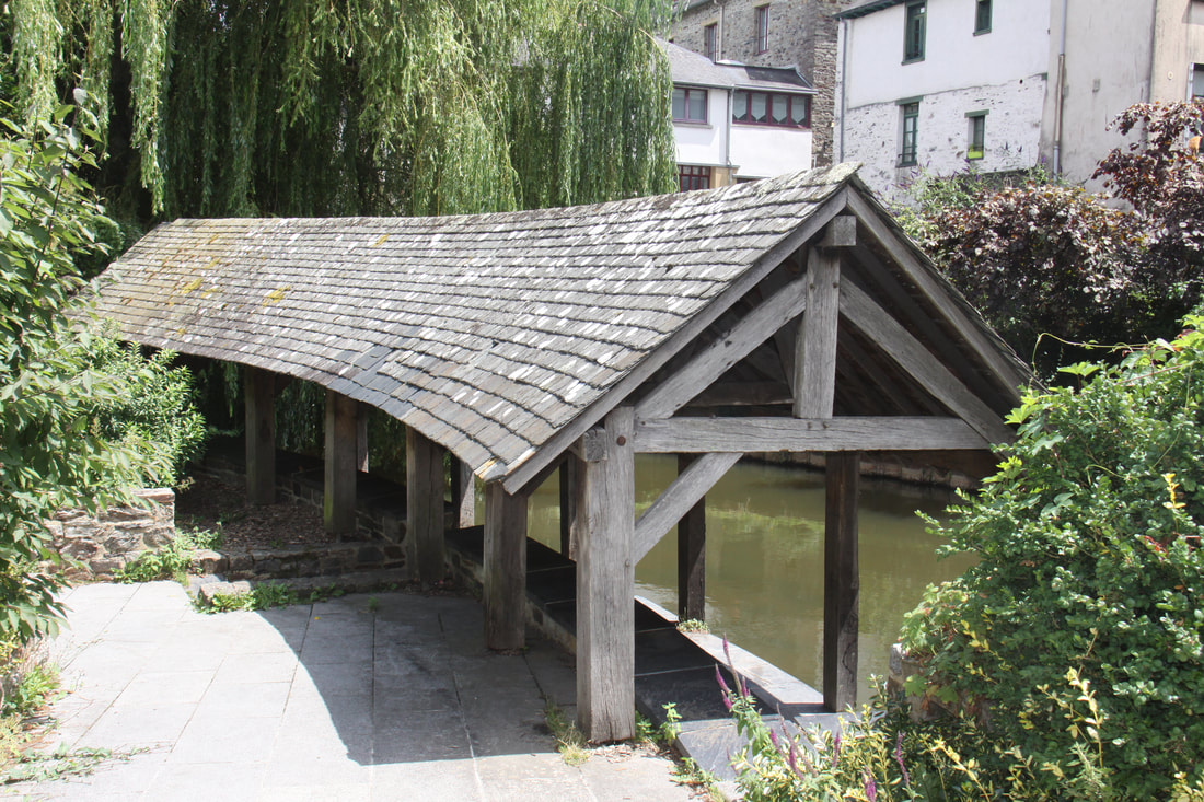
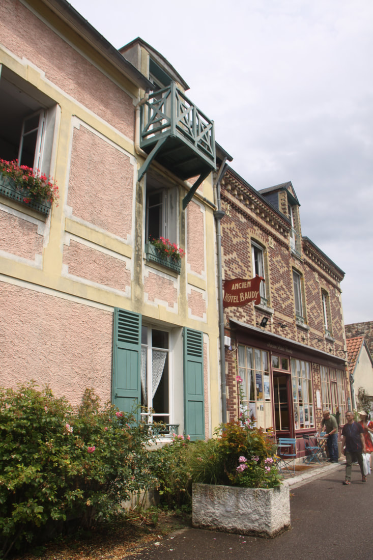
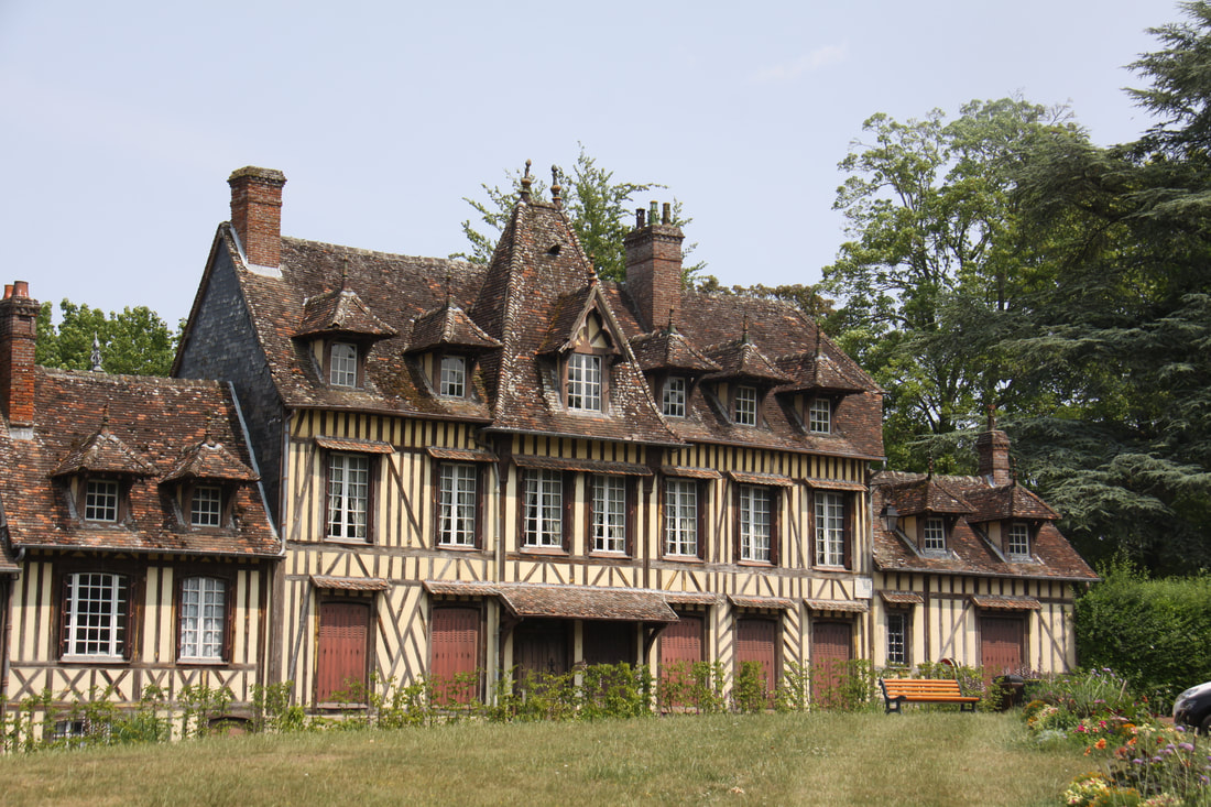
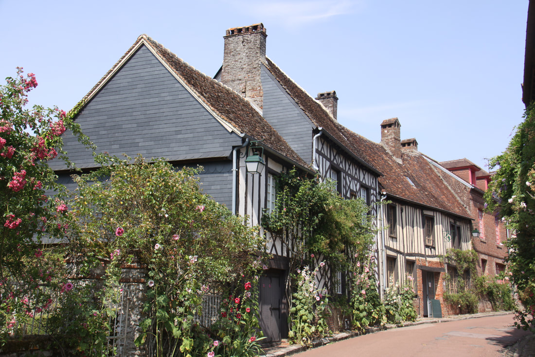
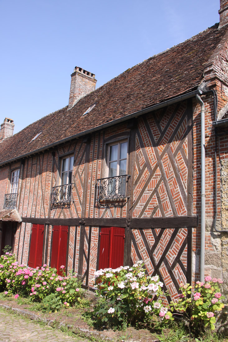
After lunch we visited Beuvron-en-Auge, one of the beautiful villages of France. Here a ring of typical Normandy half timbered houses nestle round the covered market. An elegant manor house borders a tiny stream where a washing shed is still located.
Overnight on the aire close to the village centre.
Despite being packed in like sardines, the overnight aire de camping car was quiet! Fortunately by the time we left the motorhome next door had gone making getting out a little easier.
After stopping to buy food we headed towards Caen. Traffic was light and we made good progress. We had to pay a €3.40 toll for the Pont de Tancarville crossing the river Seine.
After lunch we visited Beuvron-en-Auge, one of the beautiful villages of France. Here a ring of typical Normandy half timbered houses nestle round the covered market. An elegant manor house borders a tiny stream where a washing shed is still located.
Overnight on the aire close to the village centre.
|
|
Saturday 17th June
After filling up the motorhome with diesel and buying food for the day we headed west using fast roads and toll-free motorways. There were few lorries on the road so we made good progress.
It was another hot day so we were pleased to reach our planned overnight stay by 2 pm. The aire at Sains had six individual shady bays, electricity was included in the €7.50 charge.
Sunday 18th June
Very close to the aire was a boulongerie so we bought a baguette before leaving. The shop keeper was an English lady who had settled in France and she directed us to the nearest supermarket so that we could do the rest of our shopping.
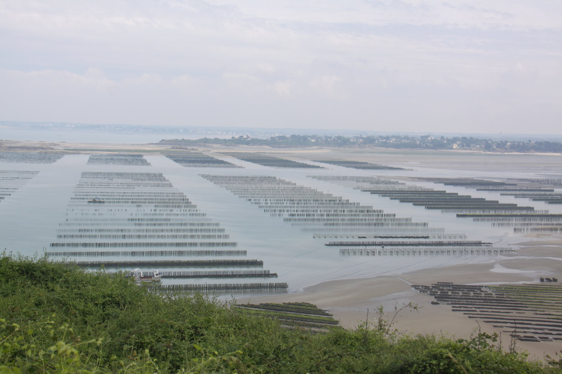
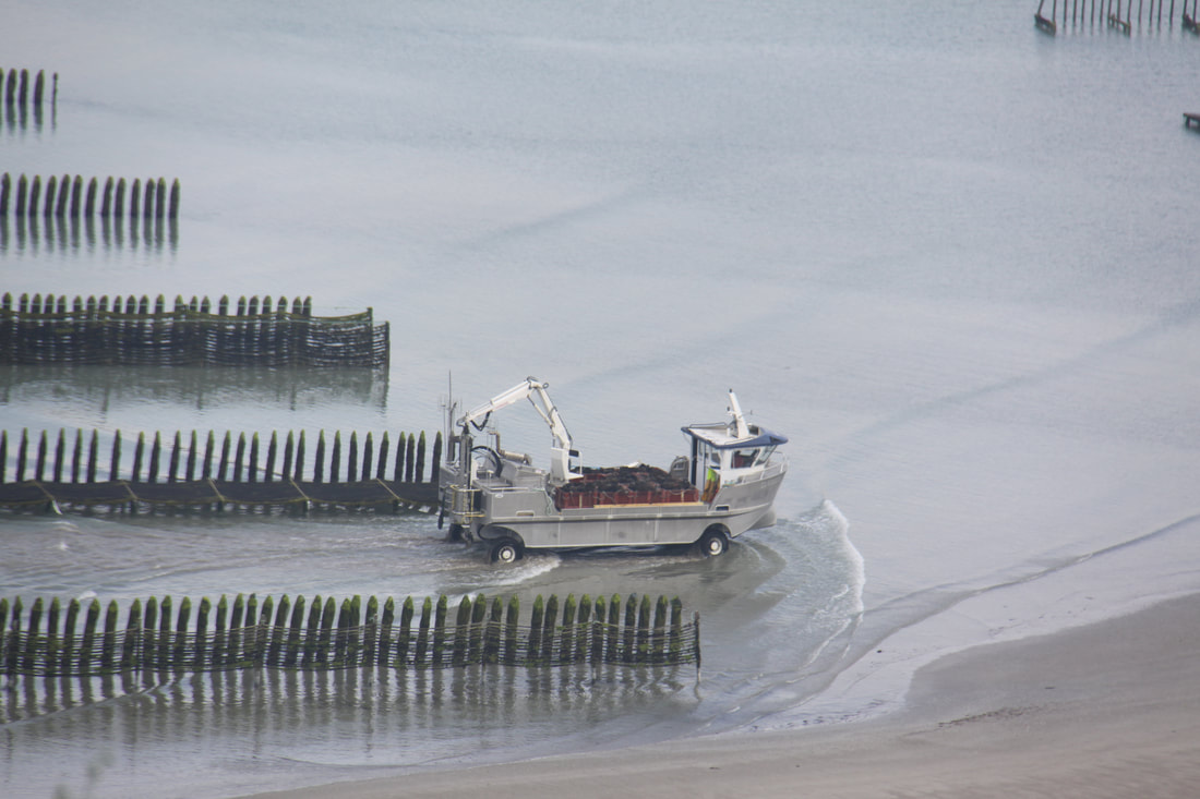
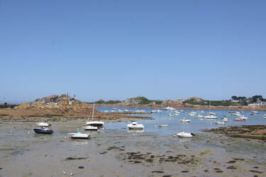
After the last few days heat the weather finally broke and we had very heavy rain for most of the morning. We decide to shorten our drive and headed to the coast west of St. Malo, stopping at an aire on the cliffs. Once the weather cleared we had superb views across the bay to St. Cast Le Guilds.
At low tide the oyster beds were exposed and we watched an amphibian vehicle checking the beds.
After filling up the motorhome with diesel and buying food for the day we headed west using fast roads and toll-free motorways. There were few lorries on the road so we made good progress.
It was another hot day so we were pleased to reach our planned overnight stay by 2 pm. The aire at Sains had six individual shady bays, electricity was included in the €7.50 charge.
Sunday 18th June
Very close to the aire was a boulongerie so we bought a baguette before leaving. The shop keeper was an English lady who had settled in France and she directed us to the nearest supermarket so that we could do the rest of our shopping.
After the last few days heat the weather finally broke and we had very heavy rain for most of the morning. We decide to shorten our drive and headed to the coast west of St. Malo, stopping at an aire on the cliffs. Once the weather cleared we had superb views across the bay to St. Cast Le Guilds.
At low tide the oyster beds were exposed and we watched an amphibian vehicle checking the beds.
|
|
Monday 19th June
On leaving our overnight halt with the view overlooking the serried lines of oyster beds we headed along the coast until we saw the signs to Cap Fréhel. Dominating the sea at over 70 metres high, the shale and pink sandstone cliffs offer one of the most beautiful views of Brittany.
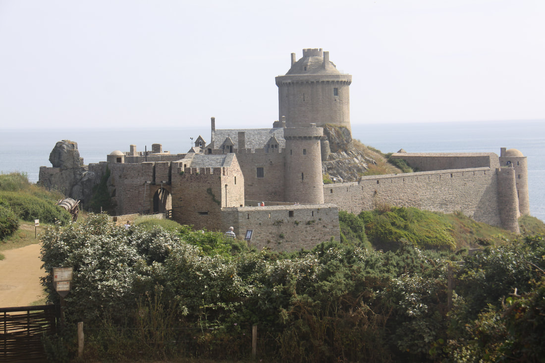
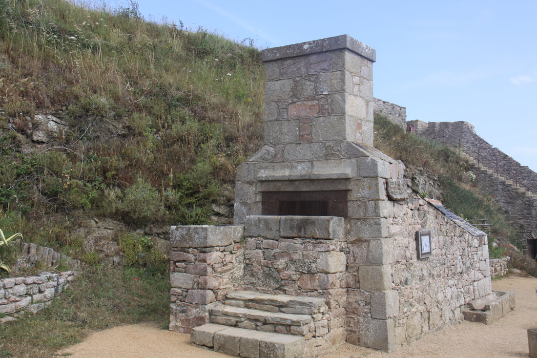
Just east of the cape, a small side road leads off to Fort La Latte situated on a headland. The fortress was built in the 13th century, changing hands a number of times over the centuries. During WW2 the occupying Germans even used it for housing prisoners of war.
After the war the owners repaired the damage and restored the castle and grounds. Of particular interest was the cannon ball foundry.
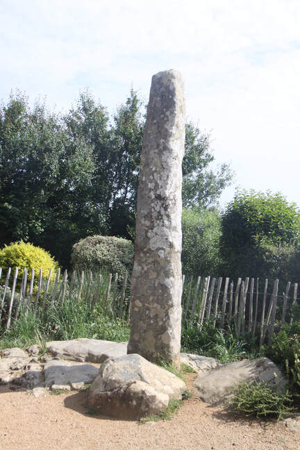
On the path leading to the castle is a menhir otherwise known as the "Doigt de Gargantua". According to legend it is the finger of the giant, the islets found in the sea are parts of his body!
On leaving our overnight halt with the view overlooking the serried lines of oyster beds we headed along the coast until we saw the signs to Cap Fréhel. Dominating the sea at over 70 metres high, the shale and pink sandstone cliffs offer one of the most beautiful views of Brittany.
Just east of the cape, a small side road leads off to Fort La Latte situated on a headland. The fortress was built in the 13th century, changing hands a number of times over the centuries. During WW2 the occupying Germans even used it for housing prisoners of war.
After the war the owners repaired the damage and restored the castle and grounds. Of particular interest was the cannon ball foundry.
On the path leading to the castle is a menhir otherwise known as the "Doigt de Gargantua". According to legend it is the finger of the giant, the islets found in the sea are parts of his body!
|
|
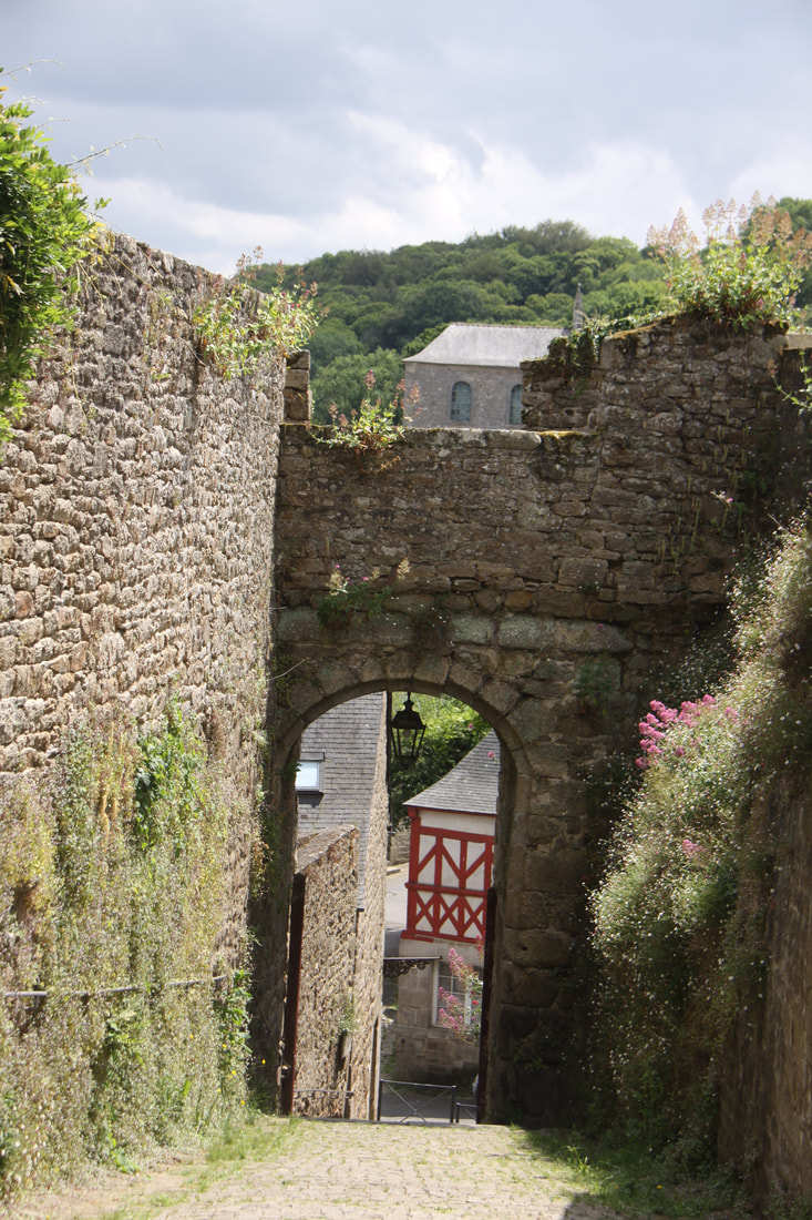
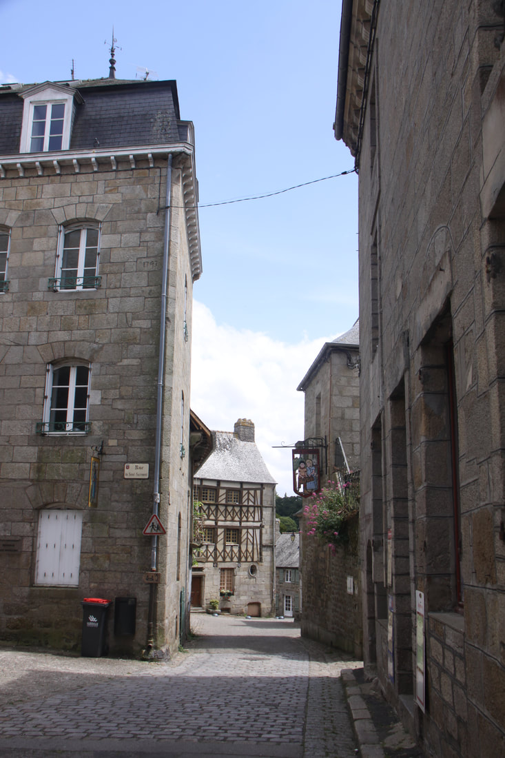
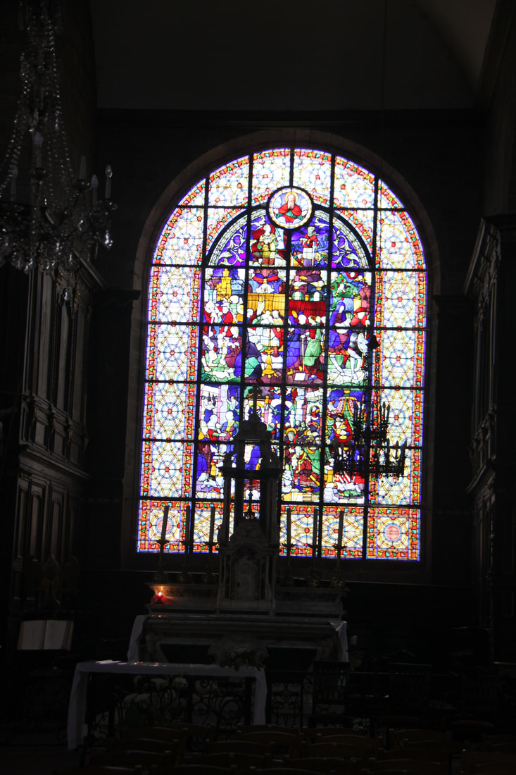
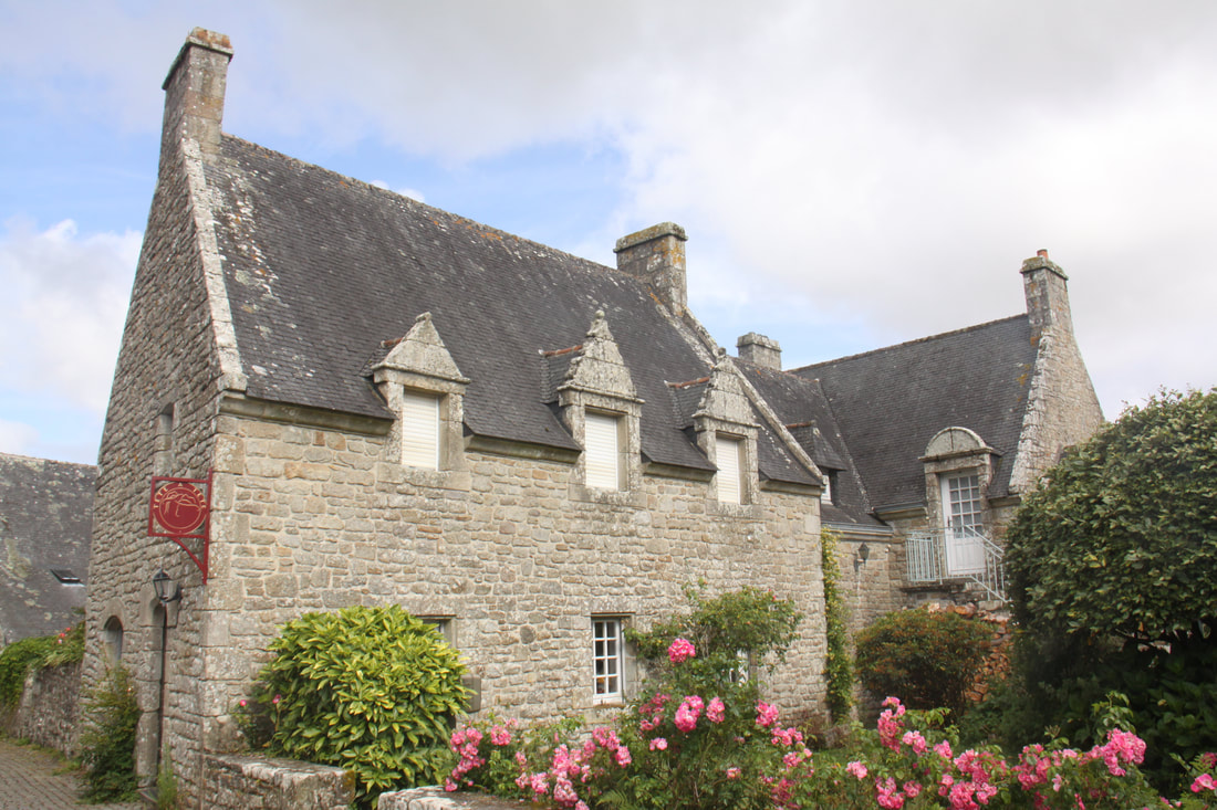
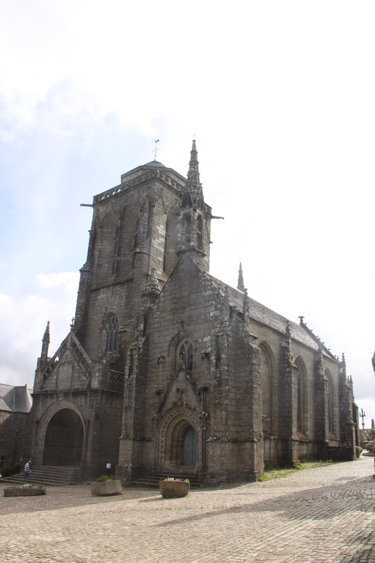
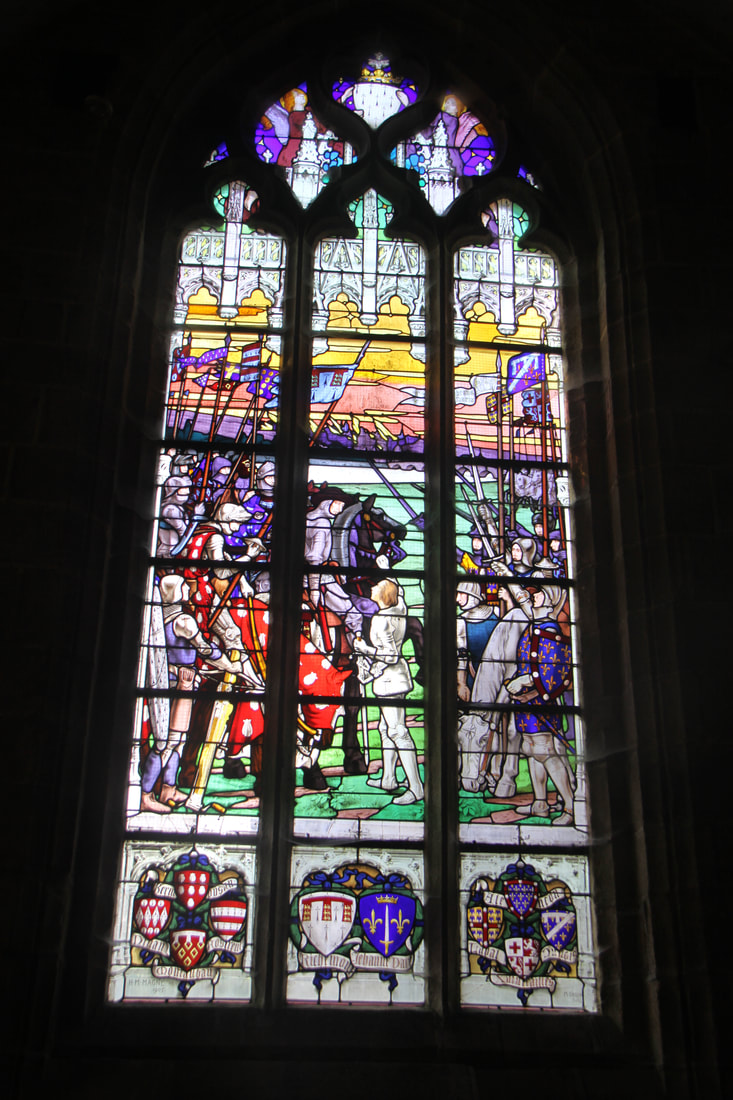
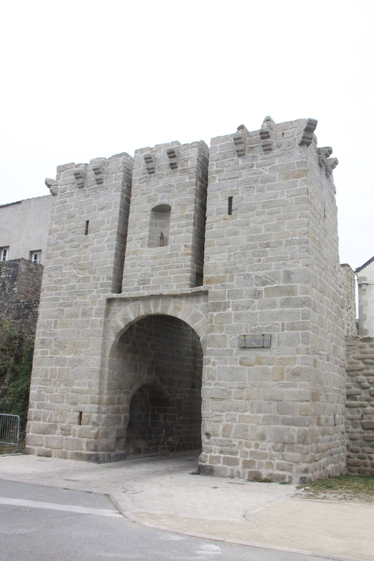
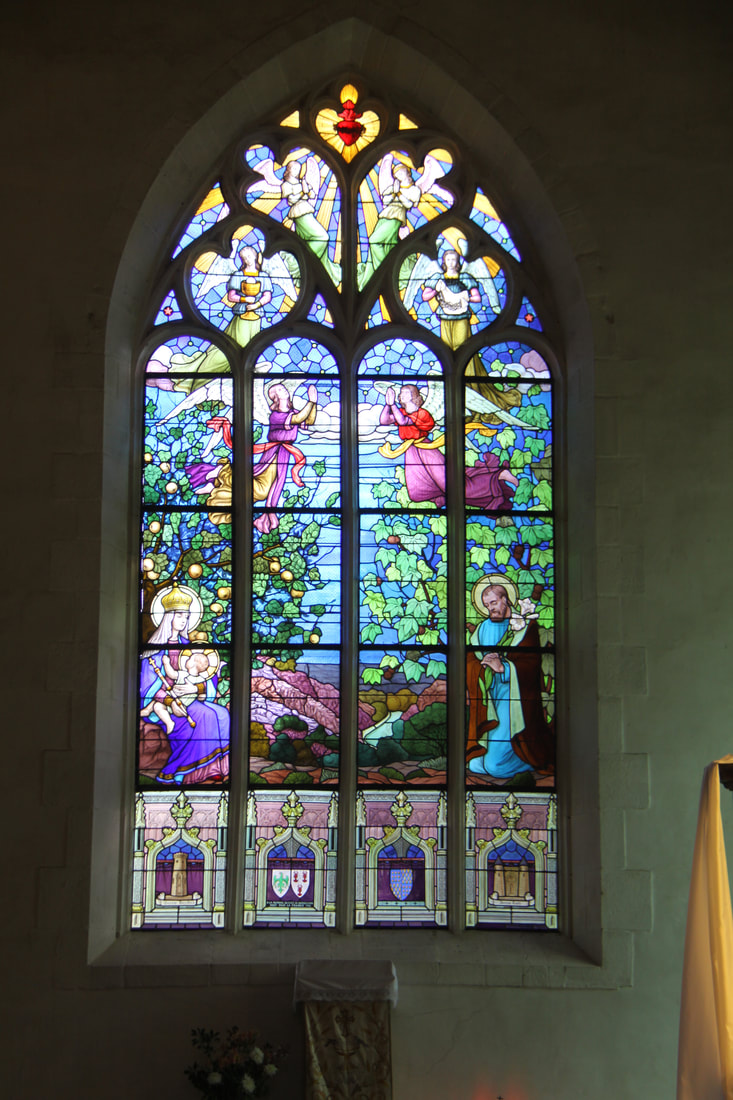
Moncontour, one of the beautiful villages of France was some twenty miles inland from the coast. The village is enclosed by impressive medieval ramparts. Within the walls the town houses constructed of granite and slate line the narrow streets where steep steps link the town to the valley below. Inside the Church of Saint Mathurin, the 16th century stained glass windows depict scenes from the life of St. Yves.
We had a few problems locating an aire for tonight but eventually found one near the small village of Lanfains. That night the rain absolutely hammered down and we were parked on a grassy field next to a lake!
We had a few problems locating an aire for tonight but eventually found one near the small village of Lanfains. That night the rain absolutely hammered down and we were parked on a grassy field next to a lake!
|
|
|
Tuesday 20th June
Woke up next morning and were relieved to find we were not underwater. We even managed to drive off the field easily enough. Having literally gone “round the fields” for mile after mile to find our aire, we discovered on leaving that we were only about 200 metres from the main road. We had taken a turn too early and ended up doing three sides of a very large rectangle!
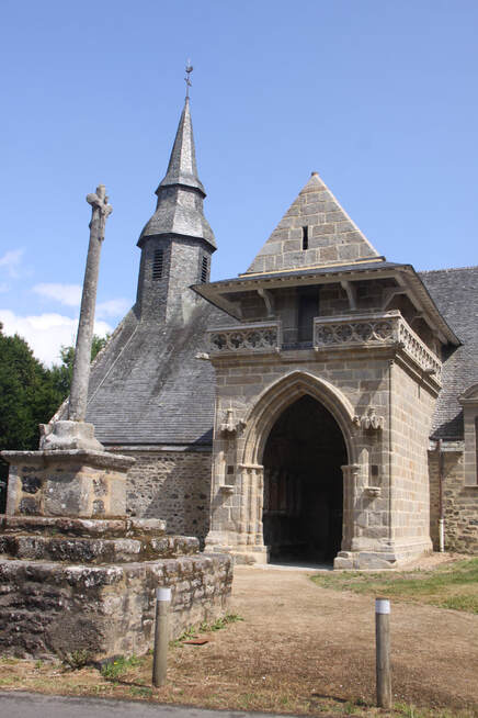
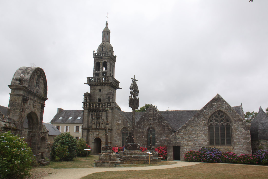
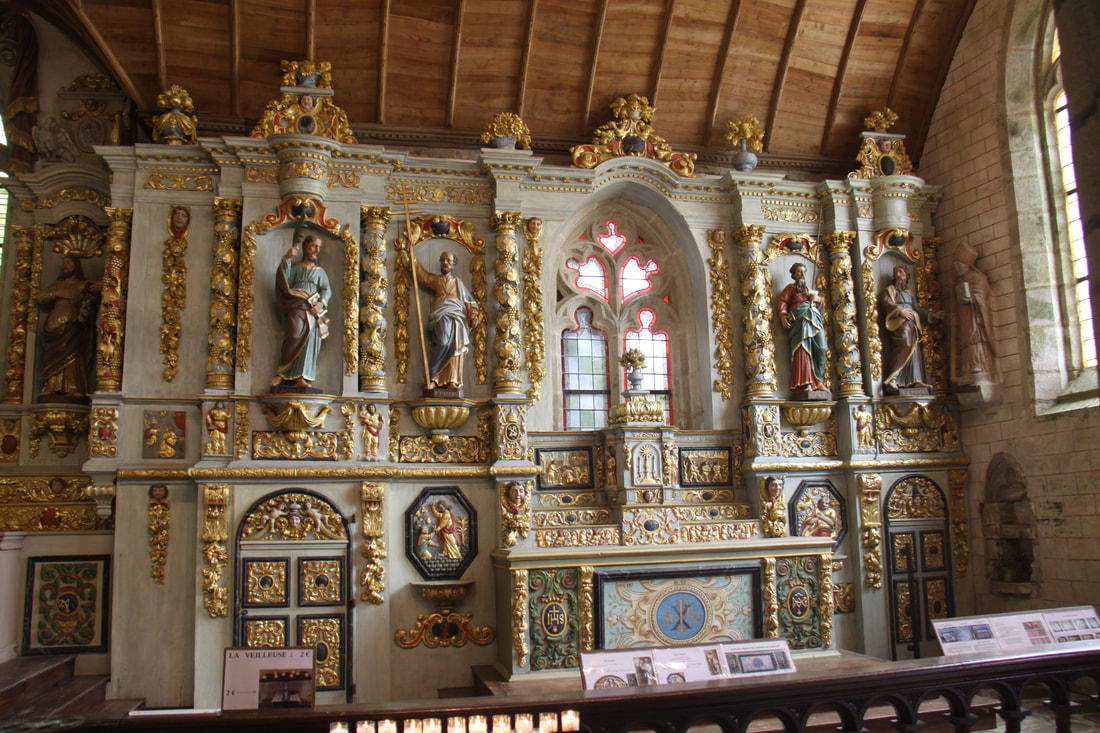
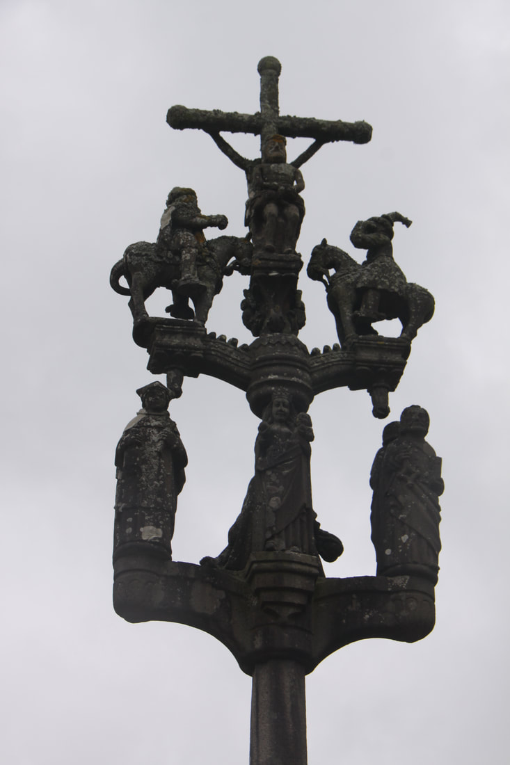
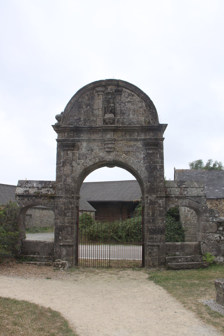
We headed back towards the coast to visit the beautiful chapel of Kermarie –an-Isquit. The oldest part of the chapel dated back to 1240 and was possibly built to show gratitude by local lords for their safe return from the crusades to the Holy Land.
The chapel became a place of pilgrimage under the influence of the monks of Beauport Abbey. This led to the nave being enlarged in the 15th century. In the 18th century the choir and octagonal bell tower were added.
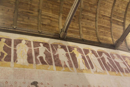
Inside, during the late 15th century, the walls 0f the nave were decorated with depictions of “The Dance of Death”. This frieze was whitewashed over with lime in the 18th and then rediscovered in the 19th century. The figures, all holding hands, represent living persons of all ages and social standing.
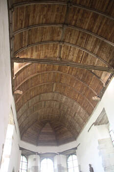
The nave itself has a wooden vault shaped like an upside down hull of a boat. All in all a fascinating visit.
Woke up next morning and were relieved to find we were not underwater. We even managed to drive off the field easily enough. Having literally gone “round the fields” for mile after mile to find our aire, we discovered on leaving that we were only about 200 metres from the main road. We had taken a turn too early and ended up doing three sides of a very large rectangle!
We headed back towards the coast to visit the beautiful chapel of Kermarie –an-Isquit. The oldest part of the chapel dated back to 1240 and was possibly built to show gratitude by local lords for their safe return from the crusades to the Holy Land.
The chapel became a place of pilgrimage under the influence of the monks of Beauport Abbey. This led to the nave being enlarged in the 15th century. In the 18th century the choir and octagonal bell tower were added.
Inside, during the late 15th century, the walls 0f the nave were decorated with depictions of “The Dance of Death”. This frieze was whitewashed over with lime in the 18th and then rediscovered in the 19th century. The figures, all holding hands, represent living persons of all ages and social standing.
The nave itself has a wooden vault shaped like an upside down hull of a boat. All in all a fascinating visit.
|
|
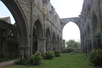
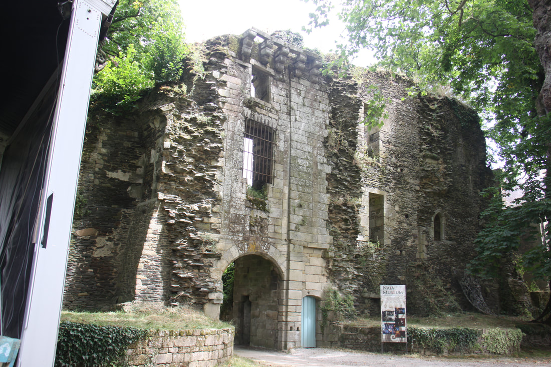
Our next stop was at the Abbaye de Beauport which was founded in 1202, but it is now mainly ruined. Originally it was a way station for English pilgrims on their way to Santiago de Compostela. It was built in the Anglo-Norman style and parts of it have been restored.
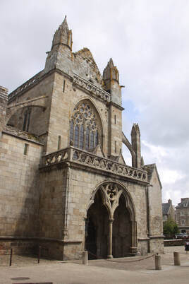
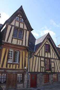
Our final stop for the day was at Tréguier where the aire was beside the tidal river Guindy. A steep walk up led us to the impressive town centre which was dominated by the cathedral which was built in Breton Gothic style in the 14th/15th C. Surrounding the cathedral and nearby were many timber framed houses and grander granite houses.
Our next stop was at the Abbaye de Beauport which was founded in 1202, but it is now mainly ruined. Originally it was a way station for English pilgrims on their way to Santiago de Compostela. It was built in the Anglo-Norman style and parts of it have been restored.
Our final stop for the day was at Tréguier where the aire was beside the tidal river Guindy. A steep walk up led us to the impressive town centre which was dominated by the cathedral which was built in Breton Gothic style in the 14th/15th C. Surrounding the cathedral and nearby were many timber framed houses and grander granite houses.
|
|
Wednesday 21st June
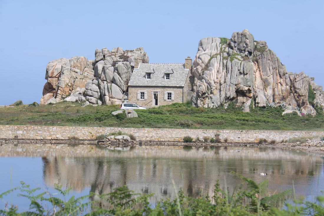
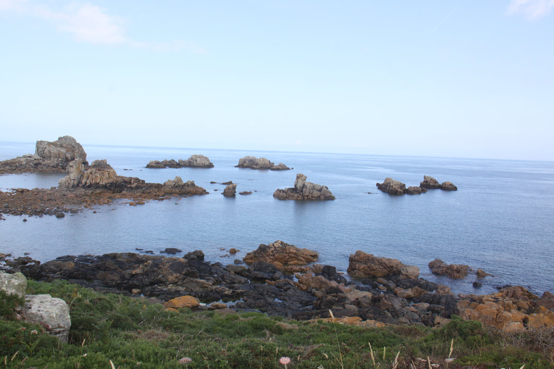
Overall a rather frustrating day due mainly to a lack of sign posts and many single lane roads. We headed north from Tréguier towards Plougrescant on narrow roads which eventually became single track, finally reaching the car park for the Maison du Gouffre. This house is built between two large granite boulders on the sea edge. Unfortunately we could only view it from a distance as the gate to the access road was closed and locked. The whole section of this coast is littered with giant pink granite boulders and rocky inlets.
More by luck than judgement we managed to find our route out through a maze of narrow lanes and headed further west. As there were very few direction signs our route along the coast was far from straight forward. However we did find a car park by the beach for lunch.
By the middle of the afternoon we reluctantly gave up on this beautiful stretch of coast and headed inland towards the town of Lannion where we found an aire by the planetarium for our overnight halt.
|
|
Thursday 22nd June
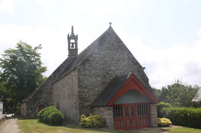
Continuing west we arrived at a small hamlet near Plouezoc’h where the fascinating small church of St. Antoine is located.
Built in 1574 and altered in the eighteenth century, the chapel consists of a nave preceded by a wooden porch closed by a fence with balusters surmounting a panelling of sculpted panels. The choir is flanked by two aisles and ends in a circular apse.
The building is entirely vaulted in wood, with sculpted tie beams and cornices.
Thursday 22nd June
Continuing west we arrived at a small hamlet near Plouezoc’h where the fascinating small church of St. Antoine is located.
Built in 1574 and altered in the eighteenth century, the chapel consists of a nave preceded by a wooden porch closed by a fence with balusters surmounting a panelling of sculpted panels. The choir is flanked by two aisles and ends in a circular apse.
The building is entirely vaulted in wood, with sculpted tie beams and cornices.
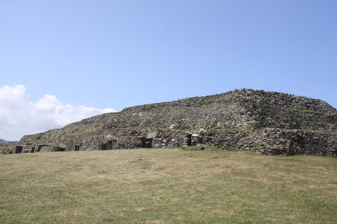
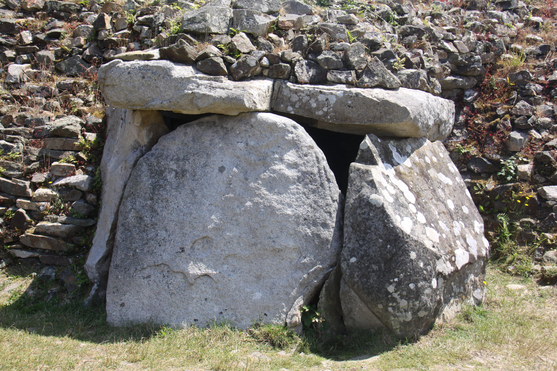
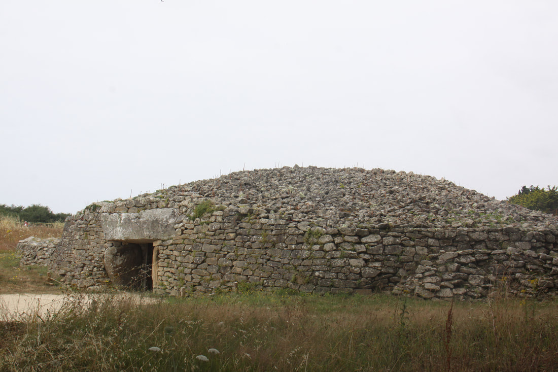
By the time we reached Barnenez it was lunch time and the cairn was closed. We drove down to the harbour and found a nice spot for a picnic. On our return we were first in and during our stay there were only a handful of visitors.
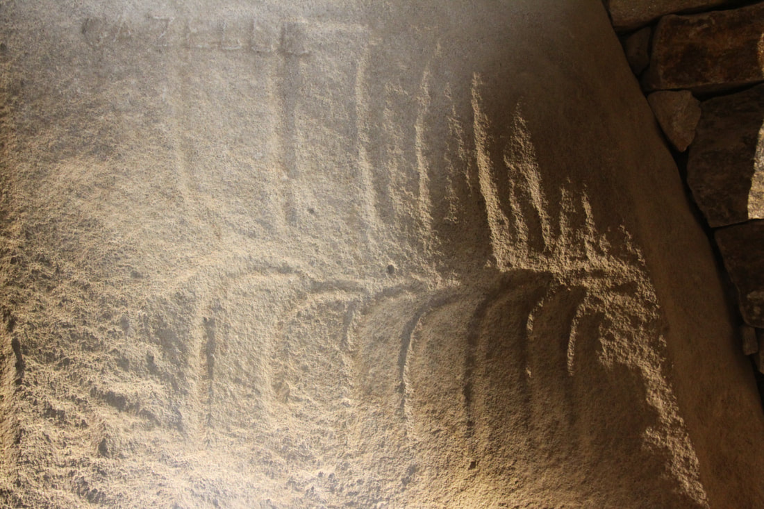
The cairn was built between 4500 and 3900 BC. It is 75m long and 28m wide and features eleven burial chambers. The cairn was built as two adjoining monuments suggesting that over time there was a need to extend it.
For millennia the cairn was covered in vegetation and forgotten. In 1851 the mounds were identified as a tumuli. Archaeological excavations in the 1950’s and 1960’s led to the “enormous mound” being declared as a “Megalithic Parthenon”.
The conjoined cairns contain 11 passage tombs, many with standing stone (dolmens) at their entrance.
|
|
Overnight on an aire at Diben with amazing views across the tidal port and estuary.
Overnight on an aire at Diben with amazing views across the tidal port and estuary.
Friday 23rd June
We were sad to leave our “pitch with a wonderful view”, but there were so many other places to see.
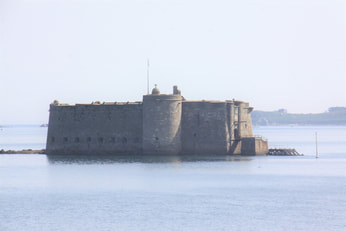
We had hoped to park at the bustling market town of Morlaix but everywhere was so crowded that we headed out back north to the beautiful rugged coast. We stopped at Pointe-de-Pen-al-Lann and took the steep path down to the view point. From here we could see the island on which the Chȃteau du Tourreau (modified by Vauban) guarded the river estuary.
We then headed for the aire de camping car on the coast at nearby Posmeur, arriving by lunchtime. After lunch we strolled a short distance to the promenade and walked beside the beach for some way. Unfortunately all the benches overlooking the sea were occupied but there was an ice cream van and a handy low wall to sit on whilst we ate our ice creams. We continued round the Pointe de Pen a Thévenand across the machie (grass) to see the Allée couvert de Guinirvit. This is a vast megalithic monument composed of three parallel rows of standing stones forming two parallel covered walkways measuring 10 meters long and 2.0 meters wide. Now it is silted up and completely covered at high tide.
|
|
Saturday 24th June
Another lovely sunny day and my birthday. John asked me what I wanted to do and there was no hesitation in my reply. A nice quiet day relaxing on the campsite next to the aire where we’d stayed overnight! We could have a swim in the pool, a shower with unlimited hot water and plenty of room rather than the cramped washroom in our motorhome and dinner in the restaurant. Today we will behave like holidaymakers rather than travellers!
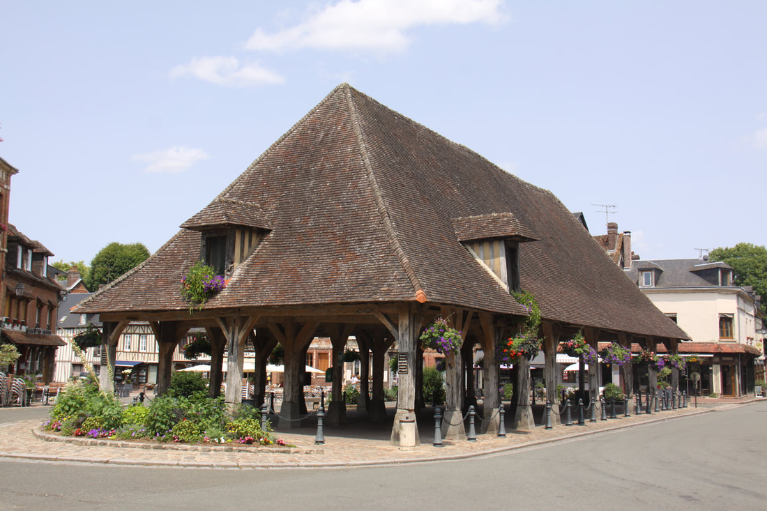
After breakfast we drove the few miles back to Plouescat and wandered round the market. The town has a magnificent covered market hall. Bought a few holiday gifts and a couple of very tasty eclairs.
At noon we booked onto the campsite. We were told to select our emplacement and report back to the office to report the number. We then had lunch followed by a swim, shower and dinner, fish and chips followed by fresh fruit salad.
Another lovely sunny day and my birthday. John asked me what I wanted to do and there was no hesitation in my reply. A nice quiet day relaxing on the campsite next to the aire where we’d stayed overnight! We could have a swim in the pool, a shower with unlimited hot water and plenty of room rather than the cramped washroom in our motorhome and dinner in the restaurant. Today we will behave like holidaymakers rather than travellers!
After breakfast we drove the few miles back to Plouescat and wandered round the market. The town has a magnificent covered market hall. Bought a few holiday gifts and a couple of very tasty eclairs.
At noon we booked onto the campsite. We were told to select our emplacement and report back to the office to report the number. We then had lunch followed by a swim, shower and dinner, fish and chips followed by fresh fruit salad.
Sunday 25th June
Drove back into Plouescat so that we could take a photo of the market hall without the market stalls and crowds. Bought a baguette from the boulangerie and a very tasty quiche for dinner from the butchers.
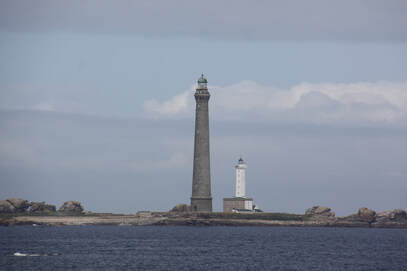
Continued along the coast road with numerous diversions – every village seemed to be having a cycle race or carnival! Eventually we reached Plouguerneau near which are the two lighthouses on the Île Vierge. The first lighthouse is a square tower 108ft high constructed in 1842–45 whilst the newer lighthouse made of concrete blocks is 271ft tall making it the tallest lighthouse in Europe. They mark the official southwestern limit of the English Channel.
Drove back into Plouescat so that we could take a photo of the market hall without the market stalls and crowds. Bought a baguette from the boulangerie and a very tasty quiche for dinner from the butchers.
Continued along the coast road with numerous diversions – every village seemed to be having a cycle race or carnival! Eventually we reached Plouguerneau near which are the two lighthouses on the Île Vierge. The first lighthouse is a square tower 108ft high constructed in 1842–45 whilst the newer lighthouse made of concrete blocks is 271ft tall making it the tallest lighthouse in Europe. They mark the official southwestern limit of the English Channel.
|
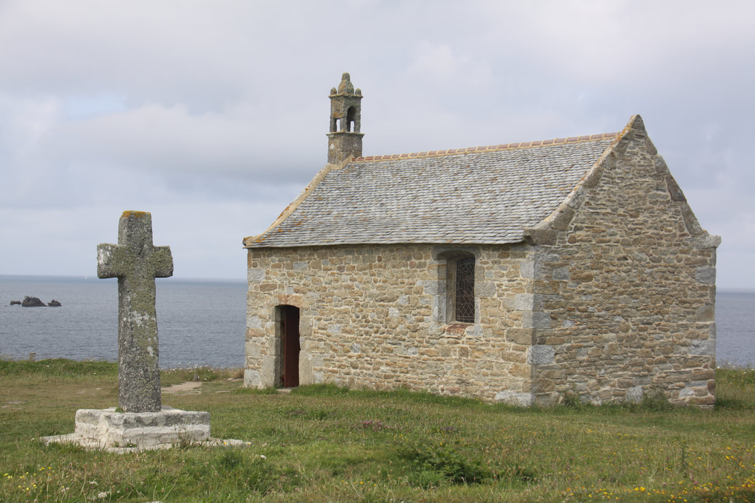
Unfortunately we could not see the ruined Château de Trémazan from the road, our guidebook warned that it was difficult to locate, but we did enjoy a beautiful coast road with dramatic cliff top views round every twist and turn. We stopped to explore the picturesque chapel of St. Samson which nestled between the coast road and the sea before finally leaving the coast road and heading inland to our halt for the night in the small village of Ploumoguer.
The aire had individual hedged bays – it had been a former camp site. Our day ended with a stroll round the village. 
|
Monday 26th June
Before we reached the northern ring road around Brest we stopped to buy food for the day.
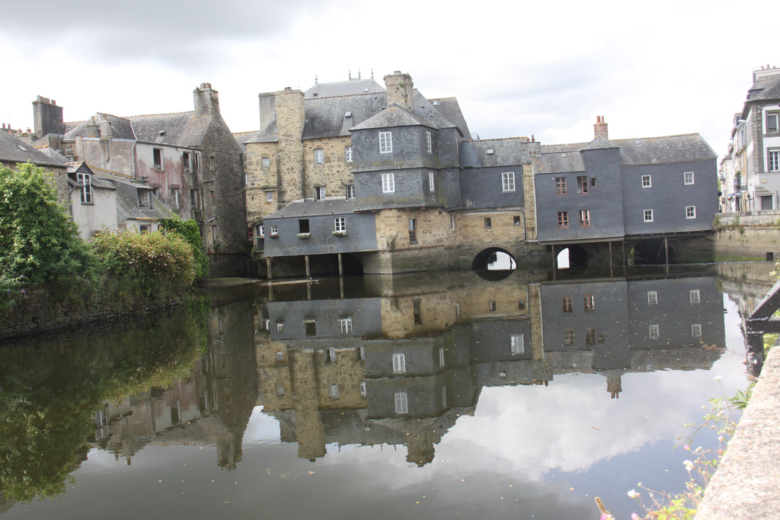
The ring road was busy with countless speed bumps and other traffic calming measures. We eventually managed to find the correct exit to Landerneau. There was plenty of parking along the river bank close to the Pont du Rohan located in the middle of the town. The bridge is lined with buildings like the Ponte Vecchio in Venice. Reconstructed in 1510 the bridge provides picturesque views from the river bank.
It was lunch time so everywhere was quiet and we enjoyed a gentle stroll round the picturesque streets and alleys. Almost every building had a history and helpful information boards gave us the full details.
Before we reached the northern ring road around Brest we stopped to buy food for the day.
The ring road was busy with countless speed bumps and other traffic calming measures. We eventually managed to find the correct exit to Landerneau. There was plenty of parking along the river bank close to the Pont du Rohan located in the middle of the town. The bridge is lined with buildings like the Ponte Vecchio in Venice. Reconstructed in 1510 the bridge provides picturesque views from the river bank.
It was lunch time so everywhere was quiet and we enjoyed a gentle stroll round the picturesque streets and alleys. Almost every building had a history and helpful information boards gave us the full details.
|

|
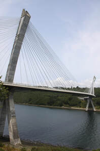
After lunch we headed west along the Crozon peninsula passing through the Parc Naturel Régional d’Armourique. We crossed the outlet for the Nantes-Brest canal by means of the impressive suspension bridge.
Camaret, our destination for the night, was at the end of the peninsula. The aire de camping cars here was expensive but its location was superb - right next to the “Alignements de Lagatjar” (eye of the chicken). Only 65 stumps remain forming three sided of a rectangle. Their name comes from the Breton name for the Pleides constellation.
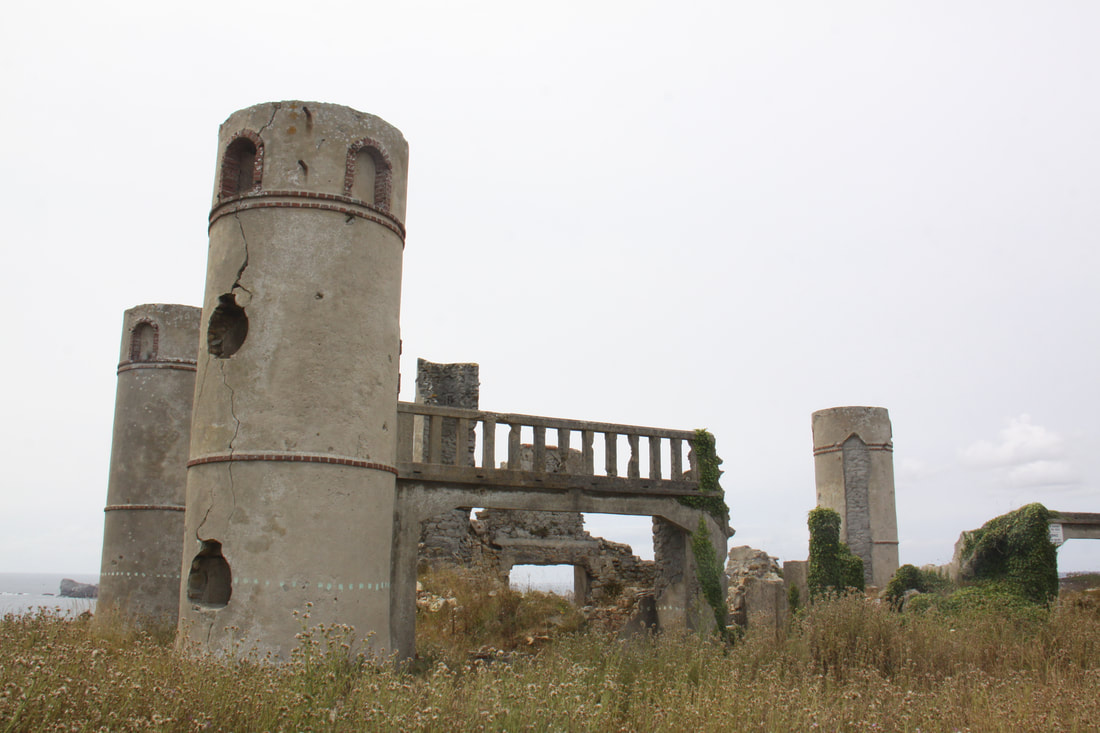
We parked up and wandered around the standing stones. Across the road were the remains of the Manoir de Saint-Pol Roux built in 1904 by the poet Pierre Paul Roux. Over the years the house had been totally destroyed by the elements.
Camaret, our destination for the night, was at the end of the peninsula. The aire de camping cars here was expensive but its location was superb - right next to the “Alignements de Lagatjar” (eye of the chicken). Only 65 stumps remain forming three sided of a rectangle. Their name comes from the Breton name for the Pleides constellation.
We parked up and wandered around the standing stones. Across the road were the remains of the Manoir de Saint-Pol Roux built in 1904 by the poet Pierre Paul Roux. Over the years the house had been totally destroyed by the elements.
|
|
Tuesday 27th June
Today was spent exploring the area around Camaret.
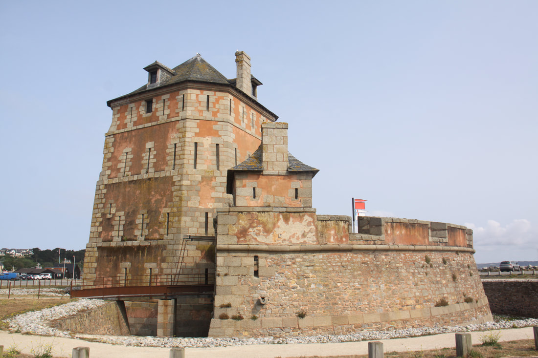
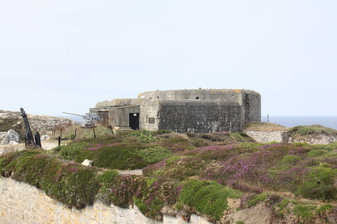
Firstly we visited the Tour Vauban which was situate on the shingle spit jetty which shelters the fishing town of Camaret. Work on the tower, which is a UNESCO World Heritage Site, began in 1689. It is walled and surrounded by a deep, dry moat. The only access into the actual fort is by means of a draw bridge. Inside there are three floors accessed by a stone spiral staircase. Outside was a hot fire furnace for heating up the cannon balls.
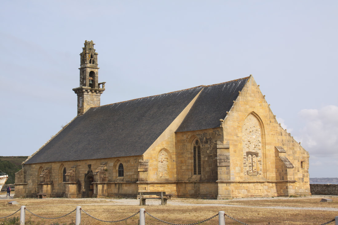
Just outside the fort is the Chapel de Notre-Dame-de-Rocammadour. This was built in the 16th century and is named for the pilgrims who stopped there on their way to Rocammadour in south western France.
Today was spent exploring the area around Camaret.
Firstly we visited the Tour Vauban which was situate on the shingle spit jetty which shelters the fishing town of Camaret. Work on the tower, which is a UNESCO World Heritage Site, began in 1689. It is walled and surrounded by a deep, dry moat. The only access into the actual fort is by means of a draw bridge. Inside there are three floors accessed by a stone spiral staircase. Outside was a hot fire furnace for heating up the cannon balls.
Just outside the fort is the Chapel de Notre-Dame-de-Rocammadour. This was built in the 16th century and is named for the pilgrims who stopped there on their way to Rocammadour in south western France.
|
|
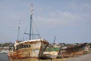
Close by the Vauban Tower and chapel Notre Dame de Rocammadour is a ship graveyard. Two of the ships,the “Etoile du Berger” and “Maitena” were used to fish lobster, crab and tuna before being decommissioned.
Close by the Vauban Tower and chapel Notre Dame de Rocammadour is a ship graveyard. Two of the ships,the “Etoile du Berger” and “Maitena” were used to fish lobster, crab and tuna before being decommissioned.
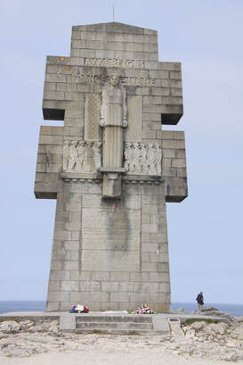
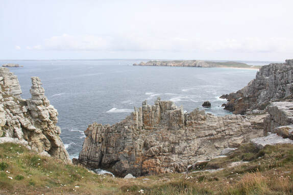
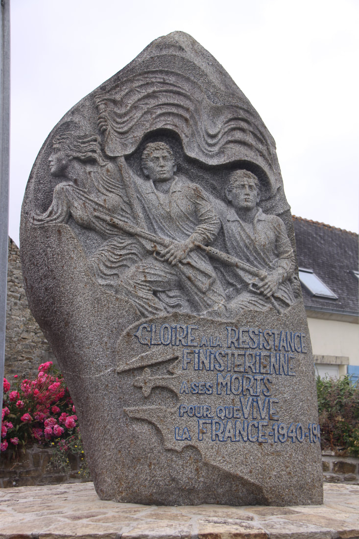
The Pointe de Pen-Hir is a dramatic granite headland a few miles west of Camaret. Here we viewed the enormous memorial Cross of Lorainne dedicated to those resistance fighters who lost their lives during the German occupation of France in WW2.
A network of paths run across the headland linking the headlands bays. The views were incredible and even high on the headland you could hear the sea as it crashed into the sheer cliffs below. Just off the point were a line of rugged rocks known as the “Tasde Pois”, Pile of Peas.
A network of paths run across the headland linking the headlands bays. The views were incredible and even high on the headland you could hear the sea as it crashed into the sheer cliffs below. Just off the point were a line of rugged rocks known as the “Tasde Pois”, Pile of Peas.
|
|
A short way back from the cliffs is a memorial museum to the Breton Resistance. Unfortunately this was closed but we were able to wander and explore the extensive and intricate network of German bunkers that stretch, half hidden along this part of the peninsula.
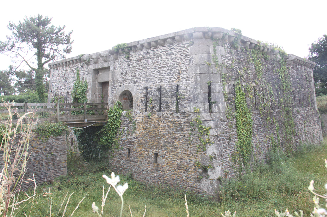
After lunch we drove out to the Pointe des Espagnols. Again there were numerous abandoned war time bunkers and installations as well as a Napolionic fort built in 1811. Unfortunately the path to the point was closed because of safety concerns whilst repairs took place so we were denied the superb views overlooking Brest.
We returned to the aire at Camaret for the night.
|
|
|
Wednesday 28th June What a difference a day makes – too hot yesterday, damp and drizzly today. On our way back from the Manoir de Saint-Pol Roux on Monday afternoon we had met a local man and got into conversation with him. He was in his 80’s and widowed. He told us took the same walk everyday and usually found someone to chat to. He very much regretted Brexit and hoped we would come back. He also gave us directions to the local supermarket. Despite this, we had difficulty locating it. With this latest incident and previous problems finding our way around Brittany, John decided to formulate the "Sod's Law of Sign Posts". |
Sod’s Law of Sign Posts
|
We did eventually find the supermarket, bought our food for the day and headed towards Locronan, one of the beautiful villages of France.
En route we passed through the tiny hamlet of Plomodiern where we discovered the amazing chapel of St. Marie du Ménez Hom. At the altar and on both sides were elaborately carved and gilded panels showing the images of the saints. To the right of the altar was a carving of the virgin Mary to whom the chapel is dedicated. Outside stood a tall, decorated calvery cross and an ornamental triumphal gate marked the original entrance to the chapel grounds. Close by the chapel was a monument to the members of WWII French Resistance.
As the weather was inclement we decided to stop early and have a relaxing afternoon on the aire at Plonévez-Porzay.
|
|
|
|
|
Thursday 29th June
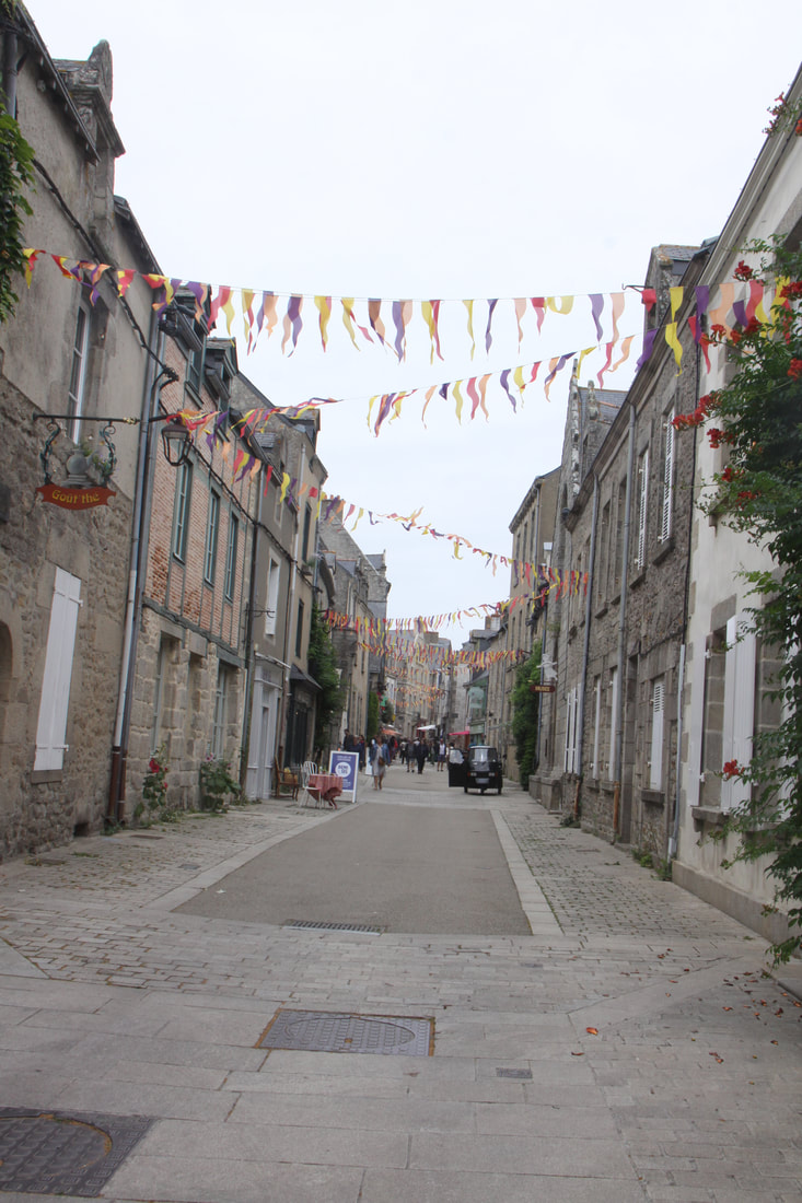
Locrannon gained its wealth and beauty in the 14th century thanks to weaving sailcloth. Trade was established with all the large fleets, leading to fortune and the construction of harmonious granite houses. The walls have remained true to their origins. It was set on the top of a hill and there was plenty of parking close by. Cars are not allowed into the village so it was pleasant to wander round the town. Narrow lanes radiate out from a cobbled central square which is dominated by the Church of St. Ronan. Old stone cottages cluster along side streets while the wealthier citizens’ houses with impressive granite facades lined the central square. A truly delightful place, it was easy to see why it had been used so often as a film set.
Locrannon gained its wealth and beauty in the 14th century thanks to weaving sailcloth. Trade was established with all the large fleets, leading to fortune and the construction of harmonious granite houses. The walls have remained true to their origins. It was set on the top of a hill and there was plenty of parking close by. Cars are not allowed into the village so it was pleasant to wander round the town. Narrow lanes radiate out from a cobbled central square which is dominated by the Church of St. Ronan. Old stone cottages cluster along side streets while the wealthier citizens’ houses with impressive granite facades lined the central square. A truly delightful place, it was easy to see why it had been used so often as a film set.
|
|
|
|
|
Further south we stopped in Concarneau. The city has two distinct areas: the modern town on the mainland and the medieval Ville Close, a walled town on a long island in the centre of the harbour. Historically, the old town was a centre of shipbuilding; its ramparts date from the 14th century. We parked by the railway station and walked into the Ville Close which we found far too crowded and touristy for our liking!
We had hoped to stay overnight at an aire on the coast near Nevez but it was full so we ended up staying on the aire in the village itself.
We had hoped to stay overnight at an aire on the coast near Nevez but it was full so we ended up staying on the aire in the village itself.
|

|
|
|
|
Friday 30th June
A grey, dismal rainy day so instead of heading directly to Carnac, we stopped short at an aire in Belz early in the day. Our fingers were crossed for a better day tomorrow.
Saturday 1st July
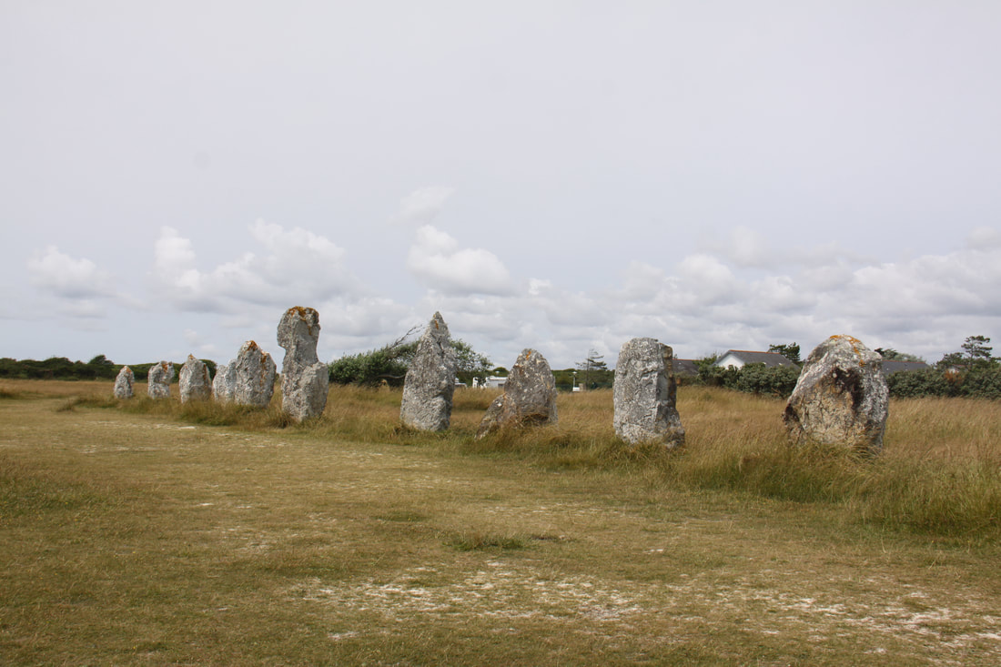
Our first stop of the day was to view the Alignement de Kerzehe located close to the village of Erdeven. In 1884, a count was reported on the site of 2 km of a set of 1100 standing menhirs. Today there are nearly 200 lined up in a dozen rows.
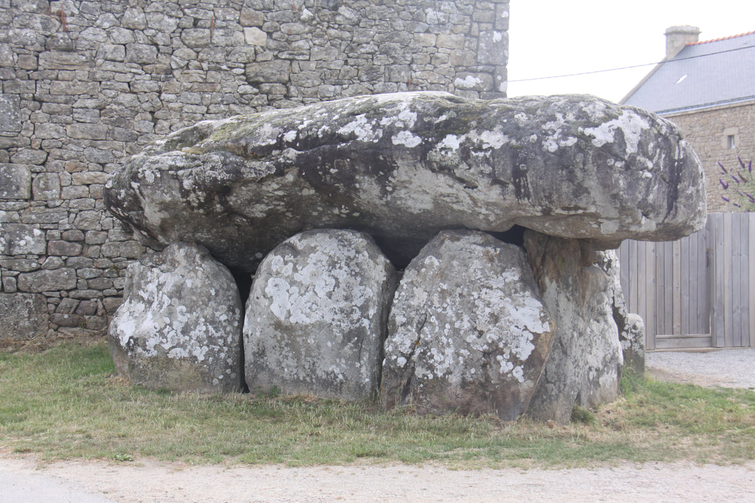
A few miles further on we stopped to view the Dolmen du Crucone which is located right beside a farmhouse in the centre of the village.
A grey, dismal rainy day so instead of heading directly to Carnac, we stopped short at an aire in Belz early in the day. Our fingers were crossed for a better day tomorrow.
Saturday 1st July
Our first stop of the day was to view the Alignement de Kerzehe located close to the village of Erdeven. In 1884, a count was reported on the site of 2 km of a set of 1100 standing menhirs. Today there are nearly 200 lined up in a dozen rows.
A few miles further on we stopped to view the Dolmen du Crucone which is located right beside a farmhouse in the centre of the village.
|
|
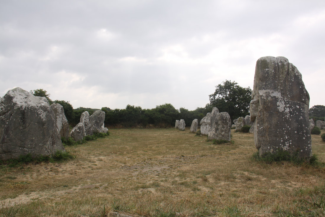
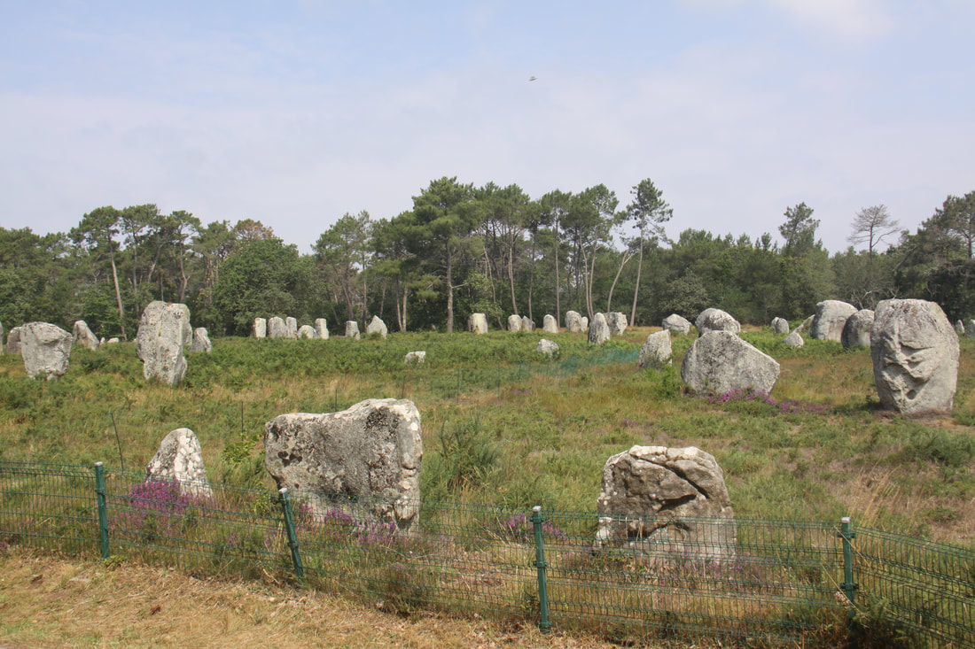
Next stop Carnac. This is one of the most important pre-historic sites in Europe and, having been founded in 5700BC, is believed to be the longest continuous settlement of anywhere in the world. There are three alignements of standing stones
- Alignements de Ménec “the place of stones” or “place of remembrance” with 1169 menhirs in eleven rows.
- Alignements de Kermario “the place of the dead” with 1029 menhirs in ten rows.
- Alignements de Kerlescan “the place of burning” with 552 menhirs in thirteen lines.
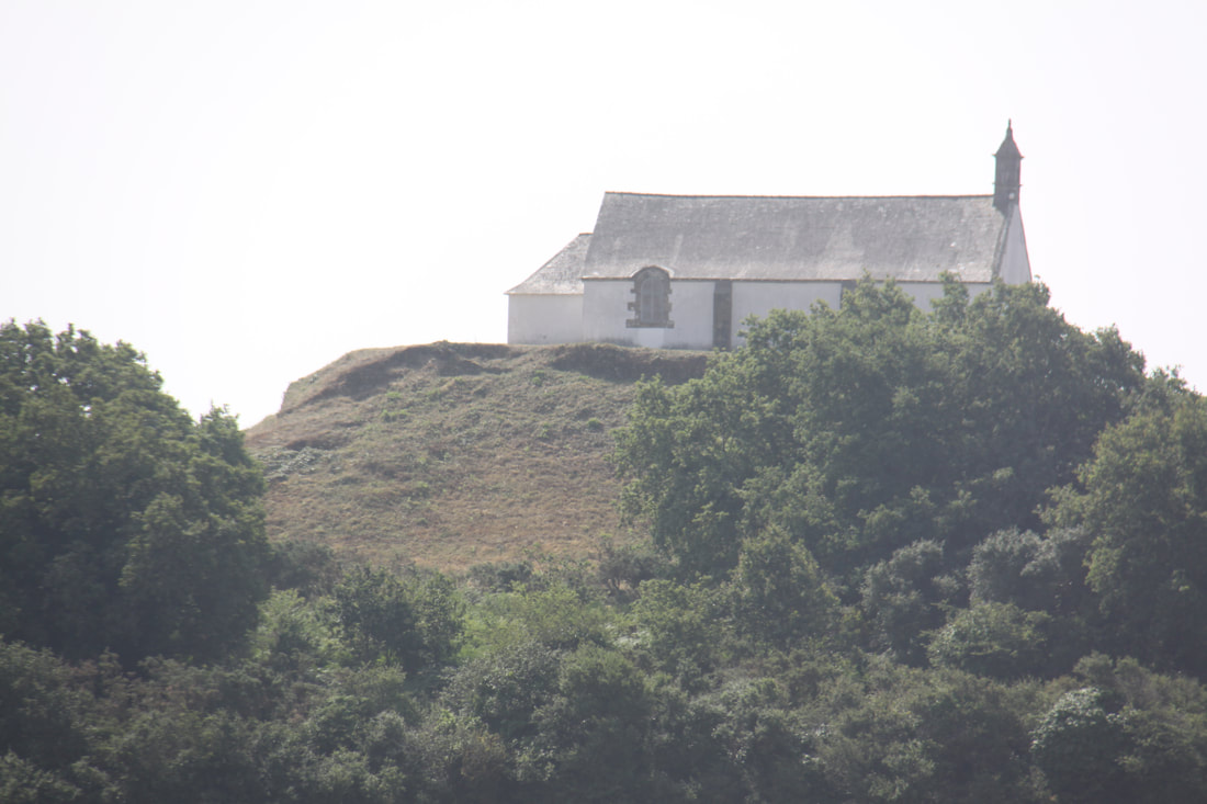
We took a guided bus tour round the large site and then headed back under our own steam to various points to explore further at leisure. We visited the Chapel of St. Michael located at the top of a steep sided tumulus constructed between 5000 and 3400BC.
Our overnight stop was on the aire located close to the Alignements de Ménec.
|
|
|
Sunday 2nd July
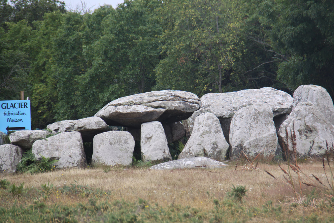
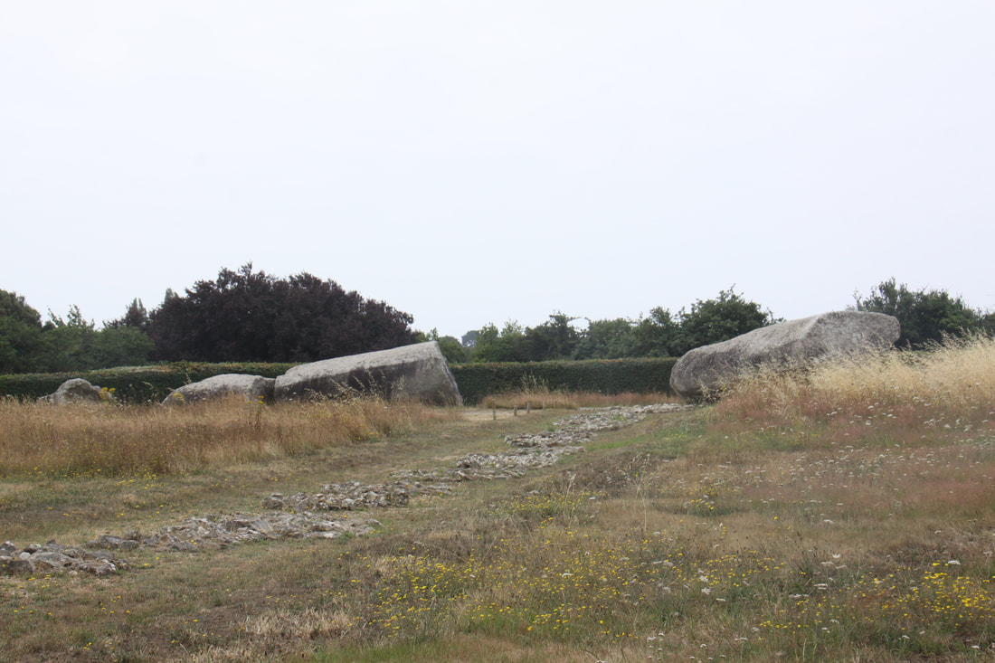
Today we headed to Locmariaquer, a Neolithic settlement rivalled only in importance to nearby Carnac. Here are three of the most important sites in the area.
The “Great Menhir”, a monolith, now lies broken into four pieces. When standing it would have stood 20 metres tall. A series of small stone circles marked the position of where it is believed other monoliths once stood.
Close by stands the “Table des Marchands de Dalmen” which was erected about 3000 BC and was still used until the beginning of the Bronze Age circa 2000 BC. Engravings on the inner sanctum of the dolmen are believed to represent the power of the divinity.
The Er-Grah tumulus is 140 metres (460 ft) long. It was probably originally constructed in the fifth millennium BC as a cairn. Funery items were found within.
|

|
Heading on further south we planned on visiting La Roche-Bernard, a small fortified settlement. On approaching it quickly became clear that there was no chance of us being able to park. This was a shame as it looked an interesting place to explore.
Instead we decided to visit Guérande with its completely walled old town – the ramparts date back to the 15th century and part of the walls are still moated.
We entered through the Porte St. Michael and wandered through the narrow pedestrianised cobbled streets. Sea salt obtained from local salt pans was on sale.
|
|
|
Finding a suitable aire for the night was not easy but we eventually ended up on the Super U car park in Muzillac. The store allowed overnight parking for motorhomes and quite a few where already there.
Monday 3rd July
The Super U had a motorhome service point next to the filling station so we filled up with diesel, emptied our toilet and waste water and filled up with fresh water before leaving. It would be nice to think that UK supermarkets might one day be similarly equipped!
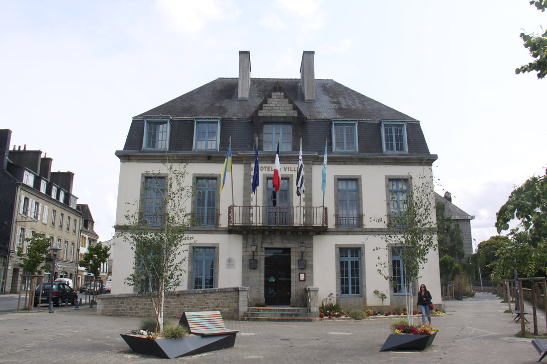
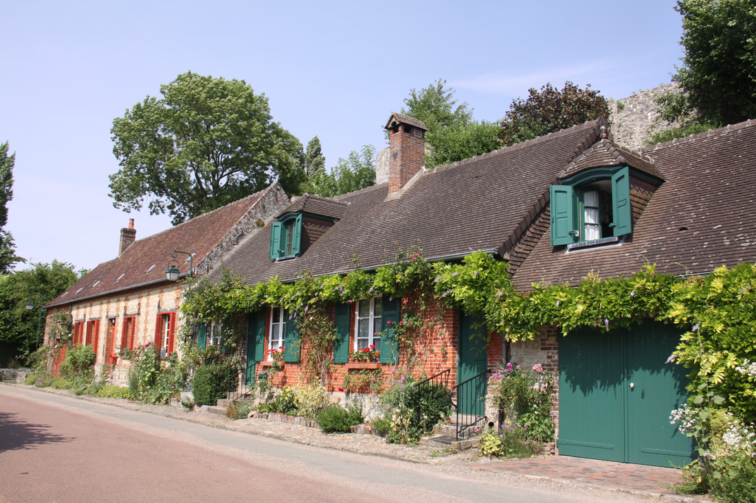
An hour’s drive through rolling countryside brought us to Rochefort-en-Terre, one of the designated beautiful villages of France. We parked on the shady aire and walked the short distance uphill into the centre of the medieval village. which dates back to the 11th century. It is also well known as a village of flowers. Granite mansions with granite and shale frontage line the streets while the ruins of a medieval castle sits at the end of the main street. The church of Notre-Dame de la Tronche (12th-14th century) holds a black madonna which was found hidden from Norman invaders in a hollow tree in the 12th century.
Monday 3rd July
The Super U had a motorhome service point next to the filling station so we filled up with diesel, emptied our toilet and waste water and filled up with fresh water before leaving. It would be nice to think that UK supermarkets might one day be similarly equipped!
An hour’s drive through rolling countryside brought us to Rochefort-en-Terre, one of the designated beautiful villages of France. We parked on the shady aire and walked the short distance uphill into the centre of the medieval village. which dates back to the 11th century. It is also well known as a village of flowers. Granite mansions with granite and shale frontage line the streets while the ruins of a medieval castle sits at the end of the main street. The church of Notre-Dame de la Tronche (12th-14th century) holds a black madonna which was found hidden from Norman invaders in a hollow tree in the 12th century.

|
|
|
|
|
Tuesday 4th July
Heavy rain and there was nowhere we had planned to visit so it was a good day for driving.
We took three attempts at finding an aire for overnight. Reddon was a busy cluttered town and we failed to find he aire there, also failing to find one in the small village of St. Just. We ended up at Messac by the canal side marina.
Wednesday 5th July
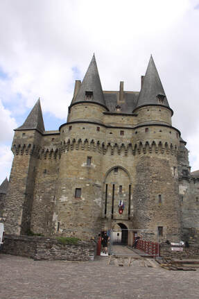
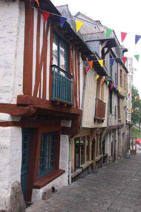
After stopping to buy food we headed to the old, walled town of Vitré. For once, parking in an old town was easy.
The towers of the chateau stand sentinel over the compact old town. Picturesque half timbered houses with over-hanging upper storeys lined the narrow streets, some of which were cobbled.
Built on a rocky outcrop, the chateau was triangular in shape with a dry moat and drawbridge being the only access.
After wandering the maze of narrow streets we eventually found the curved wash house beside the Vilaine river.
Heavy rain and there was nowhere we had planned to visit so it was a good day for driving.
We took three attempts at finding an aire for overnight. Reddon was a busy cluttered town and we failed to find he aire there, also failing to find one in the small village of St. Just. We ended up at Messac by the canal side marina.
Wednesday 5th July
After stopping to buy food we headed to the old, walled town of Vitré. For once, parking in an old town was easy.
The towers of the chateau stand sentinel over the compact old town. Picturesque half timbered houses with over-hanging upper storeys lined the narrow streets, some of which were cobbled.
Built on a rocky outcrop, the chateau was triangular in shape with a dry moat and drawbridge being the only access.
After wandering the maze of narrow streets we eventually found the curved wash house beside the Vilaine river.
|
|
|
As it was still quite early in the day we headed north to Fougères where we were lucky to find space on the aire located by the castle. According to our “All the Aires” guide it was free but when we went out for a little walk we fortunately spotted a sign directing you to the machine on the main car park where we had to pay.
Thursday 6th July
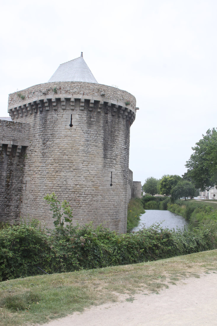
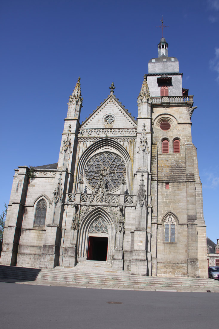
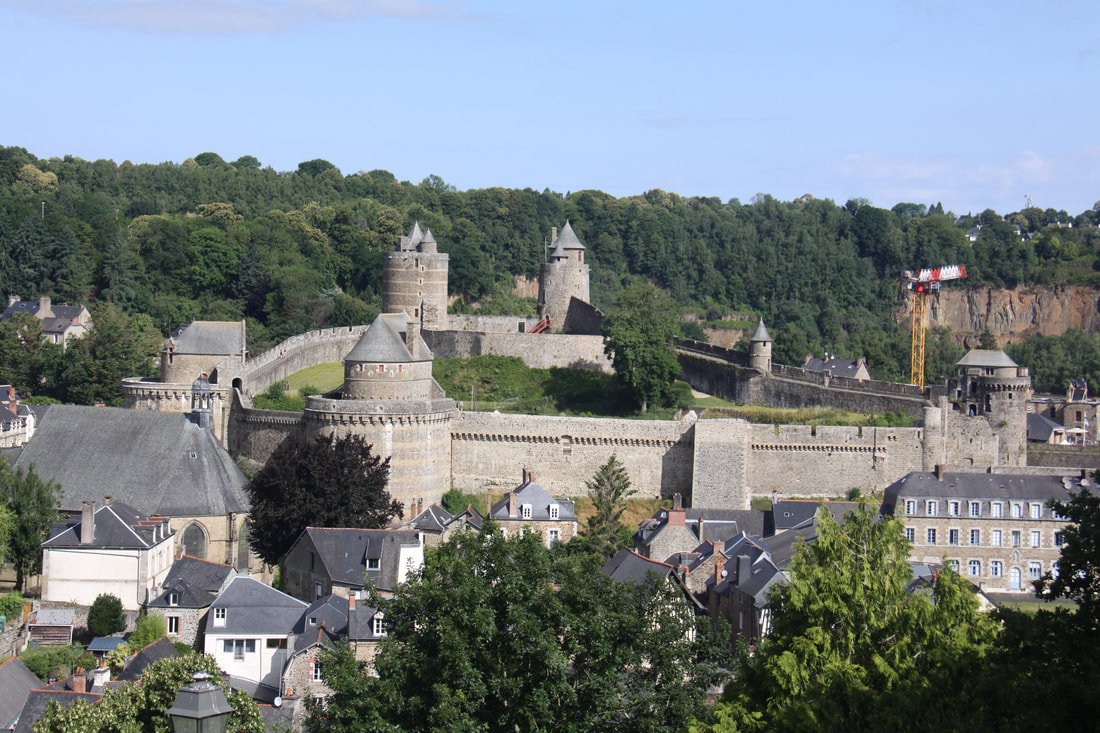
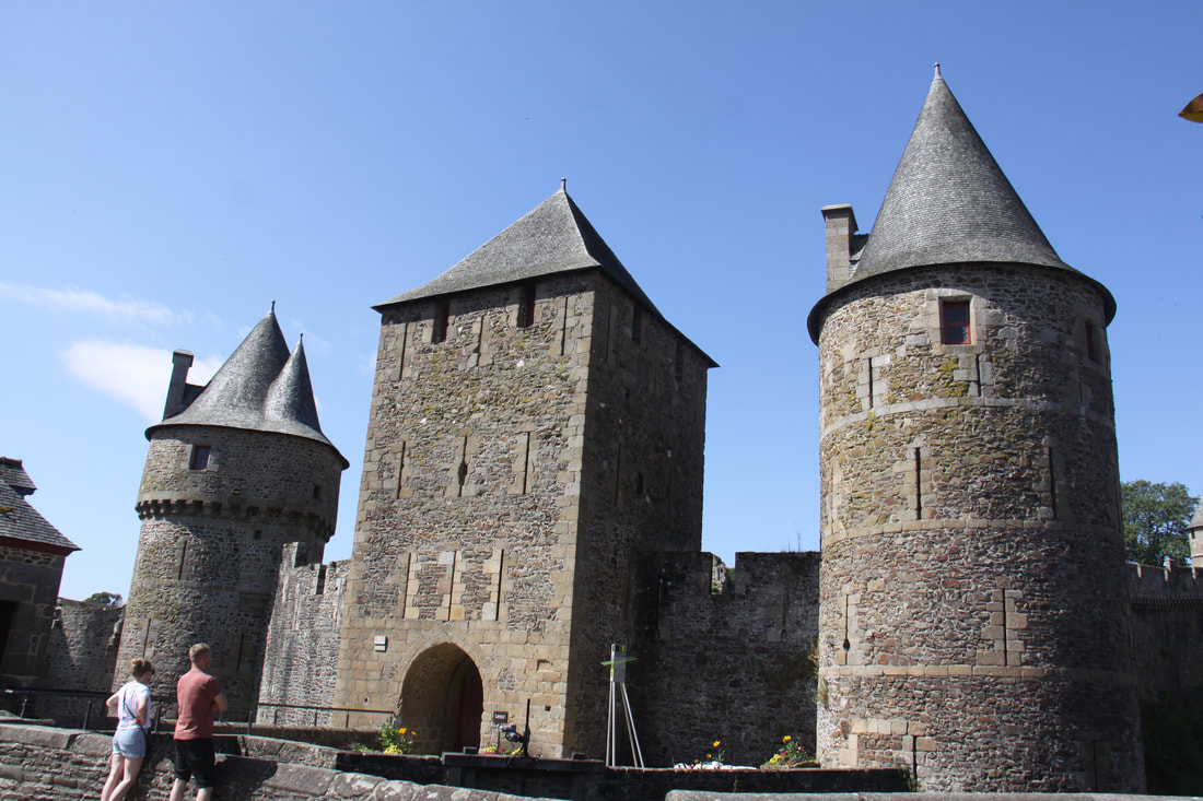
Fougères was a very interesting town of two halves – the lower by the enormous Medieval castle and the upper main town situated on a rocky spur.
We followed a circular town trail which took us through both parts of the town. A steep climb up from the aire meant a lot of steps and John found the climb very hard. The main street Rue Nationale was lined with granite buildings which in the 18th century had replaced the wooden ones which had burned down.
At the end of the road the impressive Church of St. Leonards stood sentinel over the landscaped public gardens. From a terrace there were superb views over the lower town, castle and beyond. We followed a series of steep narrow paths down the embankment and back to the castle.
Thursday 6th July
Fougères was a very interesting town of two halves – the lower by the enormous Medieval castle and the upper main town situated on a rocky spur.
We followed a circular town trail which took us through both parts of the town. A steep climb up from the aire meant a lot of steps and John found the climb very hard. The main street Rue Nationale was lined with granite buildings which in the 18th century had replaced the wooden ones which had burned down.
At the end of the road the impressive Church of St. Leonards stood sentinel over the landscaped public gardens. From a terrace there were superb views over the lower town, castle and beyond. We followed a series of steep narrow paths down the embankment and back to the castle.
|
|
|
|
|
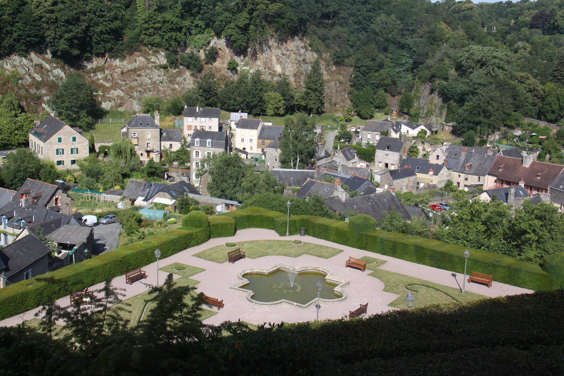
In the lower part of the town, tanners, drapers and dyers lived. The medieval buildings stand testimony to their wealth.
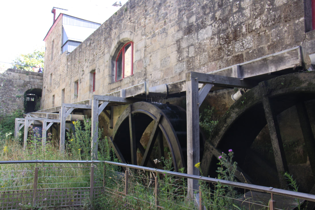
This area is over shadowed by the towering castle which in places still has a water-filled moat. We were fascinated by the weirs and four-wheeled watermill that was still in use. Five towers linked by high walls date from the 12th to 15th C, while the ramparts with 13 more towers enclose a large inner area. All very impressive.
An uninspiring journey brought us eventually to our night stop just outside the small rural village of Villaines-la-Juhel.
|
|
|
|
Friday 7th July
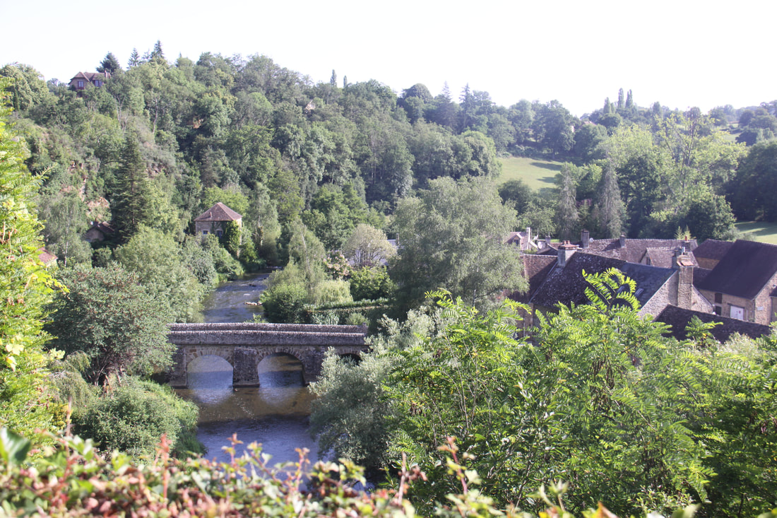
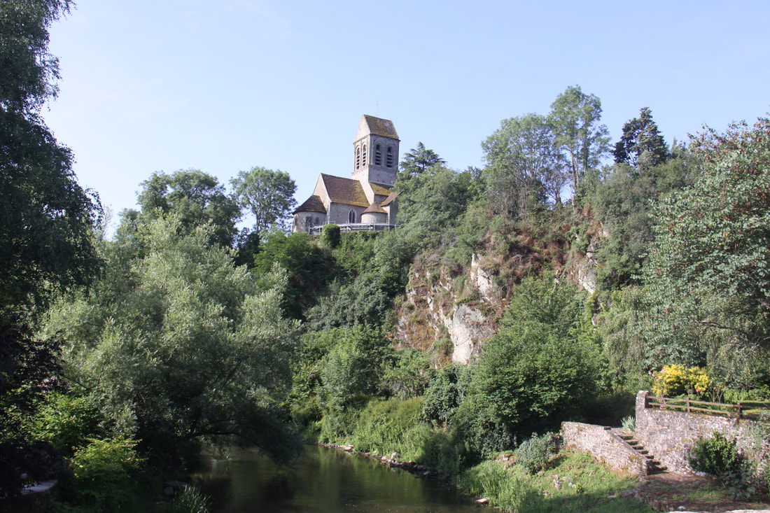
After a short drive we reached our next beautiful village of France – St. Céneri-le-Gérei. We parked in an aire de camping cars which was not listed in either ll the Aires or the Bordatlas – after the trouble (and mileage) we had last night to find somewhere to park, it was a case of if only….
A short uphill walk brought us into the pretty little hamlet. St. Cénerie church was unfortunately closed so we were unable to view the 12th C murals inside. The views from the bridge across the river Sarthe back towards the church were very impressive
We then headed further east and north until we reached the small town of Rugles where we stopped for the night.

|
|
|
|
|
Saturday 8th July
An hour or so drive brought us to the outskirts of Evreux where with more luck than navigational skill we managed to find our planned route. However it all went wrong when we took a turn on to a motorway. We took the next exit and ended up in a busy village with no idea where we were. After suggesting several times that perhaps we should use the sat-nav, John stopped the motorhome and refused to set off again until I accepted defeat in my map reading and use the sat-nav.
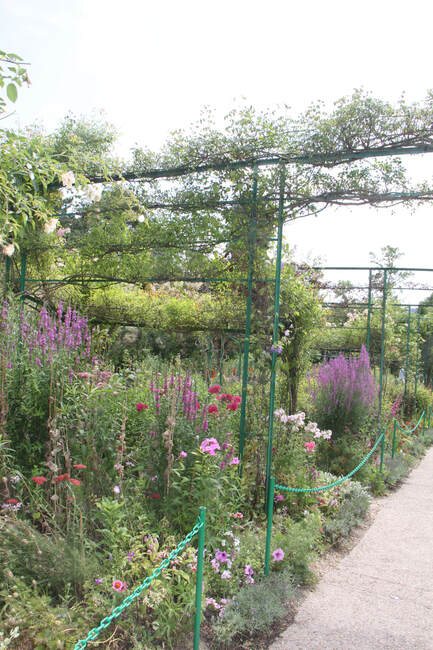
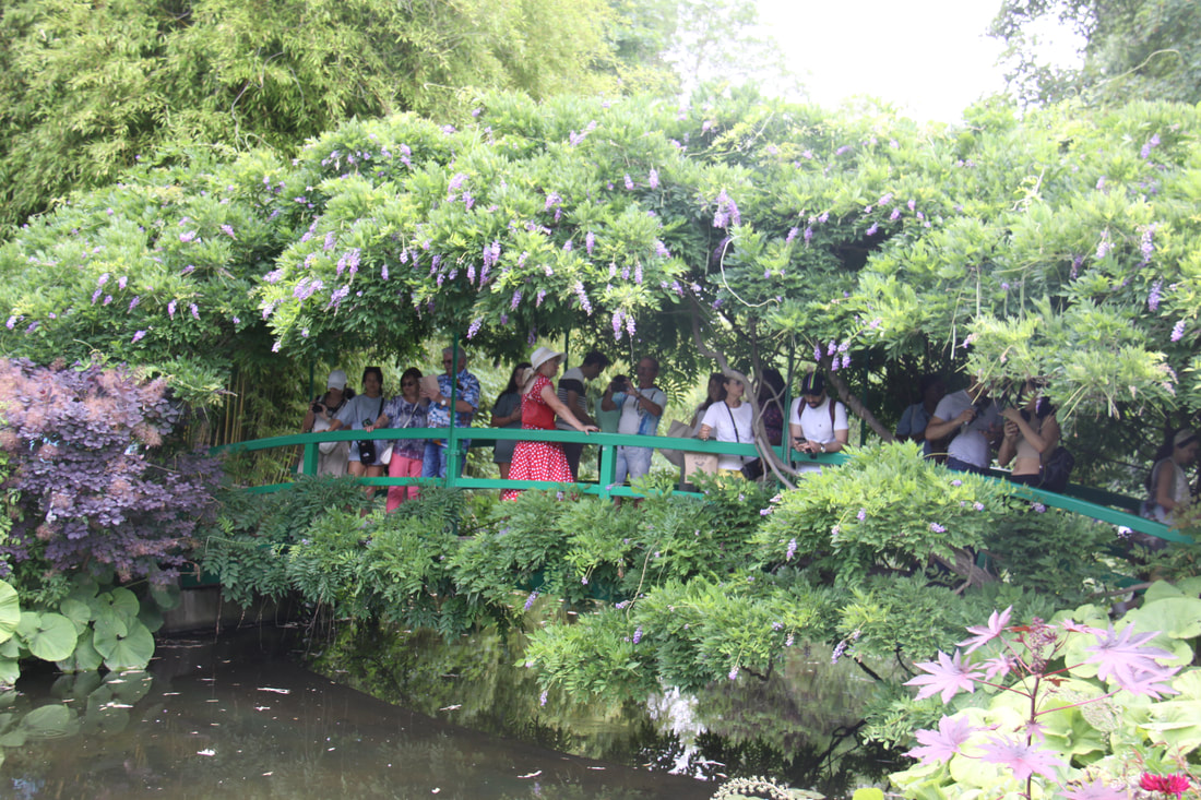
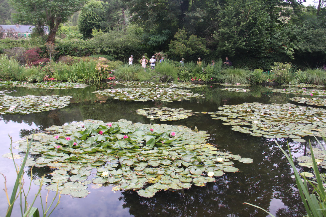
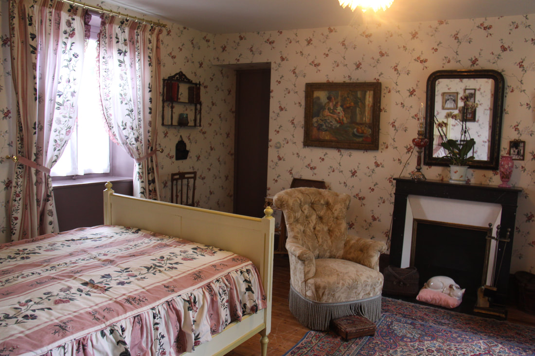
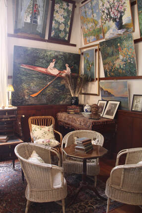
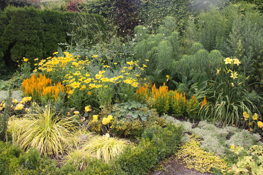
I relented and we were soon back on track. We reached our destination, Giverny and parked in the area designated for motorhomes. From here it was a short walk to Monet’s garden. It was busy but the area around the famous lilly ponds was as beautiful as his famous painting.
An hour or so drive brought us to the outskirts of Evreux where with more luck than navigational skill we managed to find our planned route. However it all went wrong when we took a turn on to a motorway. We took the next exit and ended up in a busy village with no idea where we were. After suggesting several times that perhaps we should use the sat-nav, John stopped the motorhome and refused to set off again until I accepted defeat in my map reading and use the sat-nav.
I relented and we were soon back on track. We reached our destination, Giverny and parked in the area designated for motorhomes. From here it was a short walk to Monet’s garden. It was busy but the area around the famous lilly ponds was as beautiful as his famous painting.
|
|
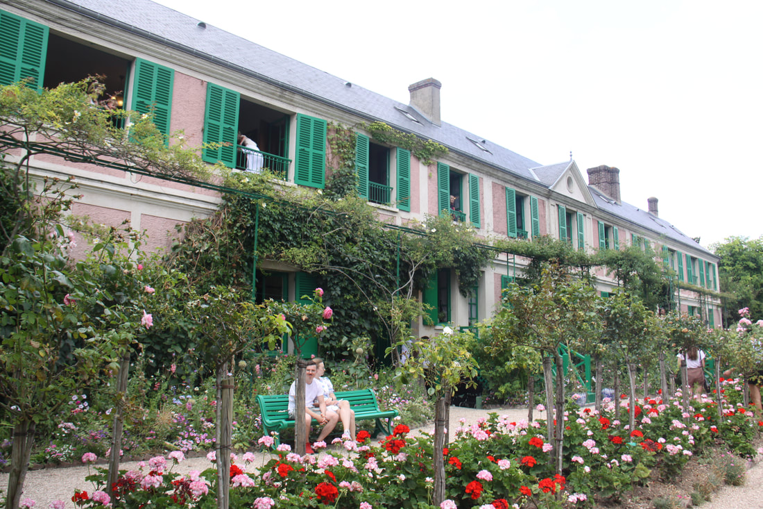
Inside Monet’s house you could walk through each room and marvel at the array of paintings.
|
|
|
Rain had threatened all day and thunder was rumbling in the distance. We stopped for an ice cream and headed back to the van, getting back just in time. The heavens opened and it fairly pelted down with rain. When it stopped we were sitting in a foot of water!
Stayed overnight in the parking area.
Sunday 9th July
The morning began with more rain, fortunately not as heavy as yesterday’s. We spent the morning relaxing in the motorhome, watching the coaches arrive and their passengers trudging out wearing rain coats and carrying umbrellas. We were so glad we’d visited the house and garden yesterday. Several times we started to think about heading out for a walk when the rain started again.
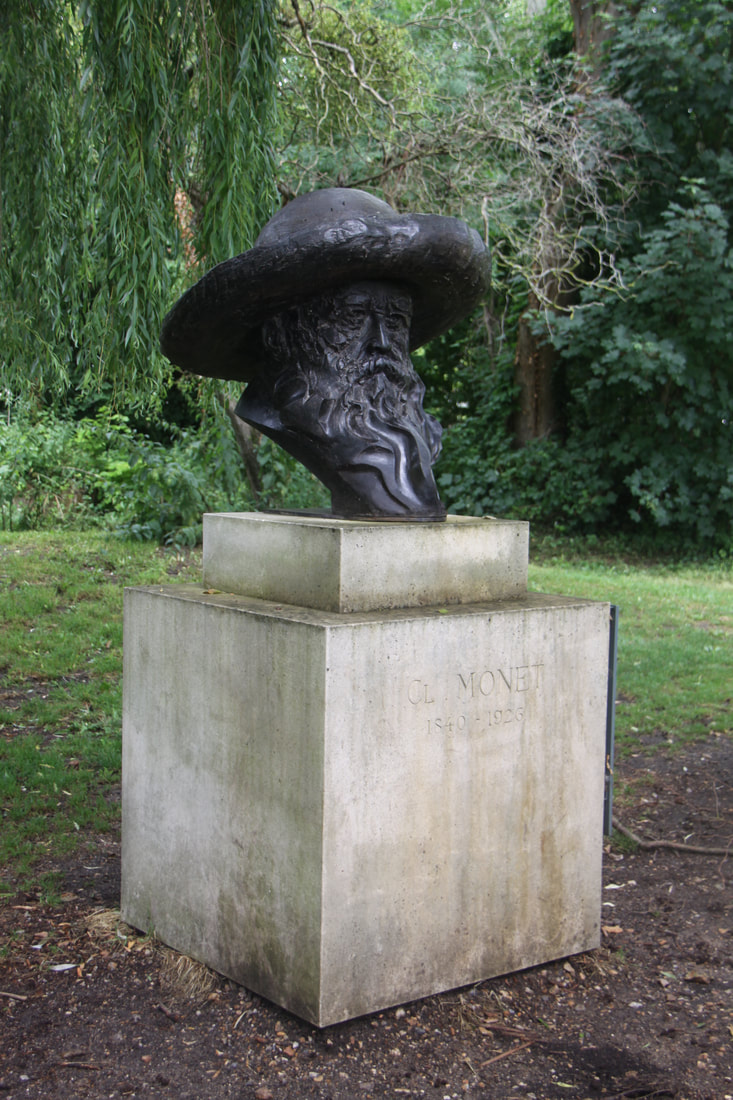
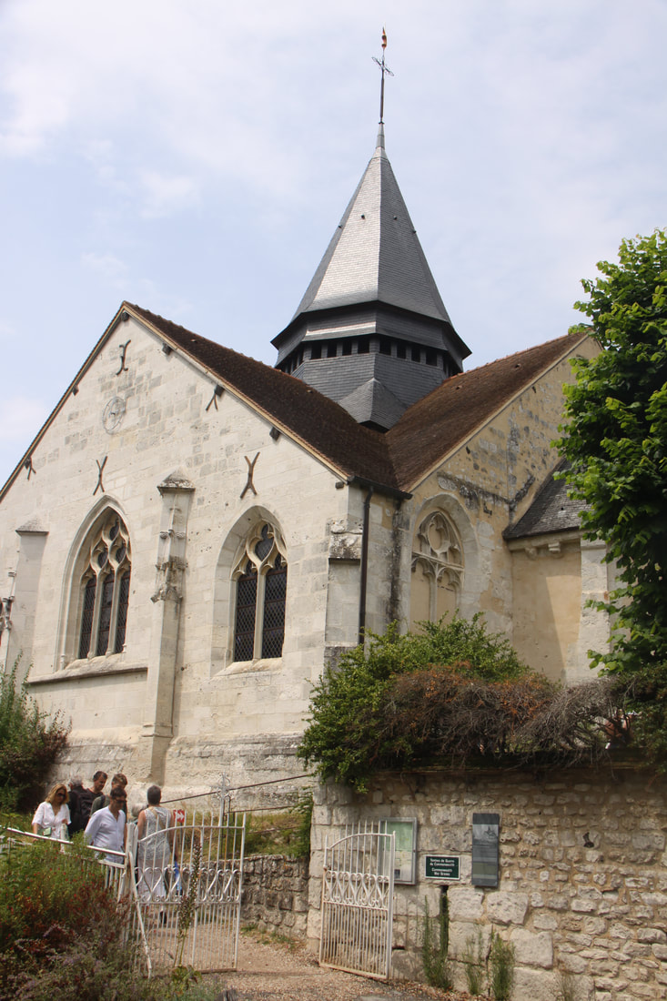
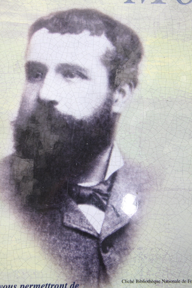
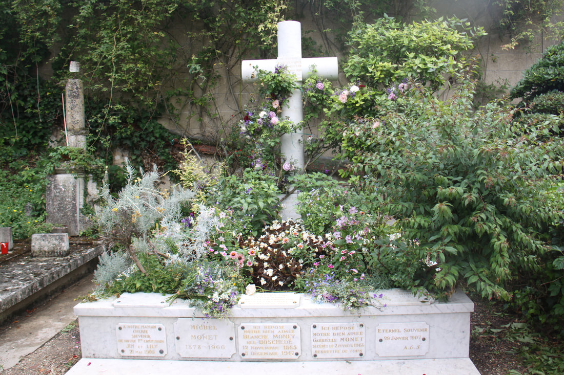
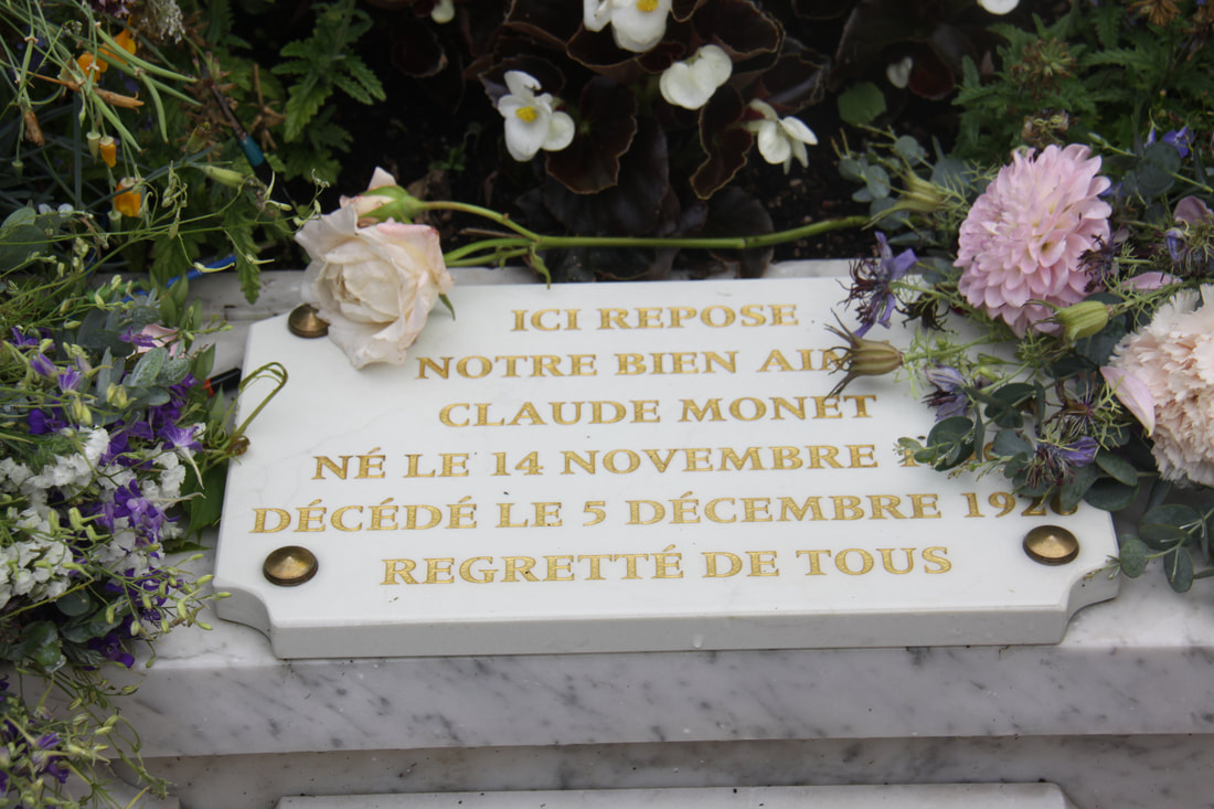
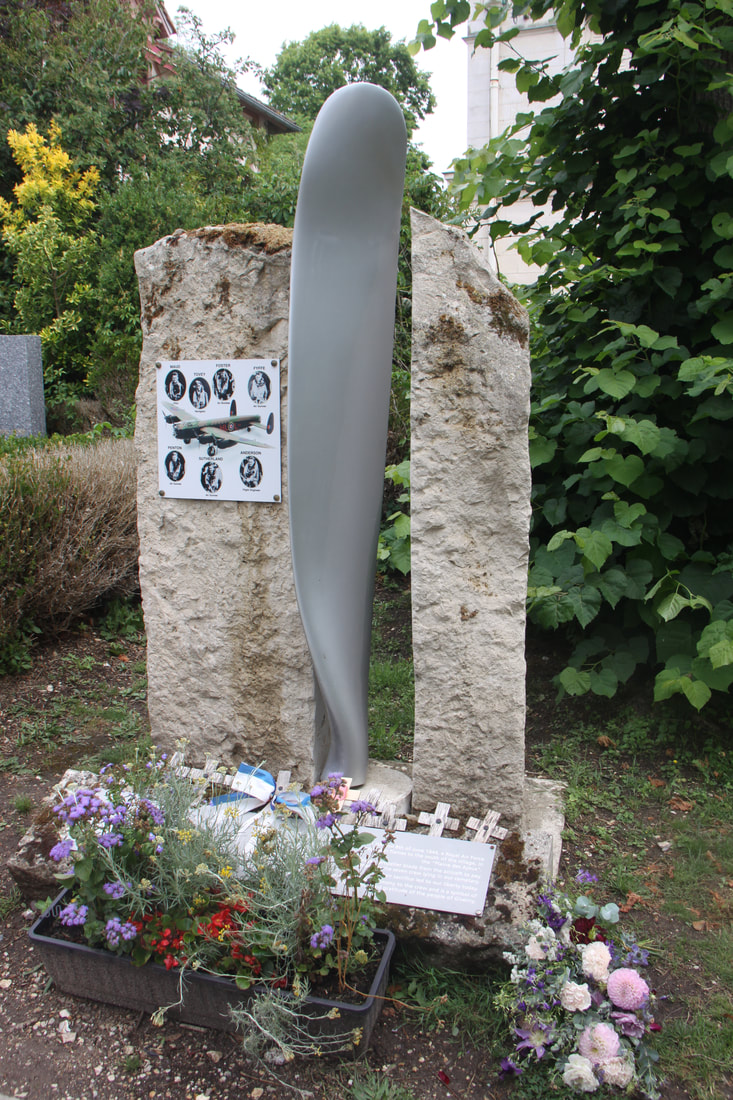
By the afternoon it had dried up a bit so we headed out to explore the village. We stopped first to take a photo of Monet's statue, then strolled along the pedestrianised main street passing by places which would have been so familiar to Monet. In the churchyard of Ste. Radegonde it was easy to spot Monet’s grave.
There was also a memorial to the crew of a British plane which crashed just two days before the end of WW2.
Stayed overnight in the parking area.
Sunday 9th July
The morning began with more rain, fortunately not as heavy as yesterday’s. We spent the morning relaxing in the motorhome, watching the coaches arrive and their passengers trudging out wearing rain coats and carrying umbrellas. We were so glad we’d visited the house and garden yesterday. Several times we started to think about heading out for a walk when the rain started again.
By the afternoon it had dried up a bit so we headed out to explore the village. We stopped first to take a photo of Monet's statue, then strolled along the pedestrianised main street passing by places which would have been so familiar to Monet. In the churchyard of Ste. Radegonde it was easy to spot Monet’s grave.
There was also a memorial to the crew of a British plane which crashed just two days before the end of WW2.
|
|
|
On our way back through the village we admired the individual “garden rooms” outside the Musée des Impressionnismes. As it was Sunday and we hadn’t shopped we were planning on a meal from packets and tins this evening. John was relieved to discover a take-away selling chips, so after a huge portion of chips and an ice cream we headed back to the motorhome where we stayed a second night on the car park.
|

|
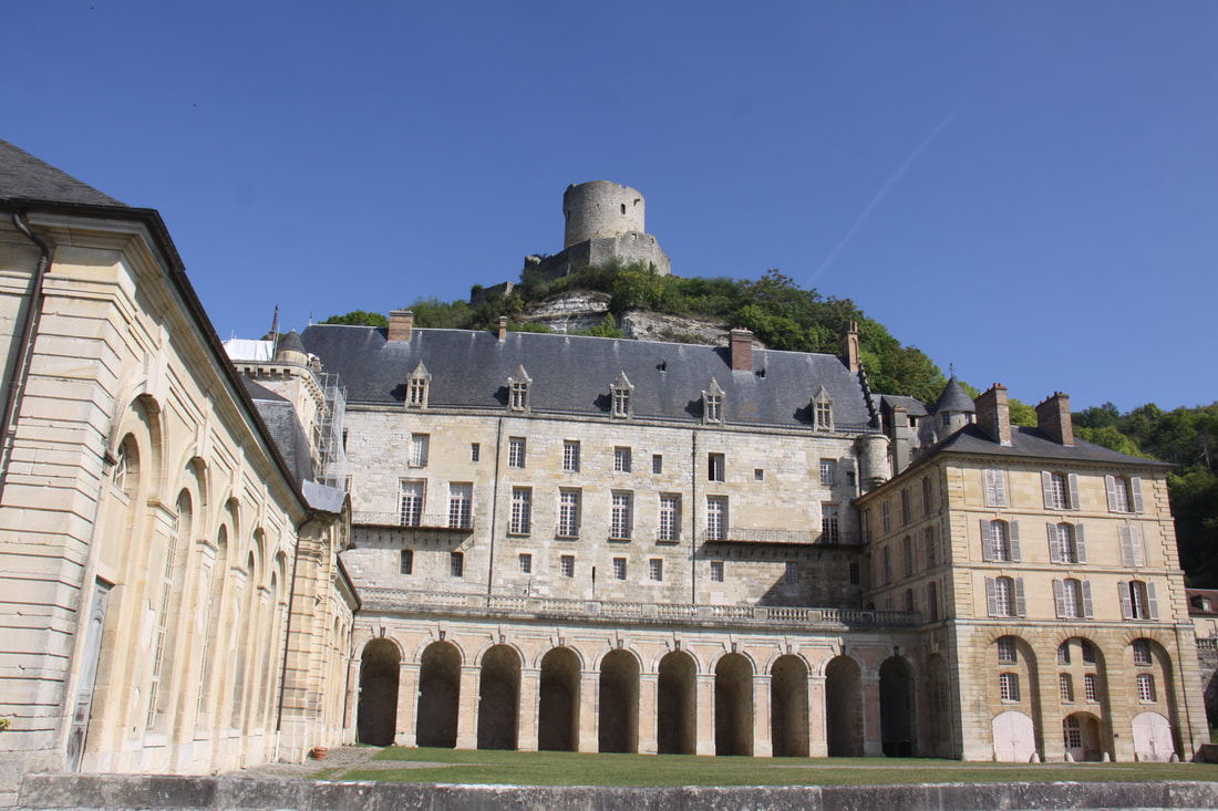
Monday 10th July After filling up with diesel and buying food for the day, we visited the village of La Roche-Guyon. Here an impressive castle built in the 13jth century towers over the impressive chateau below. Troglodyte dwellings are carved into the rock.
The climb up to the castle had many steps and no handrail and John decided it was too much for him. I set off but failed to find the path to the castle so gave up as well.
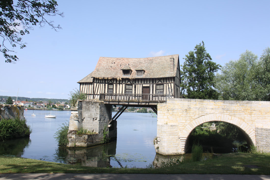
We made a brief stop in Vernon to view the picturesque old water mill that juts out over the river Seine.
The climb up to the castle had many steps and no handrail and John decided it was too much for him. I set off but failed to find the path to the castle so gave up as well.
We made a brief stop in Vernon to view the picturesque old water mill that juts out over the river Seine.
|
|
Our second “Beautiful Village of France” was Lyons-la-Forȇt. There were a number of typical Norman style buildings to see as we wandered around the old feudal mound that formed the central core of the village
|
|
As there were a distinct lack of aires, we pushed on to Gerberay, another listed beautiful village. Here we parked in a huge field with very few other vehicles but a very clear sign stating no overnight parking for motorhomes! Gerberay proved to be a gem of a place. Despite it being late in the afternoon the tourist office was still open and the man on duty gave us an extremely helpful village walk leaflet which meant that we saw the village in depth. He also told us that whilst we could not park overnight there, the near by village of Songeons had an aire de Camping Cars.
|
|
|
|
|
By the time we got to the aire all the dedicated bays were full but we found room on the edge of the car park where we were out of everybody else’s way.
Tuesday 11th July
Another incredibly hot day so we decided to stay put for another day. When the first motorhome left we claimed their pitch. We strolled into the village to buy food then relaxed for the rest of the day.
Wednesday 12th July
A lengthy drive through a mainly agricultural region took us to the Somme World War One battlefields area.
Initially we had planned to stop at an aire in Bray-sur-Somme but at €18 per night for what was nothing more than a car park we decided to give it a miss.
Instead we headed to Peronne where there was a small free aire overlooking a lake. On many aires we had stayed on there were signs clearly stating that parking was for motorhomes only (never the less, there were often cars parked there). This one had no such sign and quite a few spaces were taken up by cars. We found a spot to stop and waited for the cars to go.
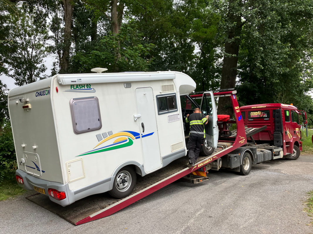
Ever since we bought Nouvelle Nicolle we have had trouble starting the engine. After having a new battery fitted we were told by the garage that the problem was fixed. We continued to have difficulty starting, especially when the engine was hot, but our Ford dealer insisted that all was well.
The problem had continued to get worse. When a car moved and we tried to drive into the space vacated, the engine refused to star completely. Totally dead.
John phoned Red Pennant, our breakdown insurance, and a mechanic arrived very promptly. He immediately announced that we needed a new starter motor and would need to transport the motorhome to the garage. As we were settled with somewhere to park for the night we agreed to stay put and he would come back in the morning. As things turned out we should have let him take our motorhome that evening!
A lengthy drive through a mainly agricultural region took us to the Somme World War One battlefields area.
Initially we had planned to stop at an aire in Bray-sur-Somme but at €18 per night for what was nothing more than a car park we decided to give it a miss.
Instead we headed to Peronne where there was a small free aire overlooking a lake. On many aires we had stayed on there were signs clearly stating that parking was for motorhomes only (never the less, there were often cars parked there). This one had no such sign and quite a few spaces were taken up by cars. We found a spot to stop and waited for the cars to go.
Ever since we bought Nouvelle Nicolle we have had trouble starting the engine. After having a new battery fitted we were told by the garage that the problem was fixed. We continued to have difficulty starting, especially when the engine was hot, but our Ford dealer insisted that all was well.
The problem had continued to get worse. When a car moved and we tried to drive into the space vacated, the engine refused to star completely. Totally dead.
John phoned Red Pennant, our breakdown insurance, and a mechanic arrived very promptly. He immediately announced that we needed a new starter motor and would need to transport the motorhome to the garage. As we were settled with somewhere to park for the night we agreed to stay put and he would come back in the morning. As things turned out we should have let him take our motorhome that evening!
|
Thursday 13th July
A very frustrating morning. We woke early in the hope that the recovery truck would arrive quickly. It didn’t! After several phone calls to Red Pennant it arrived just before noon. Apparently the driver had been on his way but had been diverted to attend to a multiple car accident on the motorway. We watched the mechanic winch Nicolle onto the breakdown truck. He then let her run down backwards to bump-start the engine. This scared me rigid as I thought she would crash into the trees behind! |
|
|
Once we were at the garage we had a two hour wait. Lunch break.
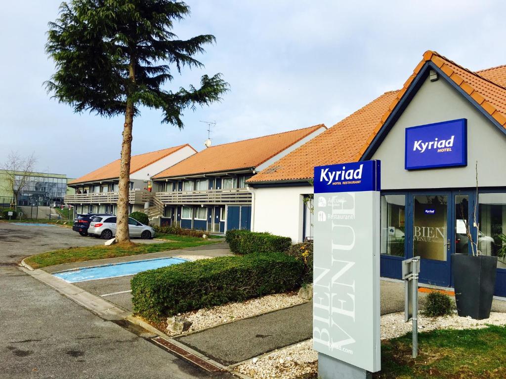
When the chief mechanic finally returned from lunch he announced that we needed a new starter motor. It seemed doubtful if they could get one before Monday. Tomorrow is Bastille Day, a public holiday and then it was the weekend. Red Pennant were brilliant. They regularly kept in touch and checked that we were okay. They booked us into a hotel for the next four nights and paid the bill in advance. The garage manager drove us to the hotel and the hotel manager arranged car hire for us and took us to collect it. The Kyriad Hotel – more like a motel- was on the outskirts of Peronne and was very pleasant. |
Friday 14th July
Bastille Day and everywhere was closed as people prepare for lavish celebrations tonight.
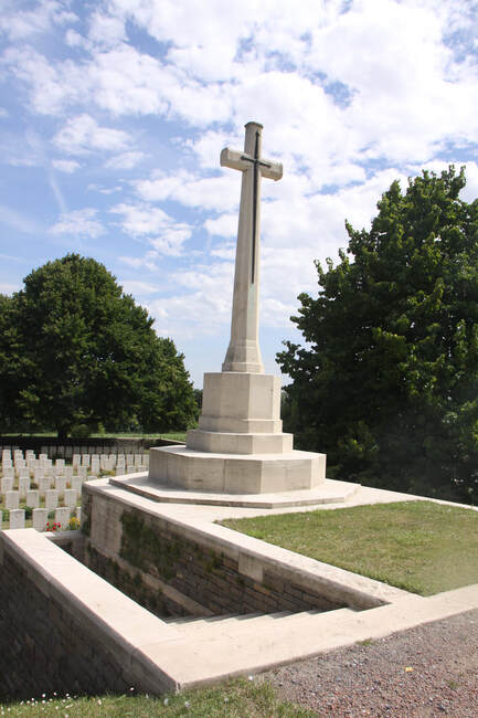
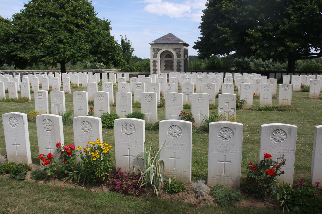
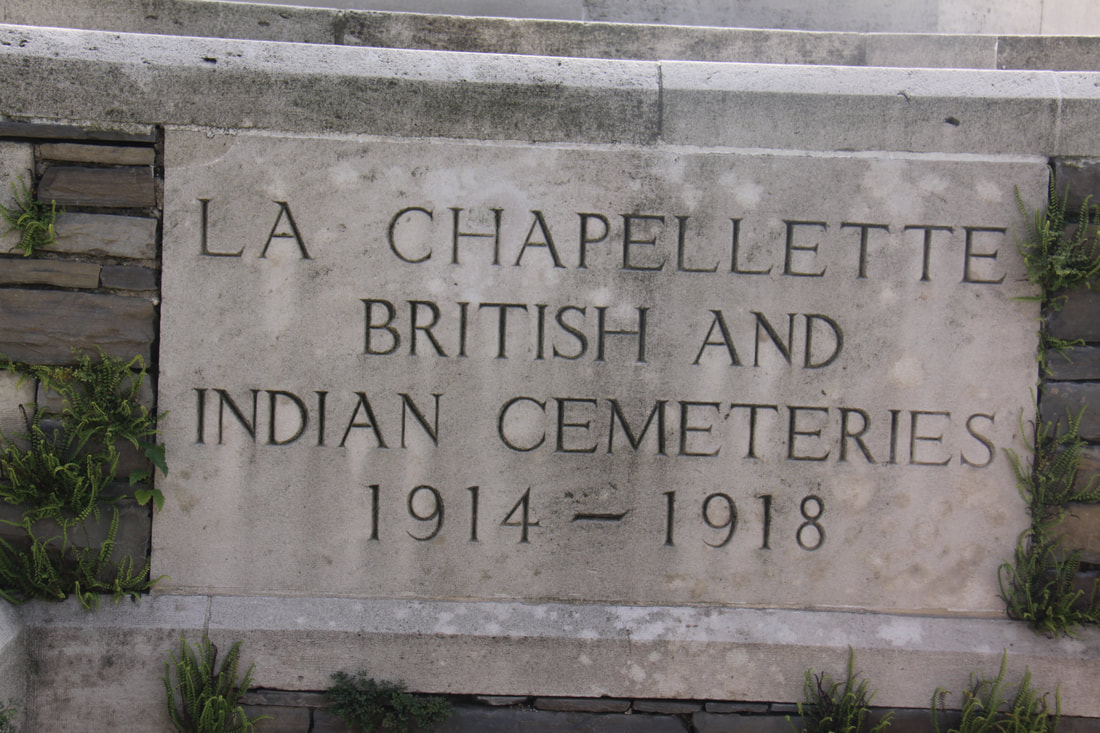
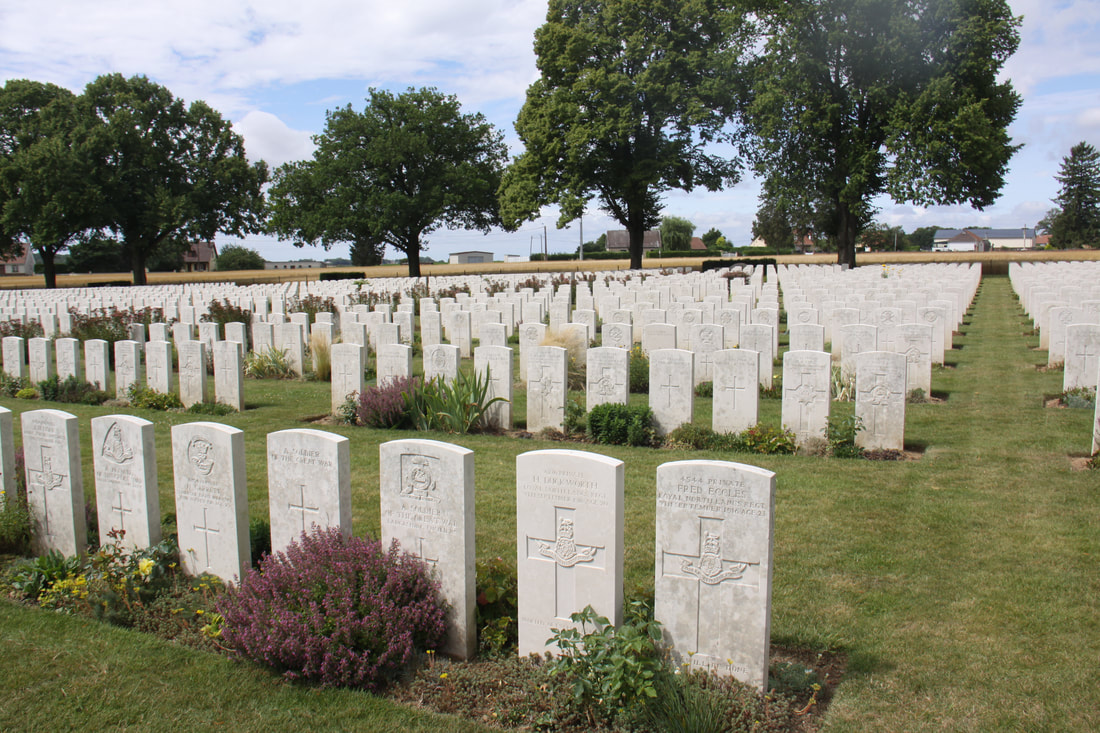
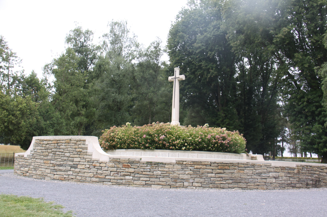
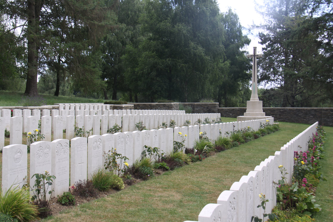
We visited the nearby La Chapelette British and Indian Cemetery. Peronne was occupied by British troops on the 18th March 1917, lost on the 23rd March 1918, and regained on the 1st September 1918. The cemetery contains the graves of 577 war casualties, 6 of which are unidentified. As with all War Grave Commission sites world-wide, it was immaculately kept.
Bastille Day and everywhere was closed as people prepare for lavish celebrations tonight.
We visited the nearby La Chapelette British and Indian Cemetery. Peronne was occupied by British troops on the 18th March 1917, lost on the 23rd March 1918, and regained on the 1st September 1918. The cemetery contains the graves of 577 war casualties, 6 of which are unidentified. As with all War Grave Commission sites world-wide, it was immaculately kept.
|
|
Saturday 15th July
John was not happy to begin with, driving our left hand drive Renault Mégane hire car, but soon got the feel of it. I didn’t have my map-book with me but we sorted out the sat-nav and even changed it so that the instructions were in English.
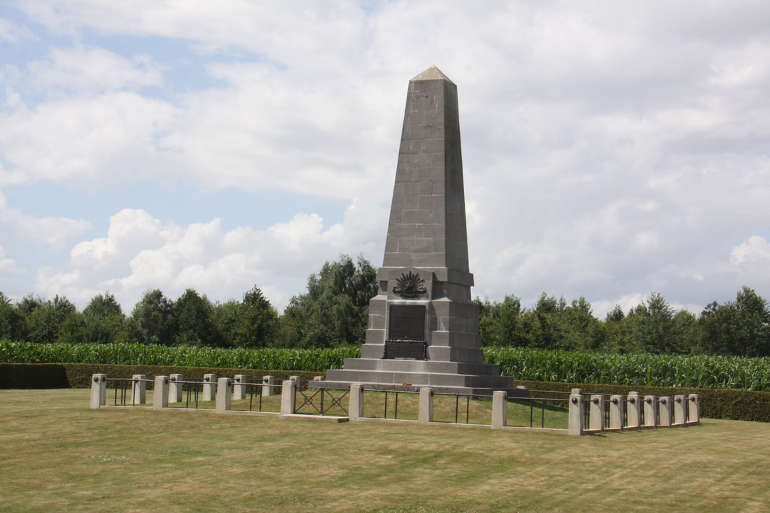
The route through the main battlefields of the Somme valley is marked by a red poppy. Our first stop was at the New Zealand Memorial located near the village of Longueval.
The New Zealand Army arrived in France in 1916 after service in Egypt and Gallipoli. At 6.20am on the 15th September, 6000 soldiers from the Auckland and Otago regiments went "over the top". On that first day, 600 were killed and 1200 were wounded or missing. A single stone memorial commemorates their actions.
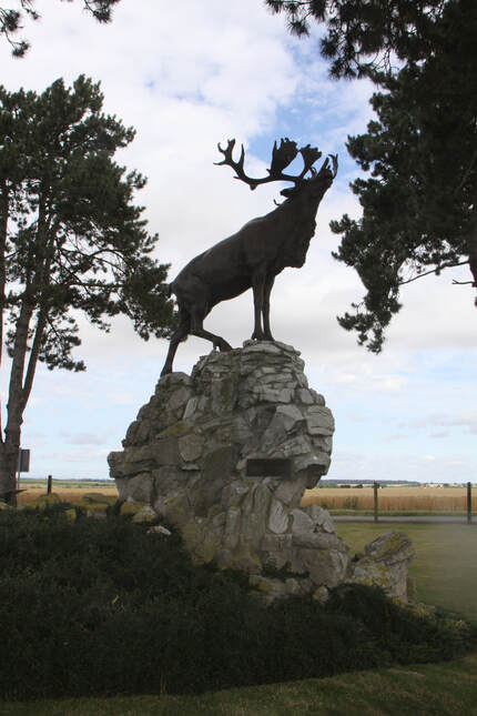
A little off the beaten track north of Longueval lies the hamlet of Gueudecourt. Here we discovered the memorial to the Royal Newfoundland Regiment that captured a German strong-point in October 2016. A stag stands on a rocky base amongst trees with a trench at its base.
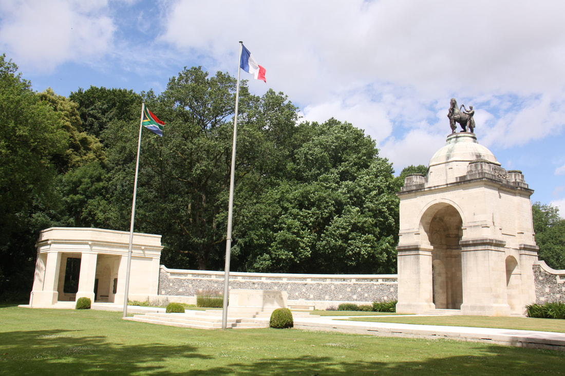
We returned to Longueval and nearby Delville Wood where the South African National Memorial and museum are located. It was in the woods surrounding the memorial that a small group of South Africans fought against units of the German 4th Army Corps. The surrounding woods is a burial ground to all the soldiers who lost their lives here.
John was not happy to begin with, driving our left hand drive Renault Mégane hire car, but soon got the feel of it. I didn’t have my map-book with me but we sorted out the sat-nav and even changed it so that the instructions were in English.
The route through the main battlefields of the Somme valley is marked by a red poppy. Our first stop was at the New Zealand Memorial located near the village of Longueval.
The New Zealand Army arrived in France in 1916 after service in Egypt and Gallipoli. At 6.20am on the 15th September, 6000 soldiers from the Auckland and Otago regiments went "over the top". On that first day, 600 were killed and 1200 were wounded or missing. A single stone memorial commemorates their actions.
A little off the beaten track north of Longueval lies the hamlet of Gueudecourt. Here we discovered the memorial to the Royal Newfoundland Regiment that captured a German strong-point in October 2016. A stag stands on a rocky base amongst trees with a trench at its base.
We returned to Longueval and nearby Delville Wood where the South African National Memorial and museum are located. It was in the woods surrounding the memorial that a small group of South Africans fought against units of the German 4th Army Corps. The surrounding woods is a burial ground to all the soldiers who lost their lives here.
|
|
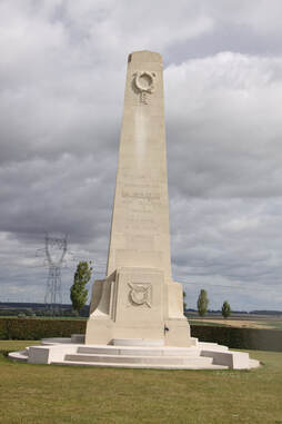
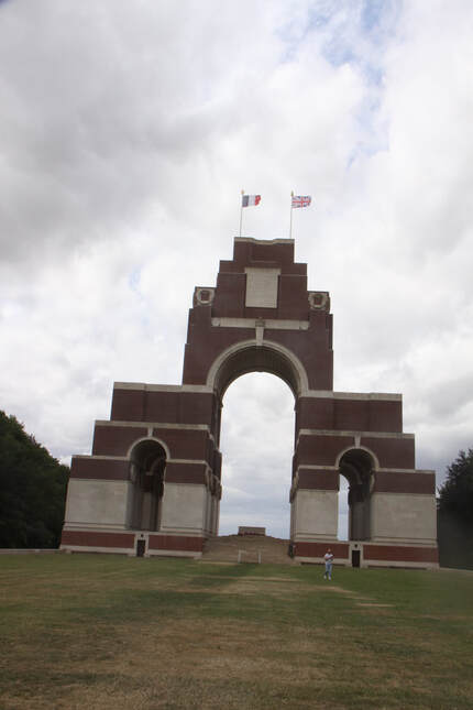
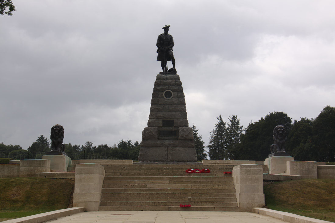
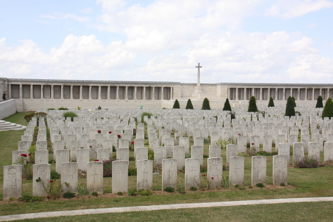
Our final visit of the day was to Thiepval where for six days a continual bombardment by British troops aimed to cut the German line. Many of the 100,000 soldiers were from “Pals Battalions”, volunteer battalions consisting of men who enlisted together as groups of local friends, and had no combat experience. By the end of the first day there were over 60,000 casualties.
Sir Edwin Lutyens designed the impressive memorial which has engraved on it the names of 72,205 British and South African soldiers who were declared missing.
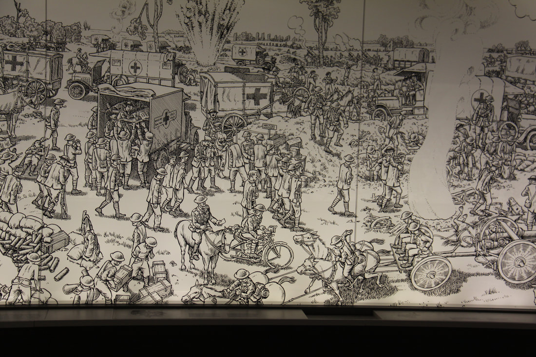
The Thiepval Museum was a very moving experience. An introductory film set the scene of the development of the First World War. This was followed by a 60 metre long tapestry depicting the first day of the Battle of the Somme. Separate areas were dedicated to missing people, use of early aeroplanes and differing perspectives of how the French and Germans viewed the Battle of the Somme.
Sir Edwin Lutyens designed the impressive memorial which has engraved on it the names of 72,205 British and South African soldiers who were declared missing.
The Thiepval Museum was a very moving experience. An introductory film set the scene of the development of the First World War. This was followed by a 60 metre long tapestry depicting the first day of the Battle of the Somme. Separate areas were dedicated to missing people, use of early aeroplanes and differing perspectives of how the French and Germans viewed the Battle of the Somme.
|

|
Sunday 16th July
Today, still in the hire car, we set out to explore more of the WWI battlefields which were located near to Peronne.
Beaumont-Hamel is the location of the Newfoundland Memorial. In 1914 Newfoundland was not part of Canada but a dominion of the British Empire. So when war was declared, Newfoundland was also at war.
The Battle of Beaumont-Hamel began on 1st July 1916 and casualties were high: 700 either killed, wounded or missing on the first day.
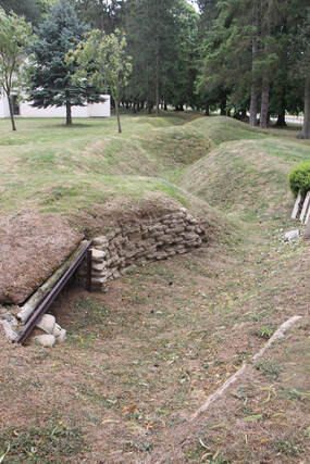
A route through the battlefield took us past former trenches, some with iron reinforcements still in place, the British and German front lines, various monuments to the Newfoundland regiments and two cemeteries.
Today, still in the hire car, we set out to explore more of the WWI battlefields which were located near to Peronne.
Beaumont-Hamel is the location of the Newfoundland Memorial. In 1914 Newfoundland was not part of Canada but a dominion of the British Empire. So when war was declared, Newfoundland was also at war.
The Battle of Beaumont-Hamel began on 1st July 1916 and casualties were high: 700 either killed, wounded or missing on the first day.
A route through the battlefield took us past former trenches, some with iron reinforcements still in place, the British and German front lines, various monuments to the Newfoundland regiments and two cemeteries.
|
|
|
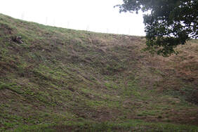
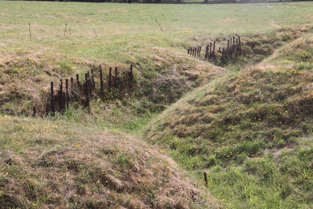
Close by was Hawthorne Ridge crater. Ten minutes before the invasion, 30,000 lb of ammonal were detonated forming a crater 11m deep and over 100m wide. We walked round and climbed down into the crater
Monday 17th July
Phoned the garage first thing this morning to be told they were hoping to locate a starter motor today. After breakfast we called in. They were expecting the starter motor to be delivered later this morning and that the repair would be completed by the end of the day.
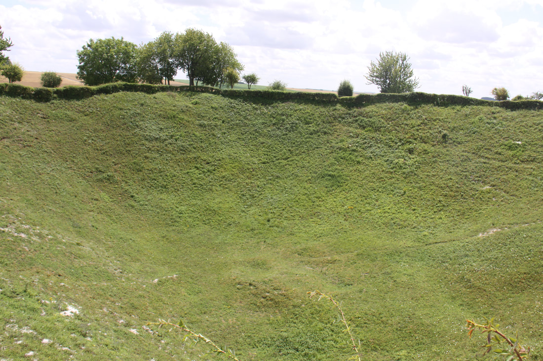
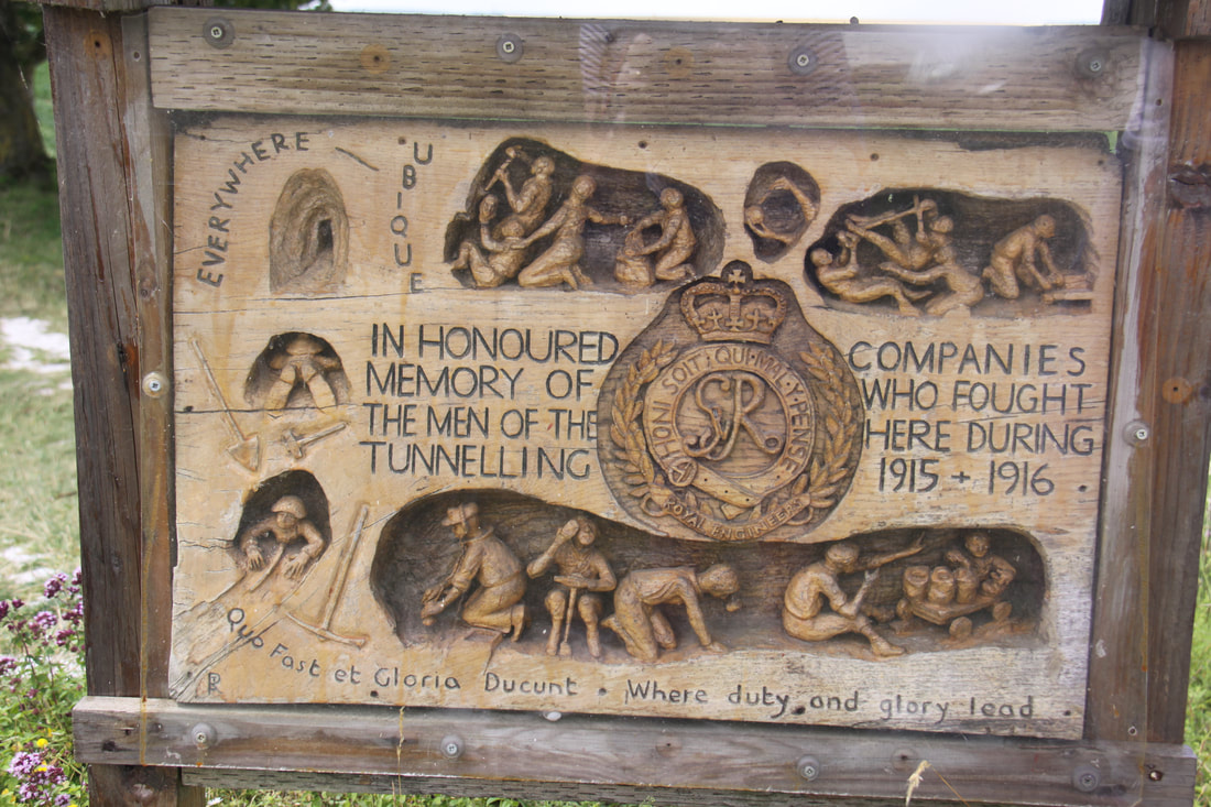
Drove out to La Boisselle, the location of the Lochnagar Crater. This was formed by mines which were tunnelled under the German front lines with the intention of destroying them. After the explosion the crater was 91m wie and 21m deep. The site is on private land and entry is free but the landowners ask for a donation which is being used to develop the site. Boardwalks run all the way round the crater and information boards tell the stories of the men involved, many who died but some that survived. Close by was the “Glory Hole", a much smaller crater.
Phoned the garage first thing this morning to be told they were hoping to locate a starter motor today. After breakfast we called in. They were expecting the starter motor to be delivered later this morning and that the repair would be completed by the end of the day.
Drove out to La Boisselle, the location of the Lochnagar Crater. This was formed by mines which were tunnelled under the German front lines with the intention of destroying them. After the explosion the crater was 91m wie and 21m deep. The site is on private land and entry is free but the landowners ask for a donation which is being used to develop the site. Boardwalks run all the way round the crater and information boards tell the stories of the men involved, many who died but some that survived. Close by was the “Glory Hole", a much smaller crater.
|
|
We then headed towards the small, near-by village of Poziéres. This was a key site in the fight to capture Thiepval Ridge and was the first time that tanks were used on the battlefield. We viewed the memorial to the Australian Army where there was the remains of an underground bunker. A large cemetery contains the graves of 2700, mainly British soldiers, whose remains were found, the memorial walls contain the names of 14,000 more who have no known grave.
|
|
We arrived back at our hotel to be told by Mr. Patel, the hotel manager, that our motorhome would be ready for collection in the morning.
Tuesday 18th July
Said goodbye to the Patel family and left the Kyriad Hotel. Took the rental car to the carwash for a clean and vacuum inside before returning it and then headed for the garage.
We had originally booked our ferry for mid-day today but obviously we would not make it on time. Red Pennant had amended the booking for us but unfortunately it was not until midnight.
It was 110 miles to Calais, the road passing through many villages with 20km speed limits and countless traffic calming measures. On reflection we should have taken the motorway.
We arrived in Calais to just miss a ferry but there was room on the next one at 18.05.
We stayed overnight at the Valiant Sailor at Capel-le-Ferne before heading for home.
[click] to return to Home Page