Harris and Lewis
Tuesday 21st May
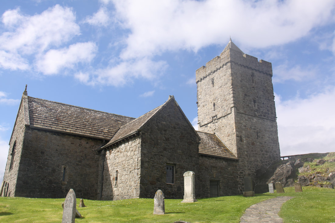
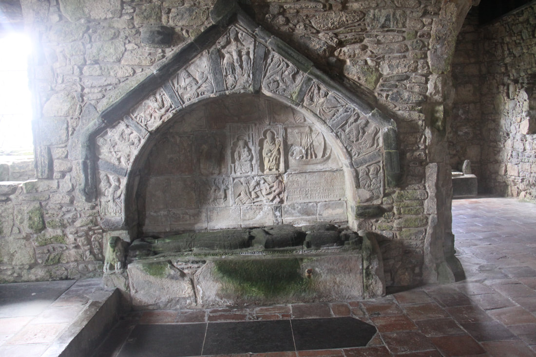
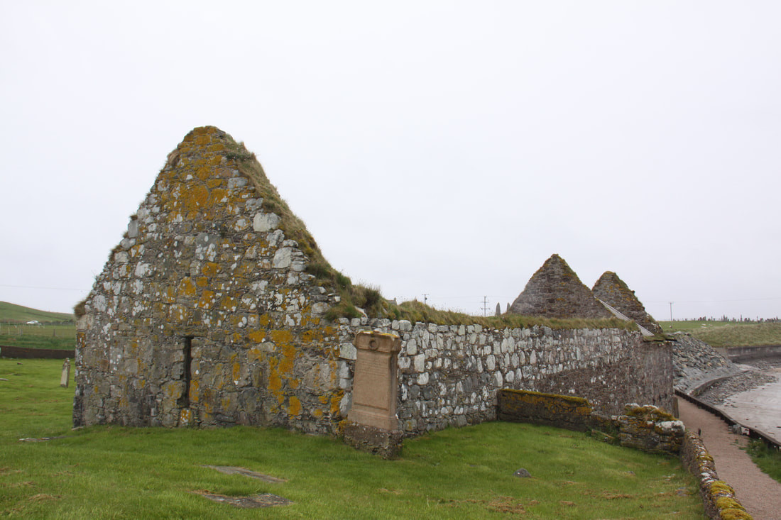
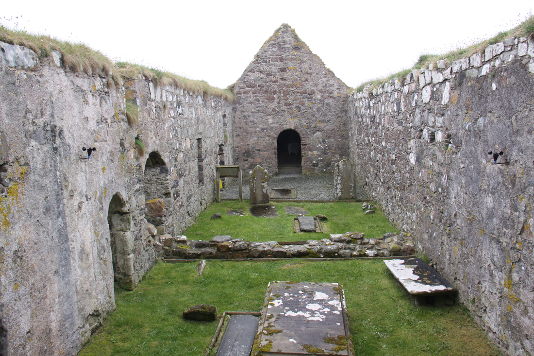
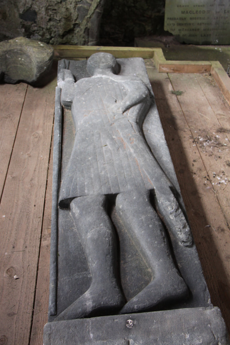
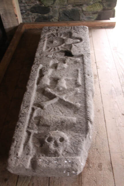
After grocery shopping in the community shop located in the village of Leverburgh we headed to Rodel, a cluster of houses clinging to the deeply indented rocky coast. St. Clement’s Church sits proudly on a knoll above the small harbour. The church dates from 1520 and its medieval roots are clear to see. There are three interior carved wall tombs that are the resting places of the Macleods of Harris and Dunvegan, while the grave of the 8th chief, Alasdair Macleod holds centre stage (it was he who built the church!). The carvings on this tomb were intricate.
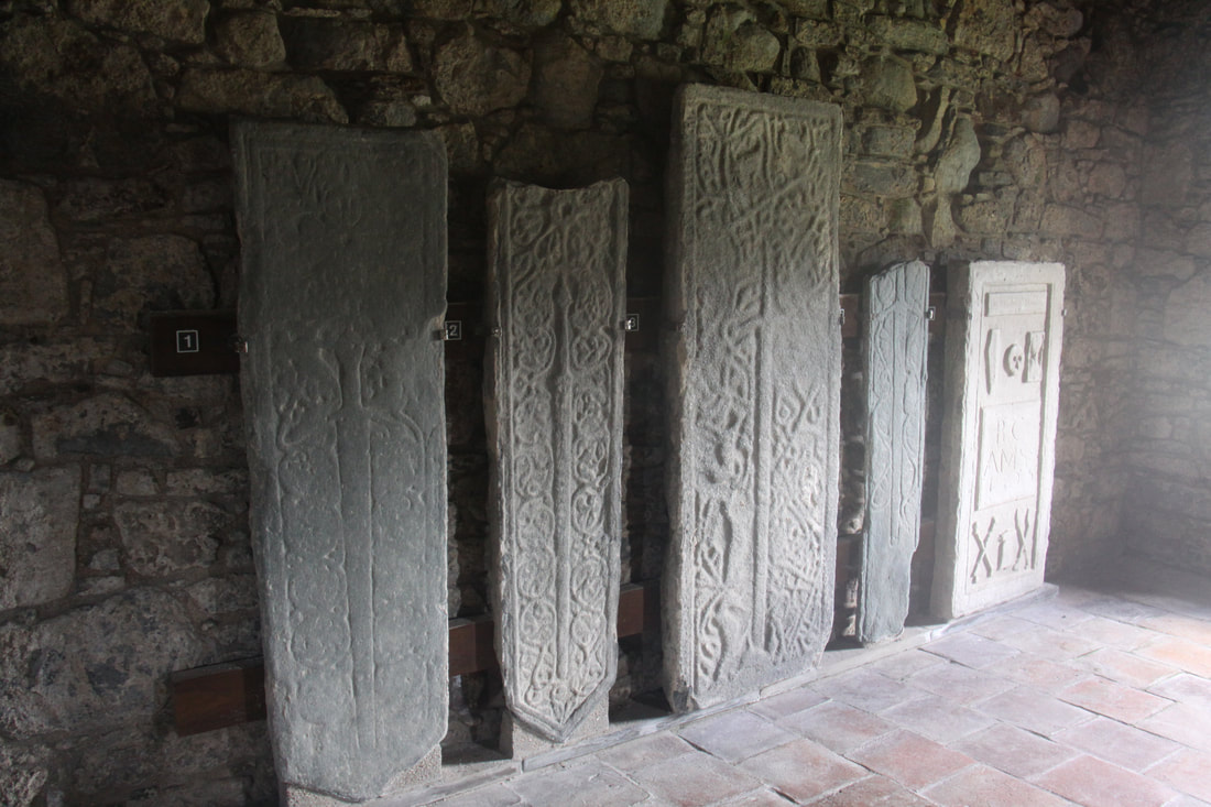
Five stone slabs all have intricate carvings including swords, stand along the wall of a side chapel. Even the outer walls of the square tower have carvings on three of the walls. A true gem of a place.
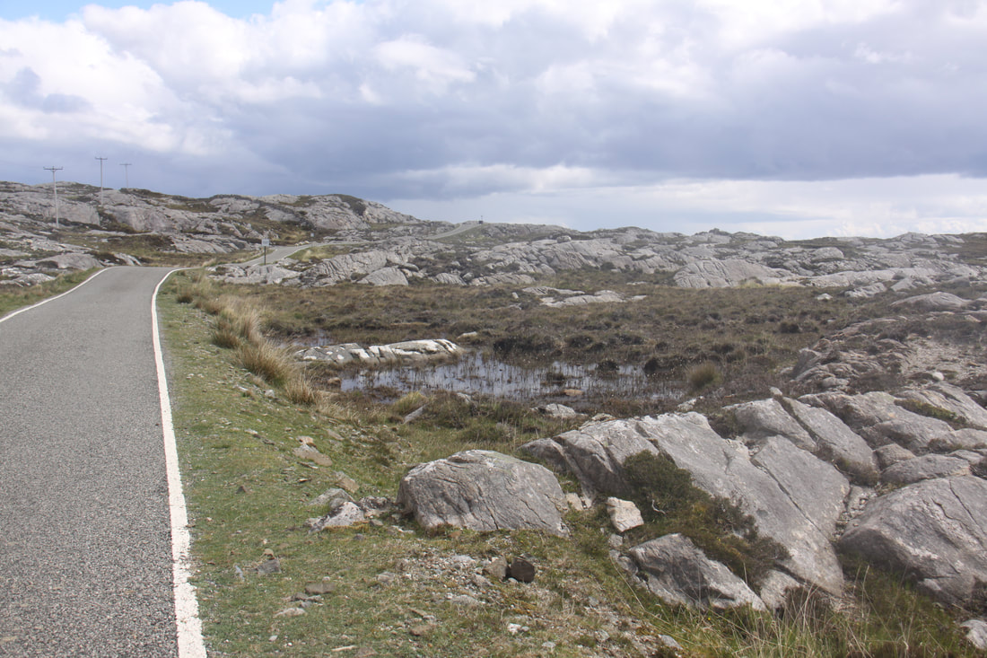
The Bays Road runs along the east coast of Harris. This tiny thread of a road links the tiny settlements, many dating back to the Viking era, by means of a tortuous switchback of bitumen where bends are taken with care in case of oncoming traffic on the single track. Luckily small passing places are frequent. The scenery is absolutely beautiful – azure blue sea, Nordic style cottages set amongst huge granite boulders and tiny fresh water lochs and lochans. Truly a great drive.
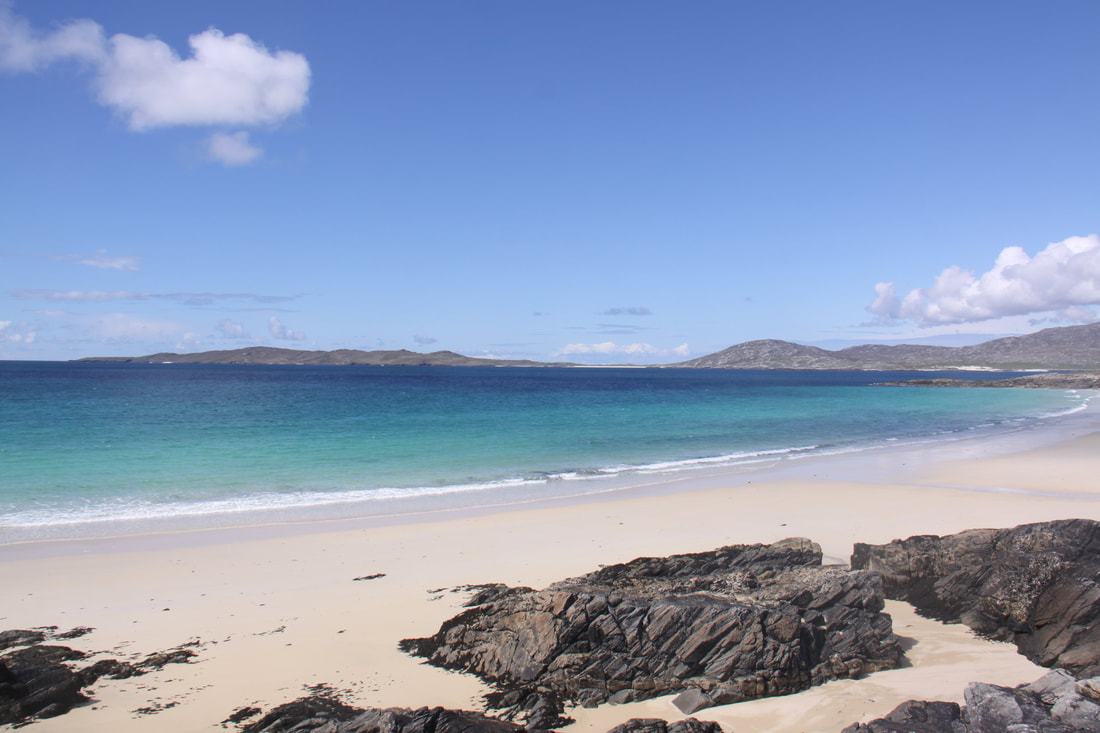
We paid a visit to the Harris Tweed Exhibition and Museum in Drinishader before heading across the west coast of Harris. As we crested the hill, the Luskentyre Sands and the Sound of Taransay were a view to end all views. We found a quiet spot here to spend the night.
After grocery shopping in the community shop located in the village of Leverburgh we headed to Rodel, a cluster of houses clinging to the deeply indented rocky coast. St. Clement’s Church sits proudly on a knoll above the small harbour. The church dates from 1520 and its medieval roots are clear to see. There are three interior carved wall tombs that are the resting places of the Macleods of Harris and Dunvegan, while the grave of the 8th chief, Alasdair Macleod holds centre stage (it was he who built the church!). The carvings on this tomb were intricate.
Five stone slabs all have intricate carvings including swords, stand along the wall of a side chapel. Even the outer walls of the square tower have carvings on three of the walls. A true gem of a place.
The Bays Road runs along the east coast of Harris. This tiny thread of a road links the tiny settlements, many dating back to the Viking era, by means of a tortuous switchback of bitumen where bends are taken with care in case of oncoming traffic on the single track. Luckily small passing places are frequent. The scenery is absolutely beautiful – azure blue sea, Nordic style cottages set amongst huge granite boulders and tiny fresh water lochs and lochans. Truly a great drive.
We paid a visit to the Harris Tweed Exhibition and Museum in Drinishader before heading across the west coast of Harris. As we crested the hill, the Luskentyre Sands and the Sound of Taransay were a view to end all views. We found a quiet spot here to spend the night.
|
|
|
|

|
|
Wednesday 22nd May
We woke to a dull wet day with mist covering the hills. No chance of the hoped for photographs of the wide expanse of silver sands and turquoise waters of Luckentyre Bay and the island of Taransay, made famous by the year long TV programme, Castaway.
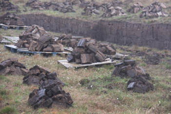
En route to Tarbert we passed a number of areas of peat bogs which had been recently cut.
Tarbert consists of two narrow main streets so we were fortunate to find a place on the Isle of Harris Distillery car park. I lost John for half an hour as he disappeared to drool over an Austin Healey 3000 sports car parked nearby!
Just across the road was the Harris Tweed retail and fabric shop, worth a look but you need a deep pocket if you want to buy something like a jacket.
As the weather was so much against us today we stopped for the night in a layby north of Tarbert – ideal as it was a remnant of the old road so well away from the modern road.
We woke to a dull wet day with mist covering the hills. No chance of the hoped for photographs of the wide expanse of silver sands and turquoise waters of Luckentyre Bay and the island of Taransay, made famous by the year long TV programme, Castaway.
En route to Tarbert we passed a number of areas of peat bogs which had been recently cut.
Tarbert consists of two narrow main streets so we were fortunate to find a place on the Isle of Harris Distillery car park. I lost John for half an hour as he disappeared to drool over an Austin Healey 3000 sports car parked nearby!
Just across the road was the Harris Tweed retail and fabric shop, worth a look but you need a deep pocket if you want to buy something like a jacket.
As the weather was so much against us today we stopped for the night in a layby north of Tarbert – ideal as it was a remnant of the old road so well away from the modern road.
|

|
Thursday 23rd May
The weather has not improved – cold and drizzle with no real signs of it getting better.
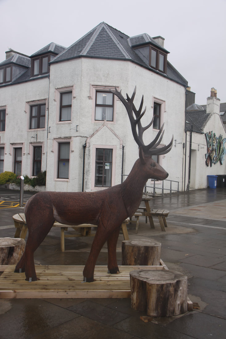
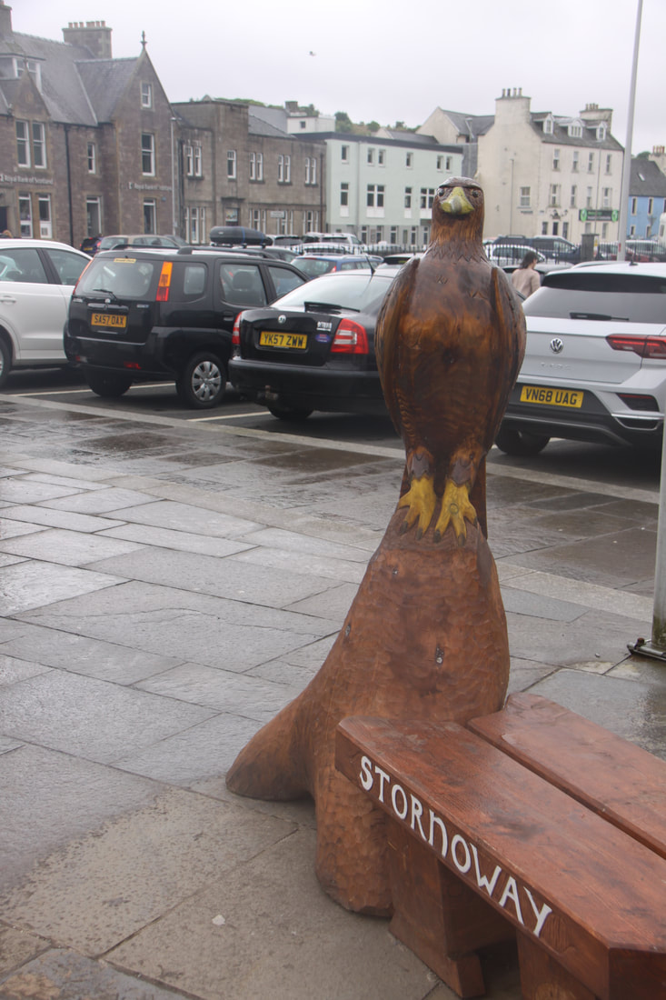
Our first stop for the day was at the Co-op in Stornaway. From there we headed into the town centre to the Scottish Information Centre – emails were successfully read and sent but the next few days weather forecast was sobering – overcast, drizzle, windy culminating in heavy rain over the weekend. Wandered round the town and along the harbourside before moving on.
The weather has not improved – cold and drizzle with no real signs of it getting better.
Our first stop for the day was at the Co-op in Stornaway. From there we headed into the town centre to the Scottish Information Centre – emails were successfully read and sent but the next few days weather forecast was sobering – overcast, drizzle, windy culminating in heavy rain over the weekend. Wandered round the town and along the harbourside before moving on.
|
|
|
|
Realising that things were only going to get worse we decided to make the most of it and visit some of the major archaeological sites today.
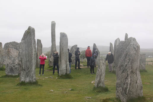
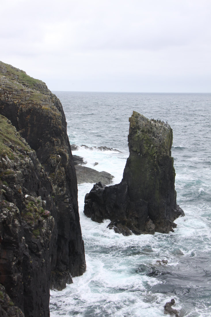
Callanish Stone Circle was erected around 4500 years ago. It consists of a single standing stone surrounded by a circle of thirteen smaller stones. Some 2000 years later, a small burial cairn was placed within the stone ring. To complete the picture rows of stone lead away from the central ring. It seemed very strange to be able to wander at will through this ancient site. Two smaller groups of stone are located nearby.
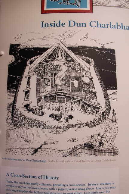
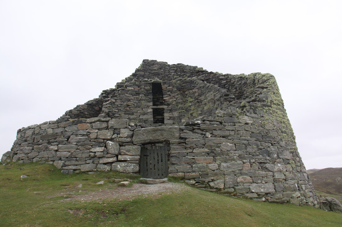
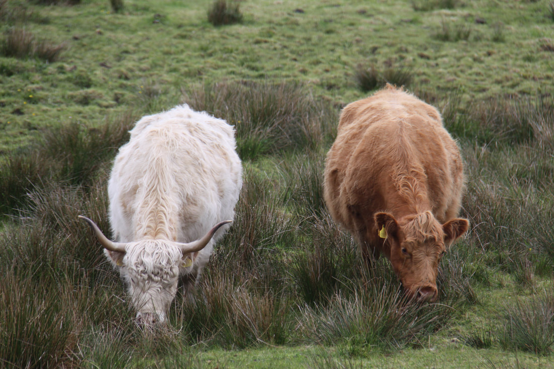
Our next stop was at Dun Carlaway to visit one of the best preserved Iron Age brochs in Scotland. The state of its presentation is incredible. You duck through a low lintel then climb with care the narrow, very uneven steps which bind the outer and inner shell of the broch together to reach what would have been the next level of the building. Truly an incredible but little understood fort or possibly home. on the way we passed some very soggy highland cattle.
Callanish Stone Circle was erected around 4500 years ago. It consists of a single standing stone surrounded by a circle of thirteen smaller stones. Some 2000 years later, a small burial cairn was placed within the stone ring. To complete the picture rows of stone lead away from the central ring. It seemed very strange to be able to wander at will through this ancient site. Two smaller groups of stone are located nearby.
Our next stop was at Dun Carlaway to visit one of the best preserved Iron Age brochs in Scotland. The state of its presentation is incredible. You duck through a low lintel then climb with care the narrow, very uneven steps which bind the outer and inner shell of the broch together to reach what would have been the next level of the building. Truly an incredible but little understood fort or possibly home. on the way we passed some very soggy highland cattle.
|
|
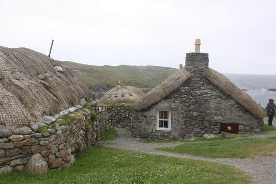
A little further north lies the Gearrannan Blackhouse Village. Here a collection of restored typical houses is huddled along a track leading to a small beach. The houses are restored long houses which were lived in up until the 1970s. It was possible to go in one house to see how people and animals shared the blackhouse with its thatched roof weighted down by boulders and the strong stone built walls.
Tonight we stopped at a small car park not far past the restored blackhouses.
Tonight we stopped at a small car park not far past the restored blackhouses.
Friday 24th May
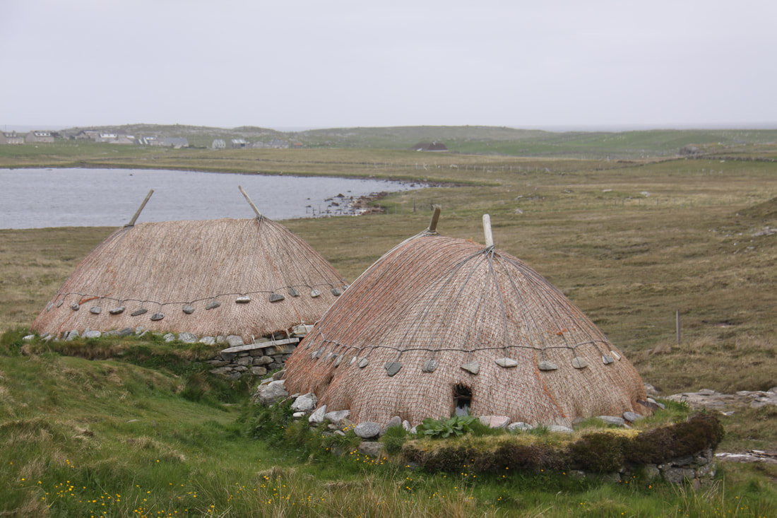
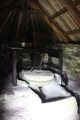
Our first visit this morning was just a short way from our overnight stop – a restored Norse mill and a reconstructed kiln barn. Both of these small, picturesque thatched buildings were set on the bank of a small stream.
Our first visit this morning was just a short way from our overnight stop – a restored Norse mill and a reconstructed kiln barn. Both of these small, picturesque thatched buildings were set on the bank of a small stream.
|
|
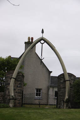
Travelling further north we spotted a whalebone arch, six metres tall and randomly located to the side of a house. The harpoon that had killed the whale before it was washed up on shore a hundred years ago, was suspended from the top of the arch.
We then made a short diversion to see the restored Arnol Blackhouse. However, as we had visited a very similar building yesterday, we decided not to go in.
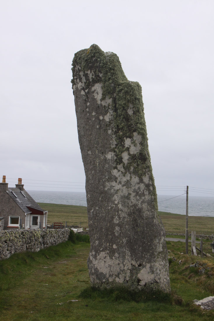
The Thrishel Stone was located at the end of a short track leading seawards off the main road. The stone is a lone 20ft high monolith which it is thought served as abeacon.
As we travelled further north it became more barren with machair the pre-dominant land – early signs of the wild flowers which dominate the land in summer, were evident. There were also many peat bogs.
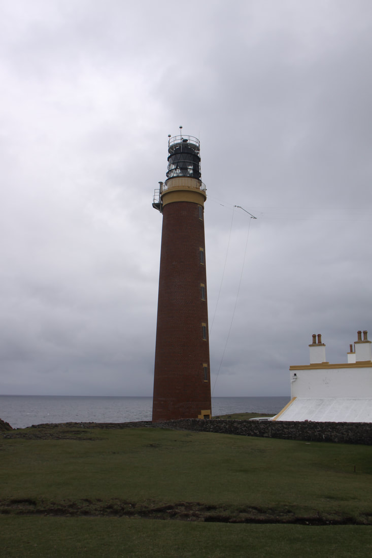
Port of Ness is the settlement at the furthermost point of the Outer Hebrides and is a windswept place. The settlement is in fact a number of different communities. From there a narrow track some one mile in length, took us to an exposed cliff on which the Butt of Lewis Lighthouse stands dramatically on the top of the sheer cliffs of this rugged coastline.
To our amazement Ness provided us the opportunity to do our laundry. We were also able to empty Nicolle’s waste water tanks and toilet and have a hot shower at the college sports centre. We then retraced our steps to the same spot we had parked last night.
We then made a short diversion to see the restored Arnol Blackhouse. However, as we had visited a very similar building yesterday, we decided not to go in.
The Thrishel Stone was located at the end of a short track leading seawards off the main road. The stone is a lone 20ft high monolith which it is thought served as abeacon.
As we travelled further north it became more barren with machair the pre-dominant land – early signs of the wild flowers which dominate the land in summer, were evident. There were also many peat bogs.
Port of Ness is the settlement at the furthermost point of the Outer Hebrides and is a windswept place. The settlement is in fact a number of different communities. From there a narrow track some one mile in length, took us to an exposed cliff on which the Butt of Lewis Lighthouse stands dramatically on the top of the sheer cliffs of this rugged coastline.
To our amazement Ness provided us the opportunity to do our laundry. We were also able to empty Nicolle’s waste water tanks and toilet and have a hot shower at the college sports centre. We then retraced our steps to the same spot we had parked last night.
|
|
|
Saturday 25th May
The forecasted bad weather has arrived – rain but luckily not high winds. We had hoped for a little sunshine so that we could retrace our steps and take some better photographs.
The main (only) road to Stornoway apart from the southern coastal route which we had already driven, was across the spine of Harris – desolate, virtually no habitation and peat bogs as far as you can see.
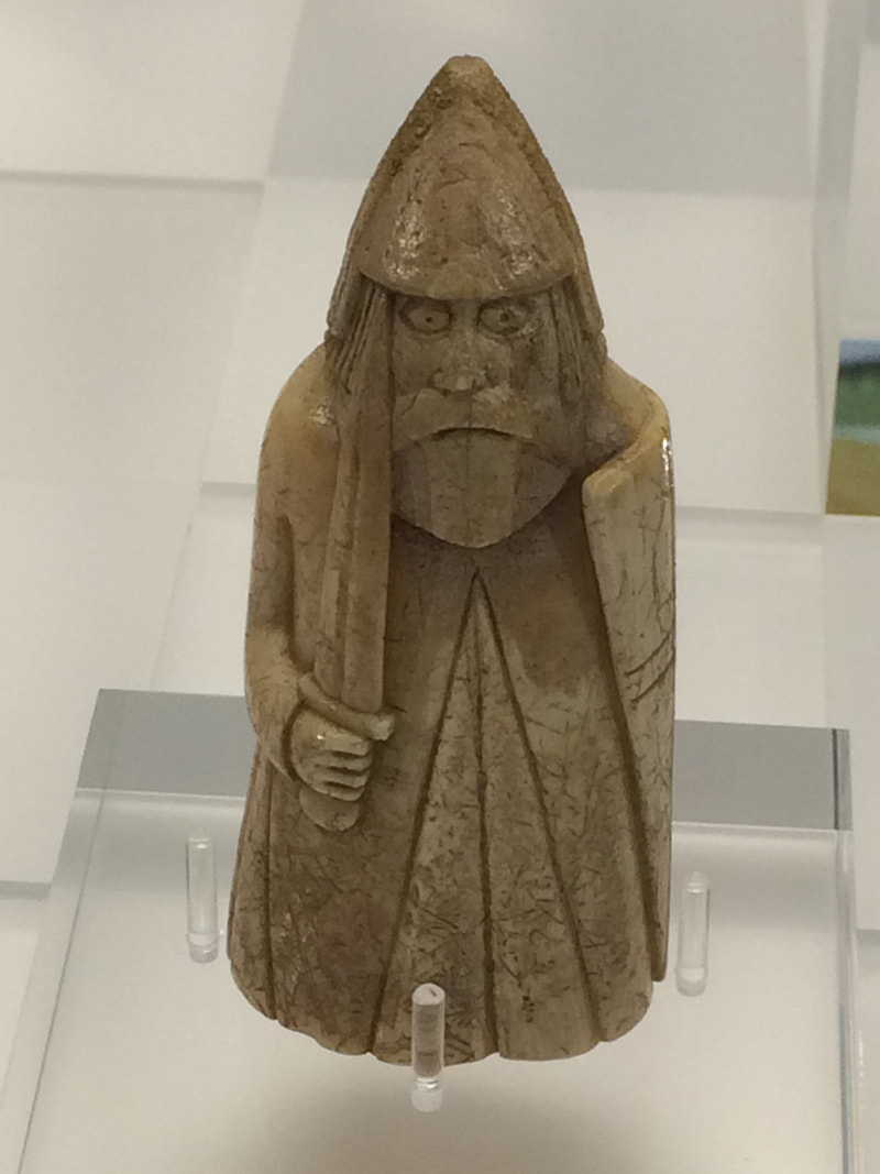
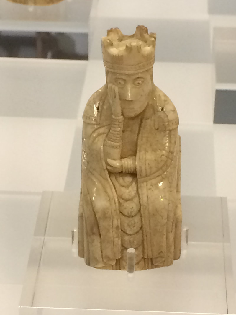
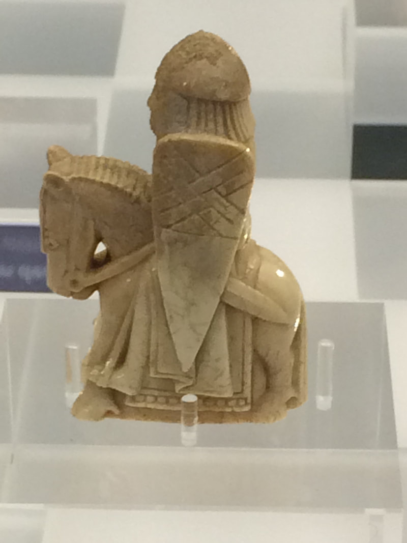
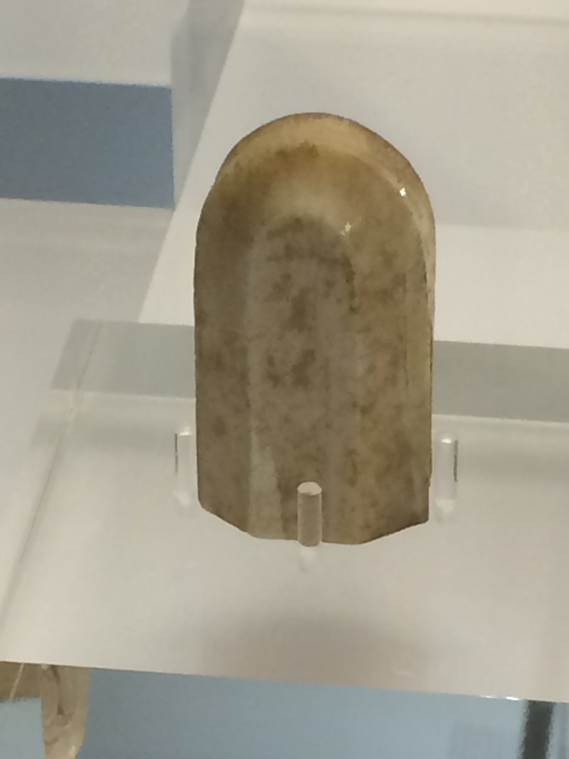
Stornoway was busy when we got there but we managed to find a place in the main car park so that we could go to the Tourist Office – weather for the next few days and accessing wifi were on our agenda. We also visited the museum at Lews Castle. The museum had many interactive displays telling the history of the island and how people today deal with the harsh conditions. However, the museum’s main exhibit are the six small original Lewis chess pieces. They are understood to be from the 12th century and to have been carved from ivory in Trondheim, Norway. The complete find of 78 chessmen were discovered in the sands in Uig.
The forecasted bad weather has arrived – rain but luckily not high winds. We had hoped for a little sunshine so that we could retrace our steps and take some better photographs.
The main (only) road to Stornoway apart from the southern coastal route which we had already driven, was across the spine of Harris – desolate, virtually no habitation and peat bogs as far as you can see.
Stornoway was busy when we got there but we managed to find a place in the main car park so that we could go to the Tourist Office – weather for the next few days and accessing wifi were on our agenda. We also visited the museum at Lews Castle. The museum had many interactive displays telling the history of the island and how people today deal with the harsh conditions. However, the museum’s main exhibit are the six small original Lewis chess pieces. They are understood to be from the 12th century and to have been carved from ivory in Trondheim, Norway. The complete find of 78 chessmen were discovered in the sands in Uig.
|
|
|
|
Our next and final stop for the day was at the remains of the church of St. Columba which is believed to date back to the 14th century. The tombs within the walls of the western chapel are of the Macleod chiefs, while various other tombs are found within the walls of the older eastern end and in the surrounding churchyard.
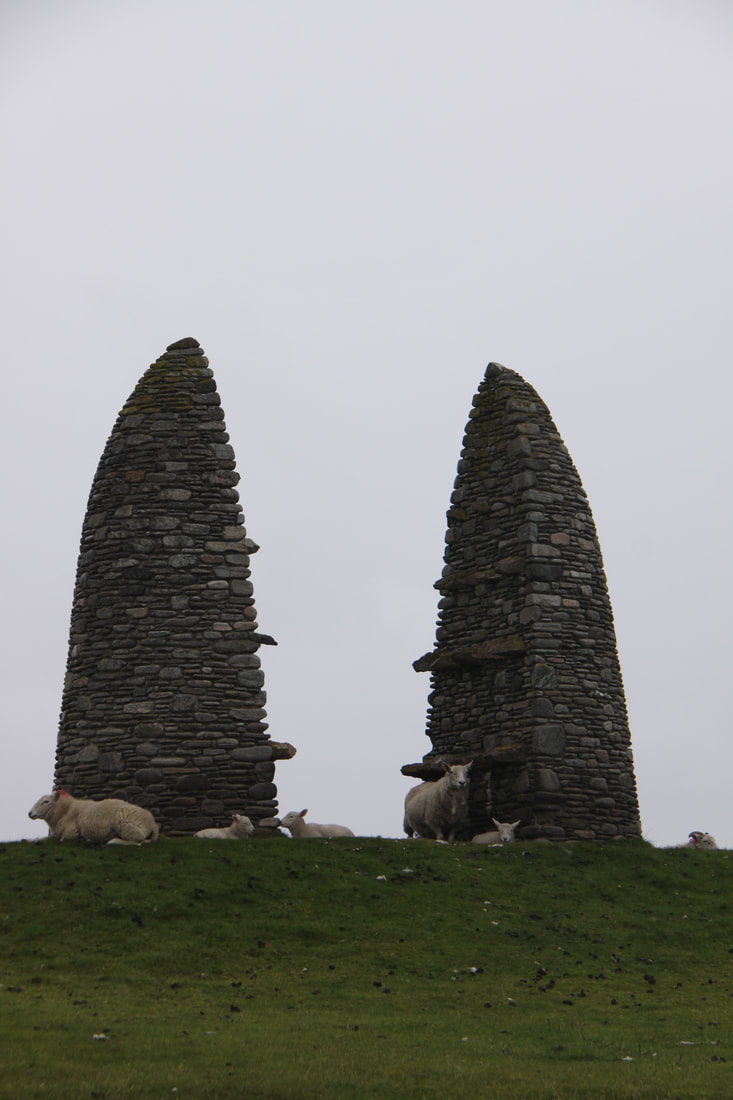
Close to St. Columba stands a high double cairn erected in memory to the Aiginis farm raiders of 1888. Today the sheep were using it as a shelter from the rain!
Tonight we spent on a car park by the isthmus leading on to the Eye peninsula.
Close to St. Columba stands a high double cairn erected in memory to the Aiginis farm raiders of 1888. Today the sheep were using it as a shelter from the rain!
Tonight we spent on a car park by the isthmus leading on to the Eye peninsula.
|
|
Sunday 26th May
After a noisy night thanks to torrential rain we were rather glad that our ferry back to Skye was booked for this afternoon.
We were sad to be leaving the Outer Hebrides but these past few days with the mist down, torrential rain and a raw cold wind blowing we were ready to leave. The hour or so’s drive across the bleak moorland in pouring rain with water running off the mountains was not easy for John.
We had quite a few hours to wait for the ferry and Tarbert has little to offer the tourist. It being Sunday everything was closed!
Despite the conditions the crossing was smooth and we were back in Uig on Skye. Along with several other motorhomers, we spent the night at the ferry terminal.
[click] to continue our trip on Skye
[click] to return to Home page