Iceland
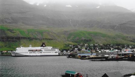
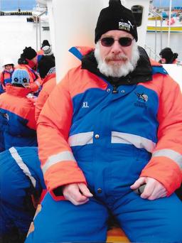
Took the Smyril Line Ferry to Seyðisfjörður, Iceland. A calm crossing which pleased Sue. Enjoyed the "Eat all you can" smorgasbord!
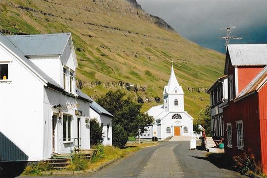
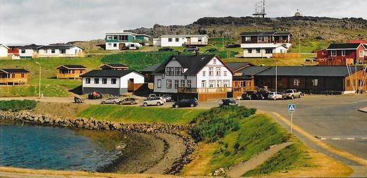
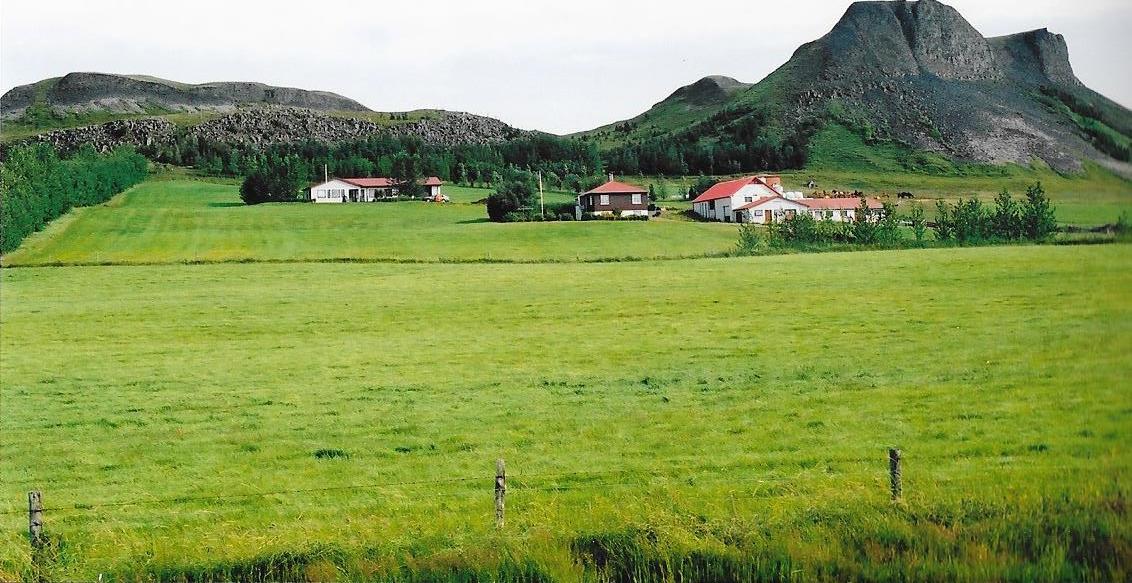
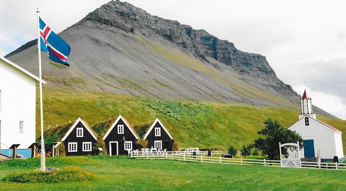
Seyðisfjörður is surrounded by mountains with the most prominent Mt. Bjólfur to the west and Strandartindur to the east. Explored the village before taking the road over Fjarðarheiði mountain pass which connects Seyðisfjörður to the rest of Iceland, 17 miles to the ring road and Egilsstaðir.
Stayed overnight at Breiðdalsvík Camping.
|
|
Visited Djúpivogur and Hofn.
|
|
We had bought an Iceland Camping Card for €90 which gave us access to over 40 camp sites around Iceland for twelve months. We would only be there for one month but this still represented a cost of just over €3 a night. Definitely a bargain!
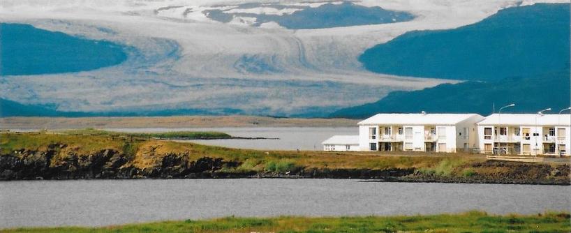
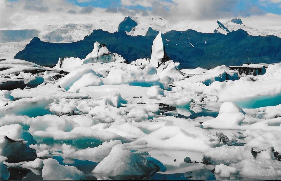
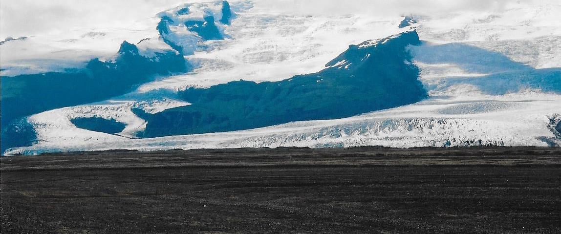
Stayed at the camping site outside the village of Kirkjubæjarklaustur in order to visit Jökulsárlón.
Situated at the head of the Breiðamerkurjökull glacier, the large glacial lake is on the edge of Vatnajökull National Park.
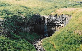
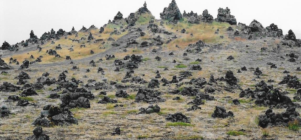
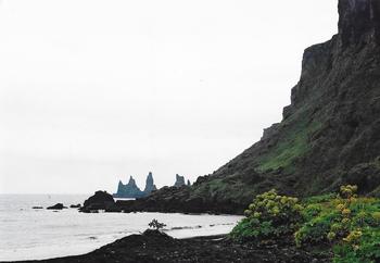
Visited Fjallsárlón Glacier, Svartifoss, Laufokalvarno Cairns and Vik Beach.
|
|
|
|
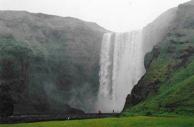
The Skógafoss is one of the biggest waterfalls in the country with a width of 49 feet and a drop of 200 ft. According to legend, the first Viking settler in the area, Þrasi Þórólfsson, buried treasure in a cave behind the waterfall.
Situated next to Skógafoss, the Skógar Folk Museum preserves the cultural heritage of southern Iceland through its collection of tools and equipment, handicrafts, old buildings, books, manuscripts, and documents.
|
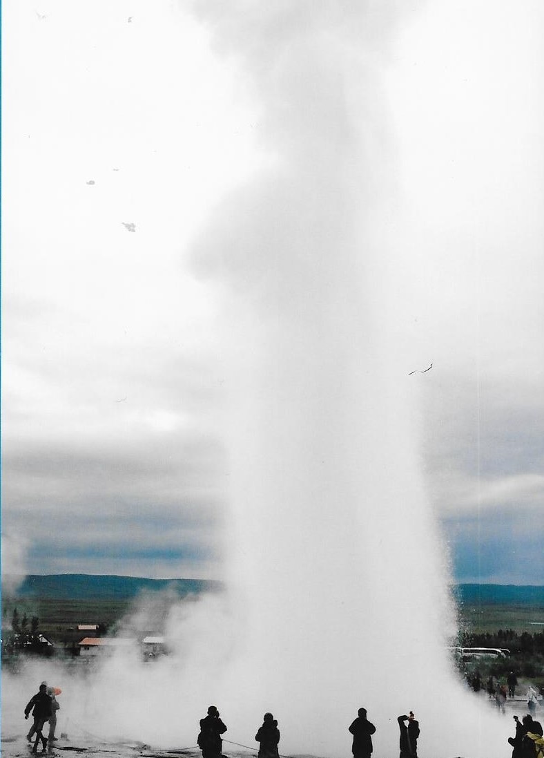
Strokkur is a fountain geyser located in a geothermal area beside the Hvítá River east of Reykjavík. It is one of Iceland's most famous geysers, erupting once every 6–10 minutes. Its usual height is 15–20 m, although it can sometimes erupt up to 40 m high. Gullfoss , the "Golden Falls" waterfall is located in the canyon of the Hvítá river. The wide Hvítá rushes southward, and about a kilometre above the falls it turns sharply to the right and flows down into a wide curved three-step "staircase" and then abruptly plunges in two stages 36 feet and 69 feet into a crevice 105 ft deep. 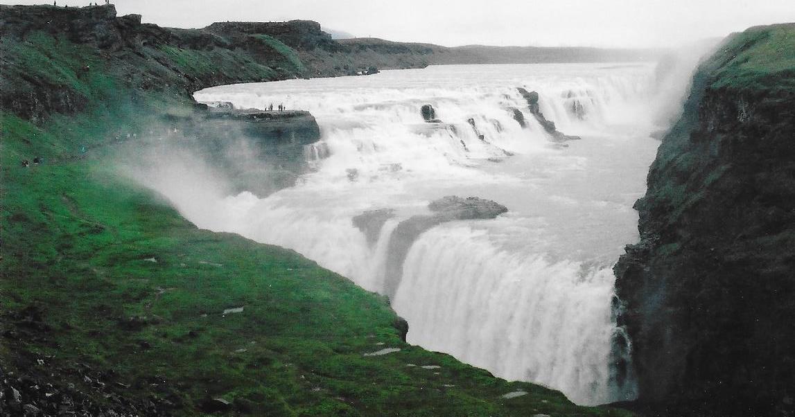
|
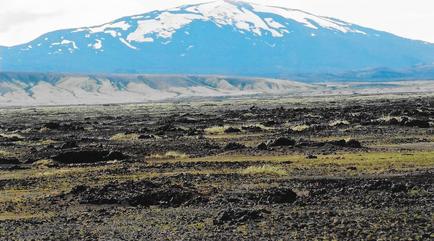
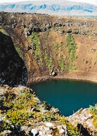
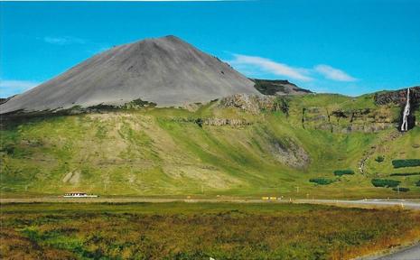
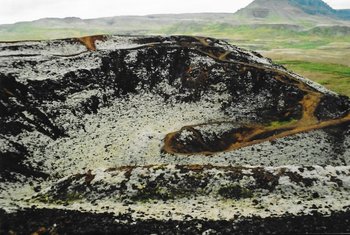
Visited Mt. Hekla, Ströng and Kerið Crater.
|
|
|
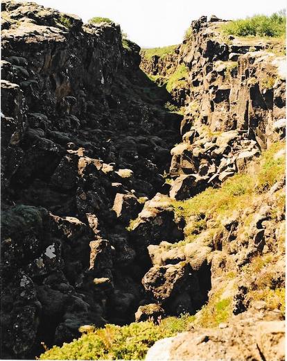
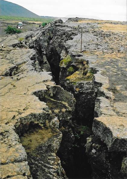
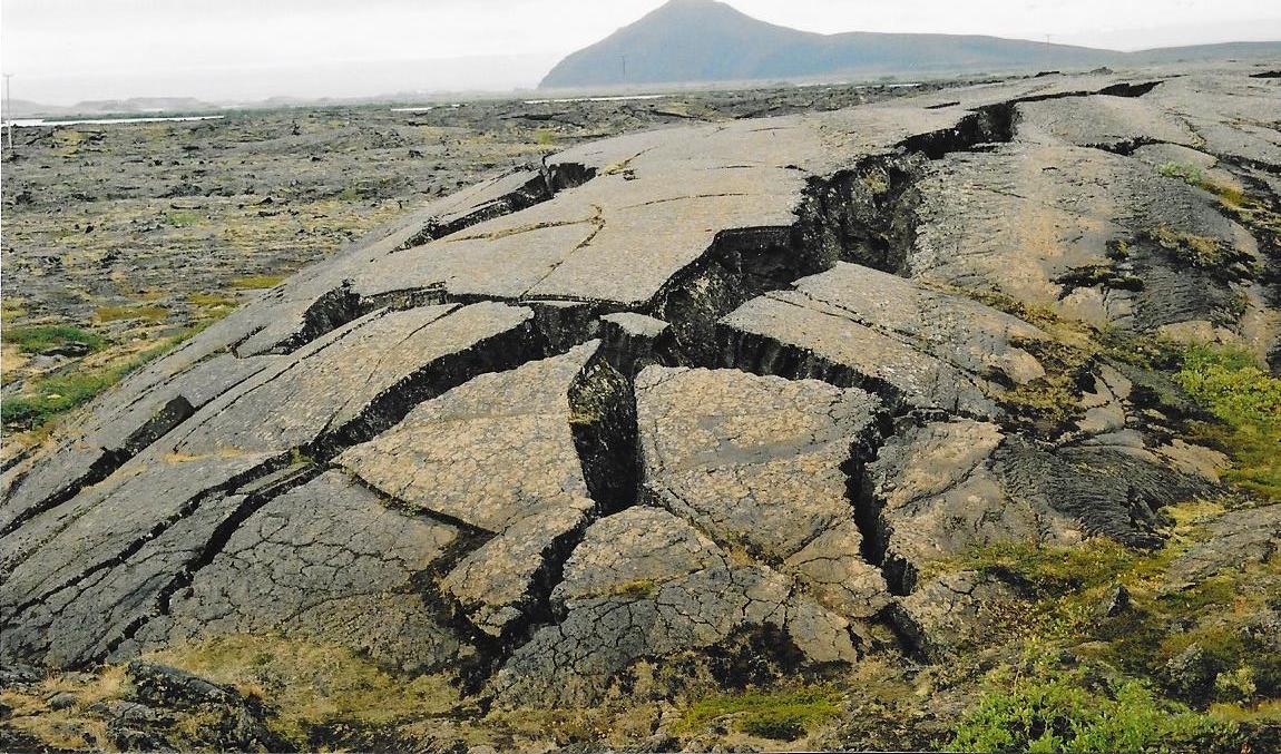
Þingvellir is the site of the oldest parliament in the world. Althing, an open-air assembly representing the whole of Iceland, was established in 930 and continued to meet until 1798. The continental drift between the North American and Eurasian plates can be clearly seen in the cracks and faults that traverse the region. 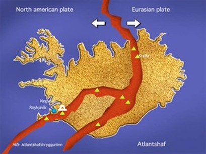
|
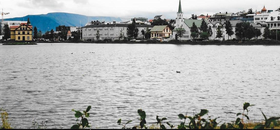
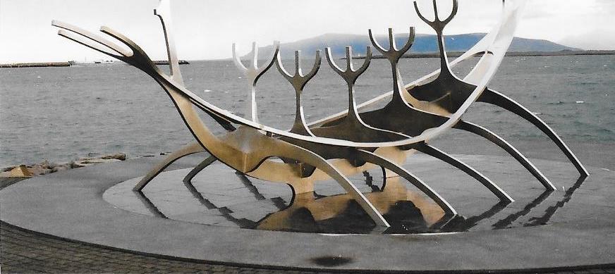
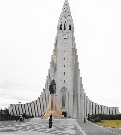
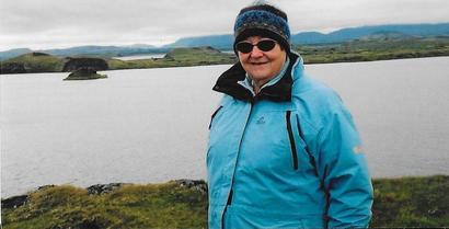
Visited Reykjavik, the capital city. Before our visit, we had been concerned about the cost involved in visiting Iceland, but so far had managed okay. The Iceland Camping Card had kept down accommodation charges and food had been reasonable, although our diet had been very limited. Local supermarkets sold frozen fish and tomatoes were cheap as they could be grown in thermally heated green houses!
We thought we might splash out on a restaurant meal. Cheapest we could find was fish and chips for £60!
|
|
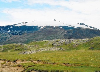
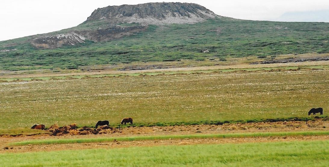
Snæfell is the highest freestanding mountain in Iceland, reaching 1833 m above sea-level. It is an ancient volcano that has been dormant for the past 10,000 years.
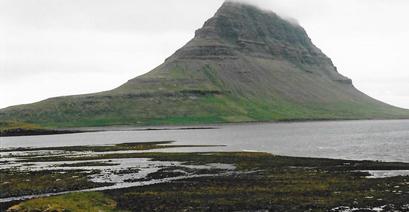
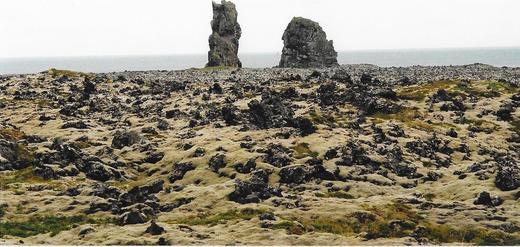
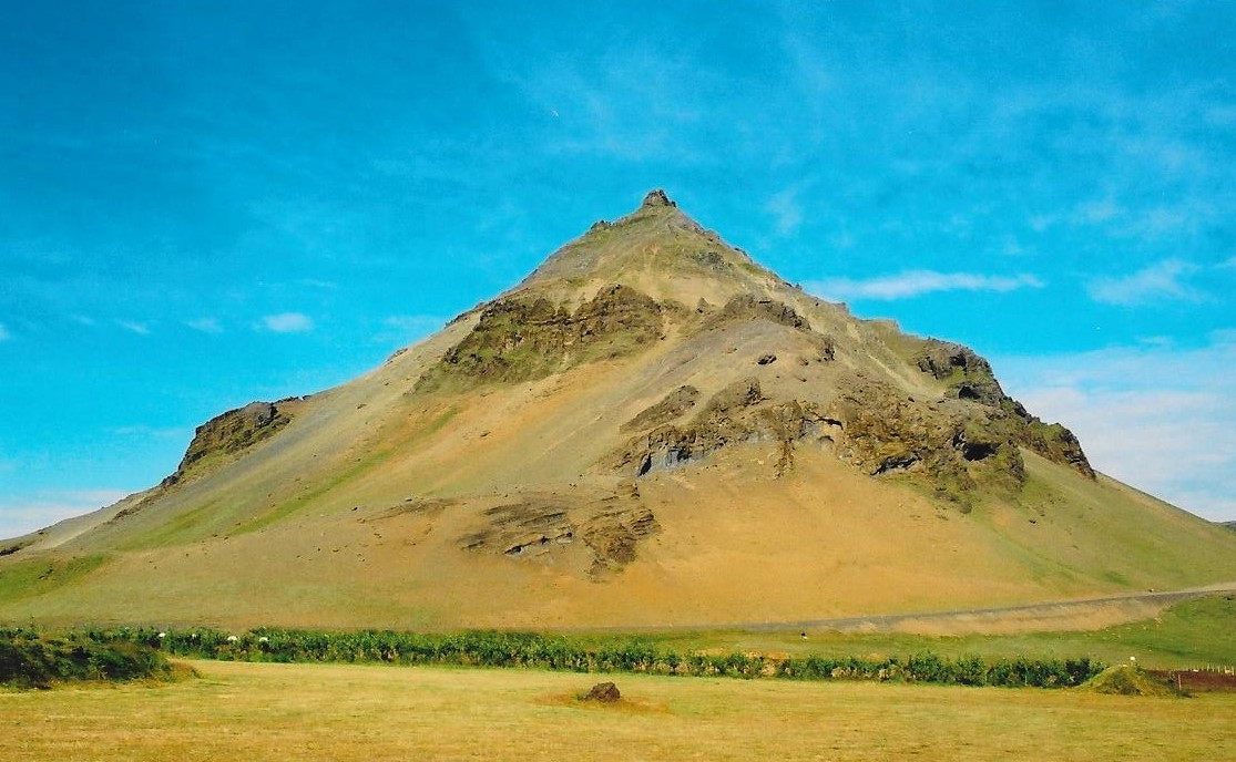
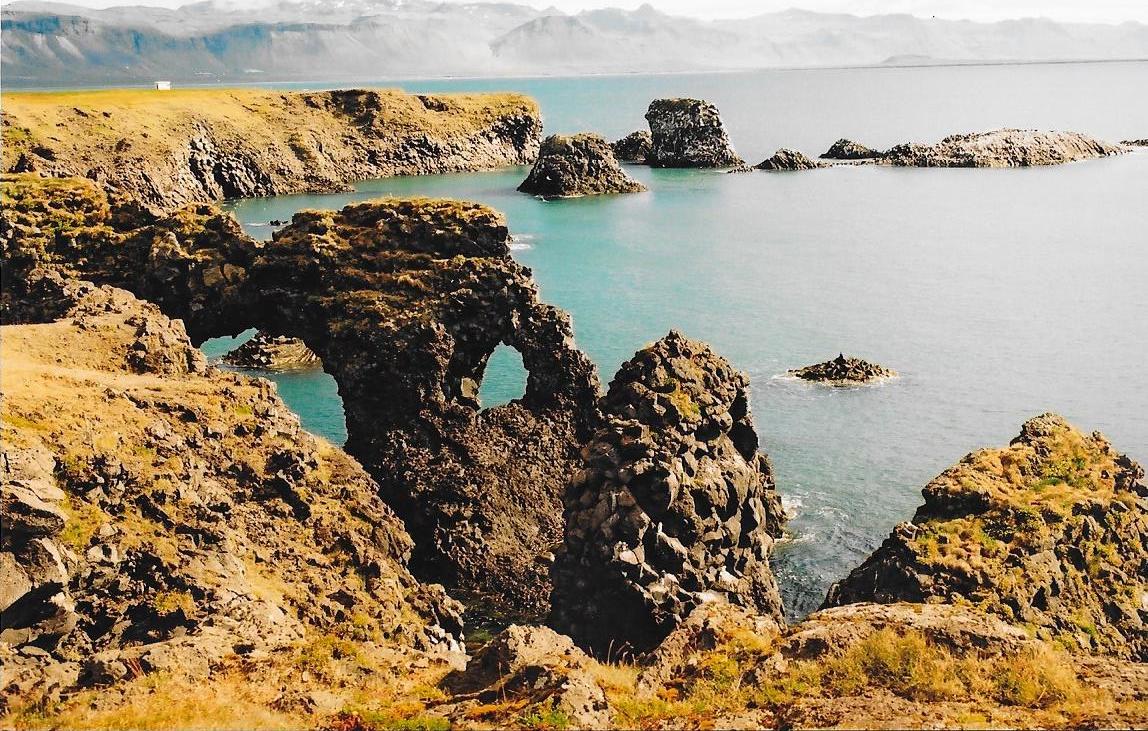
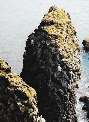
Visited Snæfell Peninsula, Kirkjufell Mountain, the Lóndrangar Rock Pinnacles and Snæfell.
|
|
|
|
The small fishing village of Arnarstapi, at the foot of Mt. Stapafell, has lovely coastal scenery with some unique rock formations.
|
|
|
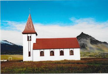
Our trip round Snæfell Peninsula ended with Hellnar Church, Búðir and Eldborg. Visited Grabrok Crater.
|
|
|
|
The hot springs at Deildartunguhver are characterized by a very high flow rate of 180 liters/second) and water emerging at 97 °C.
Water from Deildartunguhver has been used for central heating since 1925. Distribution pipes connect Deildartunguhver with Borgarnes, 34 kilometres away, and Akranes, 64 kilometres away.
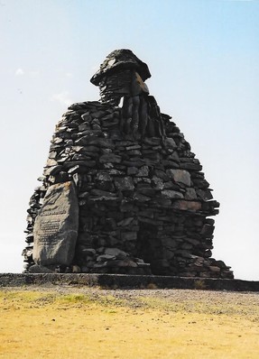
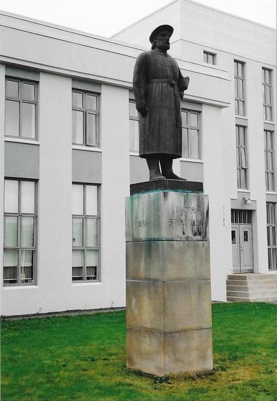
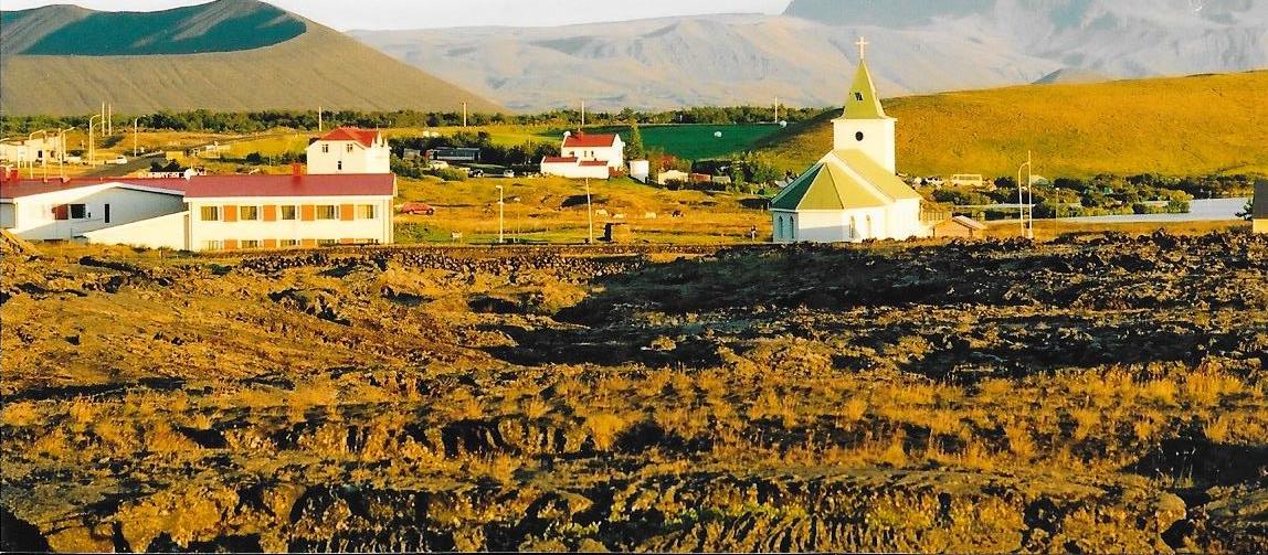
Reykholt was at one time one of the intellectual centres of Iceland and housed for many years one of its most important schools. Today, the village has 60 inhabitants, a school centre and a library concentrating on the works of the poet and politician, Snorri Sturluson. A statue of Snorri can be found here.
|
|
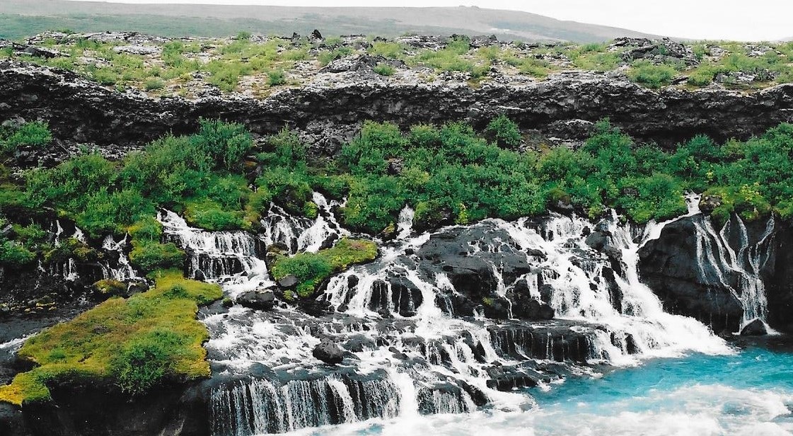
Near to Reykholt are the Hraunfossar and Barnafoss waterfalls. These are formed by rivulets streaming out of the Hallmundarhraun Lava Field. The clear, cold springs of subterranean water seep through the lava and run as tiny waterfalls and rapids into the Hvita River.
Hraunfossar means Lava Falls. Barnafoss is just upstream from Hraunfossar. Its name, the waterfall of the children, comes from an accident which is said to have taken place here in former times. There was a natural bridge over the waterfall and two children from a nearby farm fell to their deaths crossing the river on the bridge.
|
|
Stayed at Hraunsnef Campsite before heading towards the Western Fjords.
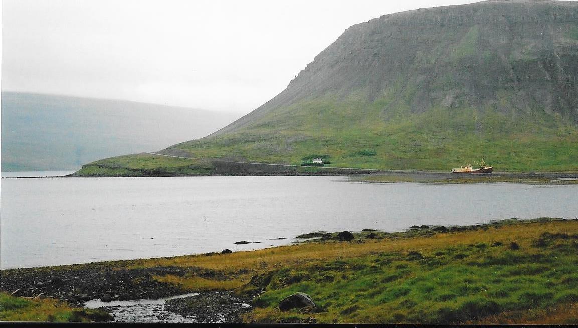
The Westfjords is a large peninsula in northwestern Iceland, lying on the Denmark Strait, facing the east coast of Greenland. The coastline is heavily indented by dozens of fjords surrounded by steep hills.
Attached to the mainland by a narrow isthmus of land barely 10km wide, the West Fjords are one of the most breathtakingly beautiful and least-visited corners of Iceland. Everything here is extreme – from the table mountains that dominate the landscape to the ferocious storms that have gnawed the coastline into countless craggy inlets.
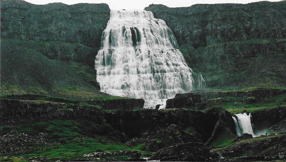
Visited Flókalundur, Dynjandi Waterfall, Hrafnseyri and Ísafjörður.
|
|
|
|
|
|
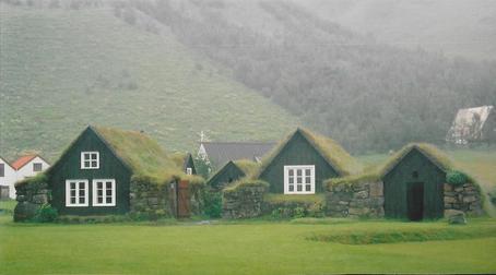
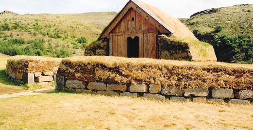
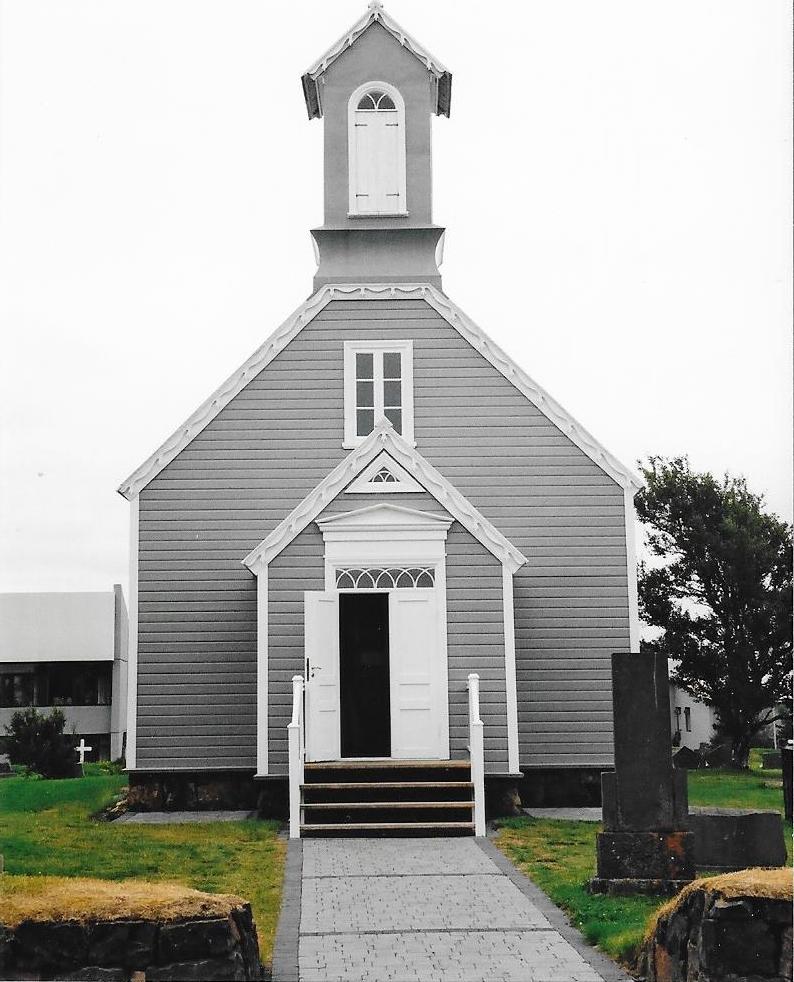
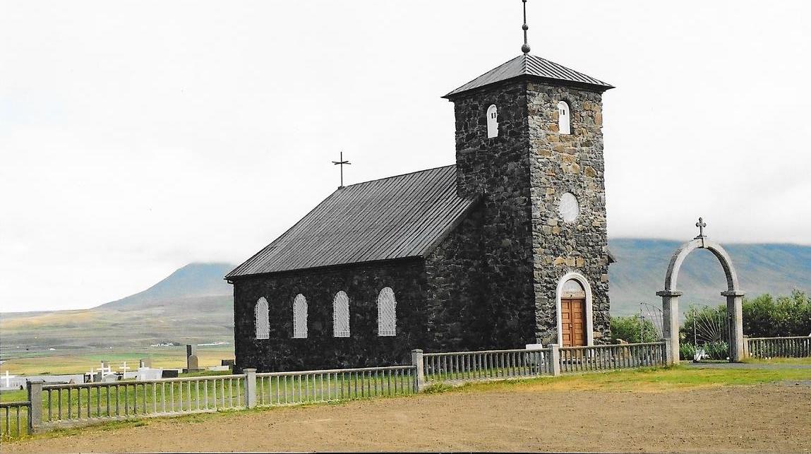
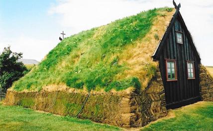
Þingeyrakirkja church was built in the 19th century on the same place where it once existed a monastery. Víðimýrarkirkja church is one of Iceland's very few turf churches to have been preserved.
|
|
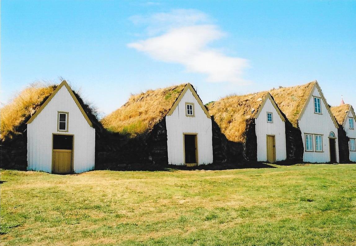
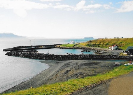
Visited the Glaumbær Turf House Museum and the historic trading port of Hofsós.
|
|
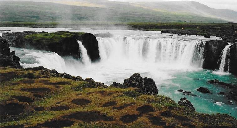
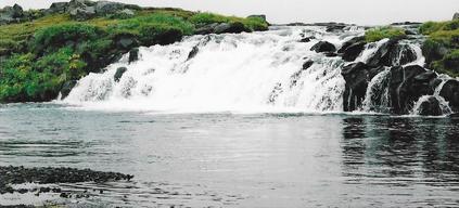
The Goðafoss, "waterfall of the gods", is one of the most spectacular waterfalls in Iceland. It is located in the Bárðardalur district of North-Central Iceland. The water of the river Skjálfandafljót falls from a height of 12 meters over a width of 30 meters.
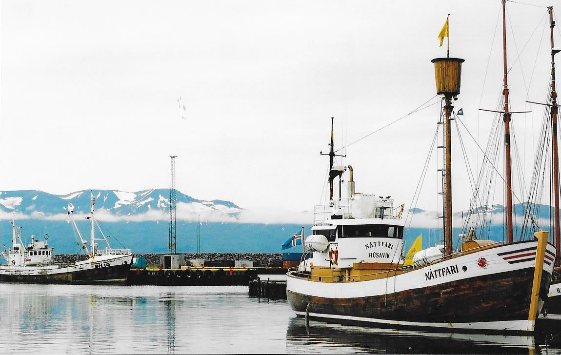
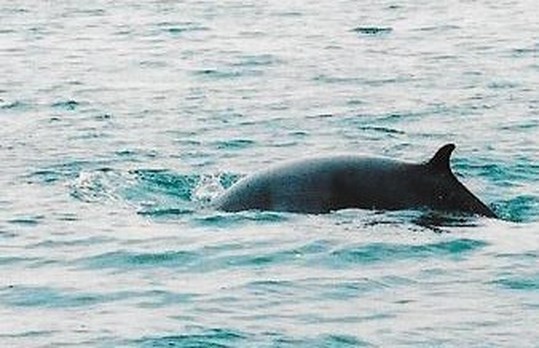
Húsavík is a town in the Norðurþing municipality on the shores of Skjálfandi bay. The most famous landmark of the town is the wooden church Húsavíkurkirkja, built in 1907. The Apollo astronauts trained in Húsavík during the 1960s. The town has become a centre of whale watching due to whales of different species that frequently enter the bay. Went on a whale watching cruise with Gentle Giants.
|
|
|
|
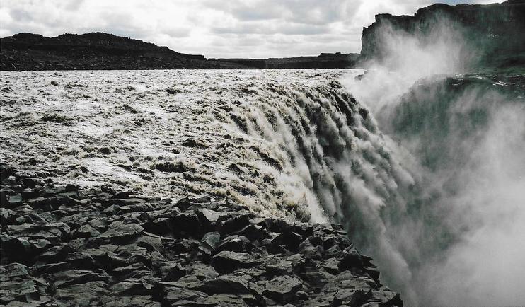
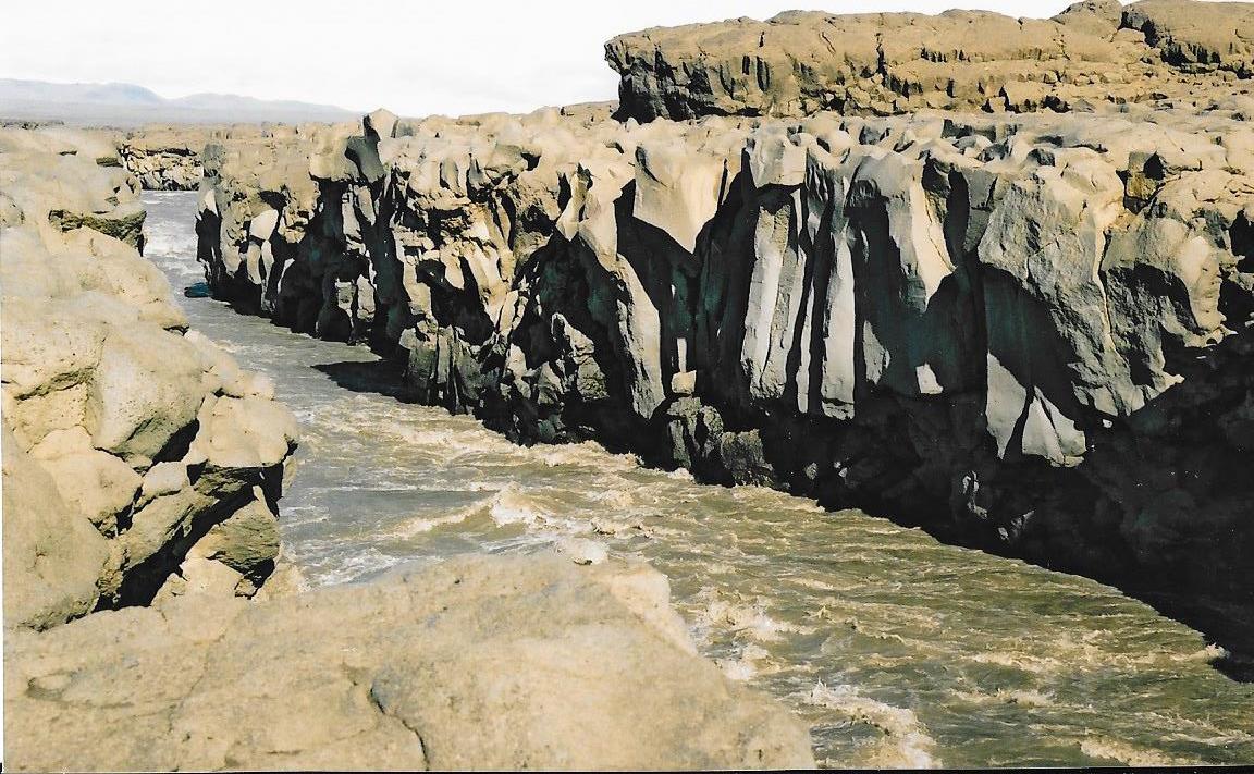
Dettifoss is the most powerfull waterfall in Europe. The water comes from the nearby Vatnajökull glacier, whose sediment-rich runoff colours the water a greyish white.
Dettifoss is situated on the Jökulsá á Fjöllum river, which flows from the Vatnajökull Glacier and collects water from a large area in Northeast Iceland. The falls are 330 ft wide and have a drop of 144 ft down to the Jökulsárgljúfur canyon.
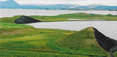
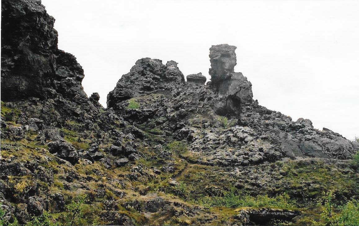
Lake Mývatn was created about 2300 years ago by a large fissure eruption pouring out basaltic lava. The lava flowed down Laxárdalur Valley to the lowland plain of Aðaldalur where it entered the Arctic Ocean. The crater row that was formed on top of the eruptive fissure is called Þrengslaborgir and has often been used as a textbook example of this type of volcanic activity. When the glowing lava encountered the lake some of the water-logged lake sediment was trapped underneath it. The ensuing steam explosions tore the lava into small pieces which were thrown up into the air, together with some of the lake.
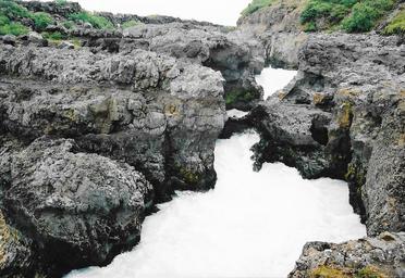
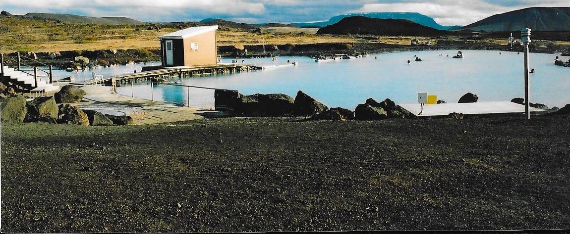
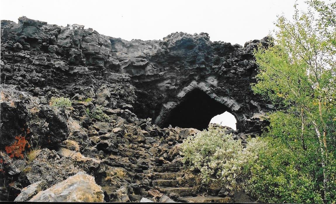
Spent a few days here, visiting the lake, Reykjahlíð lava flows, Mývatn Naturebath, Skútustaðagígar pseudo craters, the Dimmuborgir lava formations and Grjótagjá, where the Mid Atlantic Fault is clearly visible.
Spent a few days here, visiting the lake, Reykjahlíð lava flows, Mývatn Naturebath, Skútustaðagígar pseudo craters, the Dimmuborgir lava formations and Grjótagjá, where the Mid Atlantic Fault is clearly visible.
|
|
|
|
|
|
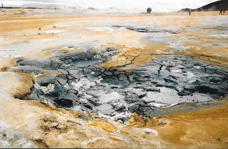
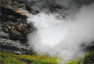
Hverarönd is an area near Mývatn. The area has a lot of geothermal energy which shows itself in the form of bubbling pools of grey mud and sulphur. As a result of this the area smells rather strongly of sulphur but experiencing the almost alien-like landscape is well worth the smell.
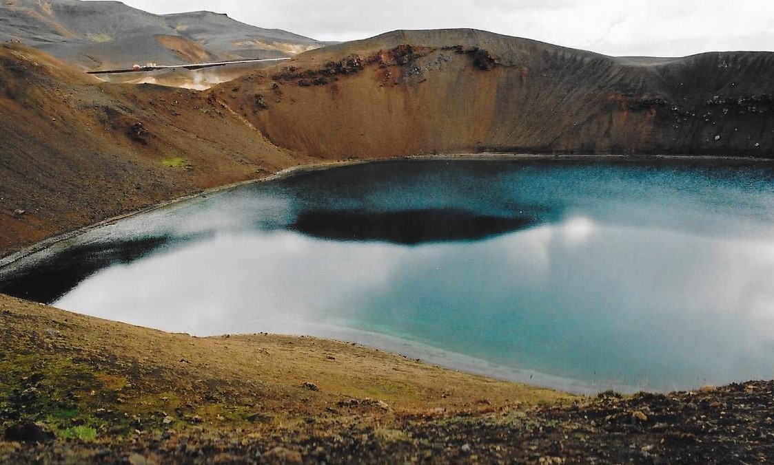
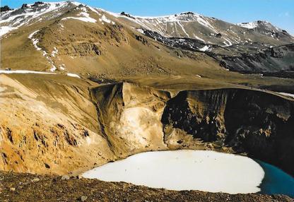
Viti Lake is a circular crater filled with blue water and surrounded by a geothermal area and colourful moutains.
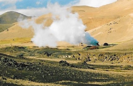
The Krafla geothermal power plant produces 500 GWh of electricity annually with its installed capacity of 60 MW.
|
|
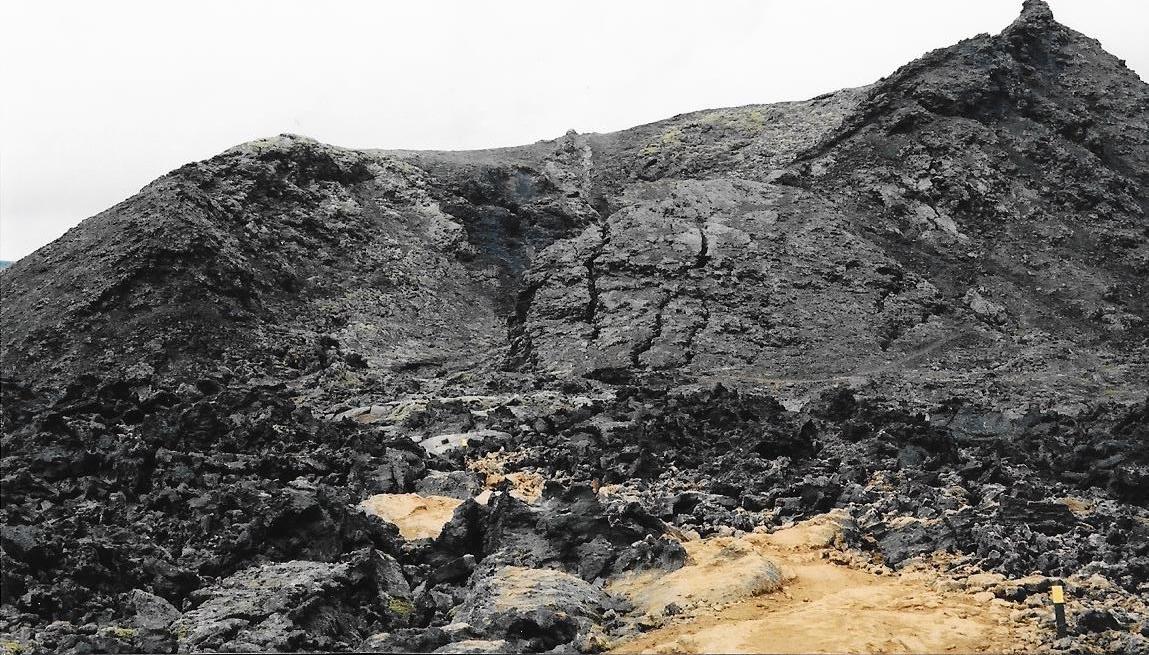
Leirhnjúkur Lava Fields, with its steaming sulphuric terrain and craggy, lava field landscapes, is truly one of the must-see gems of the Mývatn area.
|
|
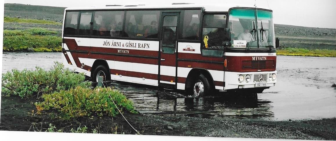
Our trip round Iceland had, so far, restricted us to the ring road. Many parts of the road were now tarred and the rest were good dirt. But we knew we needed a 4X4 off road truck to get into the interior. Took a trip with Askja Tour to visit the Askja caldera.
The route included crossing of unbridged rivers. At one river crossing we came across a German registered motorhome stuck in the middle. Our driver stopped, attached a tow rope and pulled the motorhome onto dry land. All part of the service!
Stopped at the nature reserve Herdubreiðarlindir and Drekagil canyon at the south of Dyngjufjoll mountain range, and finally arrived at Vikrarborgir from where we walked to the Askja caldera. Askja is a sunken crater which formed at the end of the Ice Age in a major ash eruption which caused the roof of the magma chamber at the heart of the volcano to subside.
|
|
|
|
Our trip to Iceland was at an end. We were due to take the last ferry out.
It was the end of August. It started to snow heavily. I spoke to a local who told me that the snow had come early this year. I asked when it normally came. His reply was "September!"
[click] to continue on our trip to the Faroe Islands
[click] to return to Home page