Outer Hebrides
Tuesday 14th May
Before leaving this morning we took the opportunity to fill up with water and empty waste water and toilet at the dockside facilities and take a shower at Lochmaddy Marina.
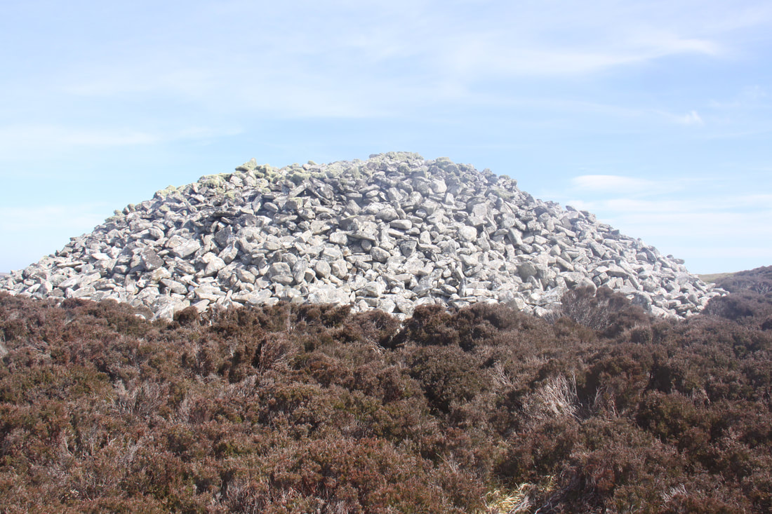
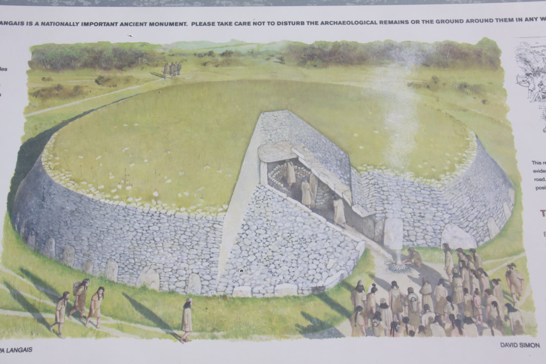
A couple of miles down the road was the Neolithic tomb of Barpa Langass. The tomb is some 80ft in diameter and consists of an internal burial chamber where six large stone slabs support the roof. Unfortunately at present you cannot enter the structure due to a collapse of the passageway so we had to be content with walking around the exterior of the cairn, which incidently is one of the oldest standing buildings in Northern Europe.
Before leaving this morning we took the opportunity to fill up with water and empty waste water and toilet at the dockside facilities and take a shower at Lochmaddy Marina.
A couple of miles down the road was the Neolithic tomb of Barpa Langass. The tomb is some 80ft in diameter and consists of an internal burial chamber where six large stone slabs support the roof. Unfortunately at present you cannot enter the structure due to a collapse of the passageway so we had to be content with walking around the exterior of the cairn, which incidently is one of the oldest standing buildings in Northern Europe.
|
|
Nearby was the stone circle of Fingal’s People. This is the largest stone circle on the Uists but it proved elusive to us as there were “No Parking” signs on its only access road.
Most of the roads on the Uists are good single track with many passing places. As a lot of the area consists of low lying machair – sea meadow and coastal grasslands - it was easy to see approaching traffic.
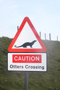
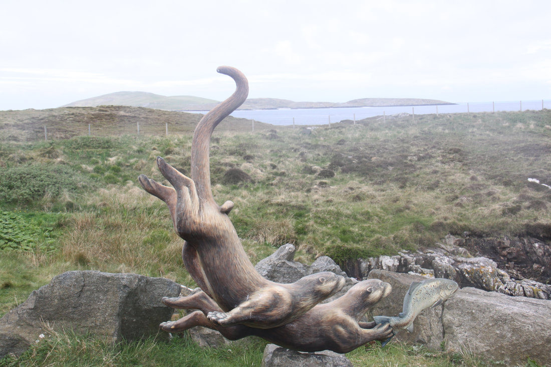
North Uist. Benbecula and South Uist are linked by causeways, on one of which we spotted a sign – “Beware Otters Crossing”. This whole area is a maze of lochs and marshy land with building situated on any area of higher ground.
On Benbecula a detour led us to and past the former RAF developed settlement of Nunton. The area around the base was used extensively for final training of troops prior to departure to the Falklands.
We stopped for the night in a layby beside a semi-circular bay of silver sand where the next landfall was the North American continent – perfection except the name of the beach, “Stinky Beach”, called this because of the rotting kelp at the high water line.
Most of the roads on the Uists are good single track with many passing places. As a lot of the area consists of low lying machair – sea meadow and coastal grasslands - it was easy to see approaching traffic.
North Uist. Benbecula and South Uist are linked by causeways, on one of which we spotted a sign – “Beware Otters Crossing”. This whole area is a maze of lochs and marshy land with building situated on any area of higher ground.
On Benbecula a detour led us to and past the former RAF developed settlement of Nunton. The area around the base was used extensively for final training of troops prior to departure to the Falklands.
We stopped for the night in a layby beside a semi-circular bay of silver sand where the next landfall was the North American continent – perfection except the name of the beach, “Stinky Beach”, called this because of the rotting kelp at the high water line.
Wednesday 15th May
Today we spent exploring South Uist which was separated from Benbecula by the South Ford Causeway. More road sign warns you to be wary of otters crossing.
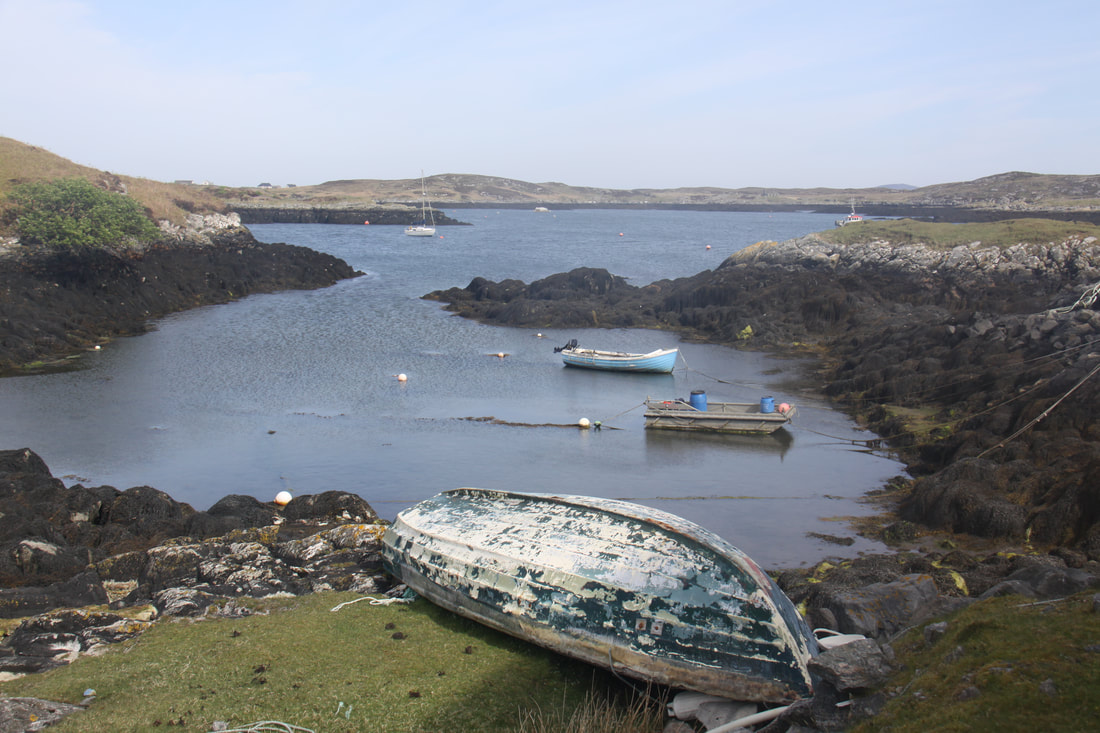
We deviated off the main road that runs from north to south effectively dividing the island in half, to visit the Salar Smokehouse. You couldn’t see any of the factory but the beautiful location made the detour more than worthwhile.
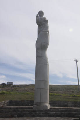
Our next stop involved an uphill climb to view the statue “Lady of the Isles”. It is made of white granite and stands some 30 feet tall making it the largest religious statue in Britain.
Today we spent exploring South Uist which was separated from Benbecula by the South Ford Causeway. More road sign warns you to be wary of otters crossing.
We deviated off the main road that runs from north to south effectively dividing the island in half, to visit the Salar Smokehouse. You couldn’t see any of the factory but the beautiful location made the detour more than worthwhile.
Our next stop involved an uphill climb to view the statue “Lady of the Isles”. It is made of white granite and stands some 30 feet tall making it the largest religious statue in Britain.
|
|
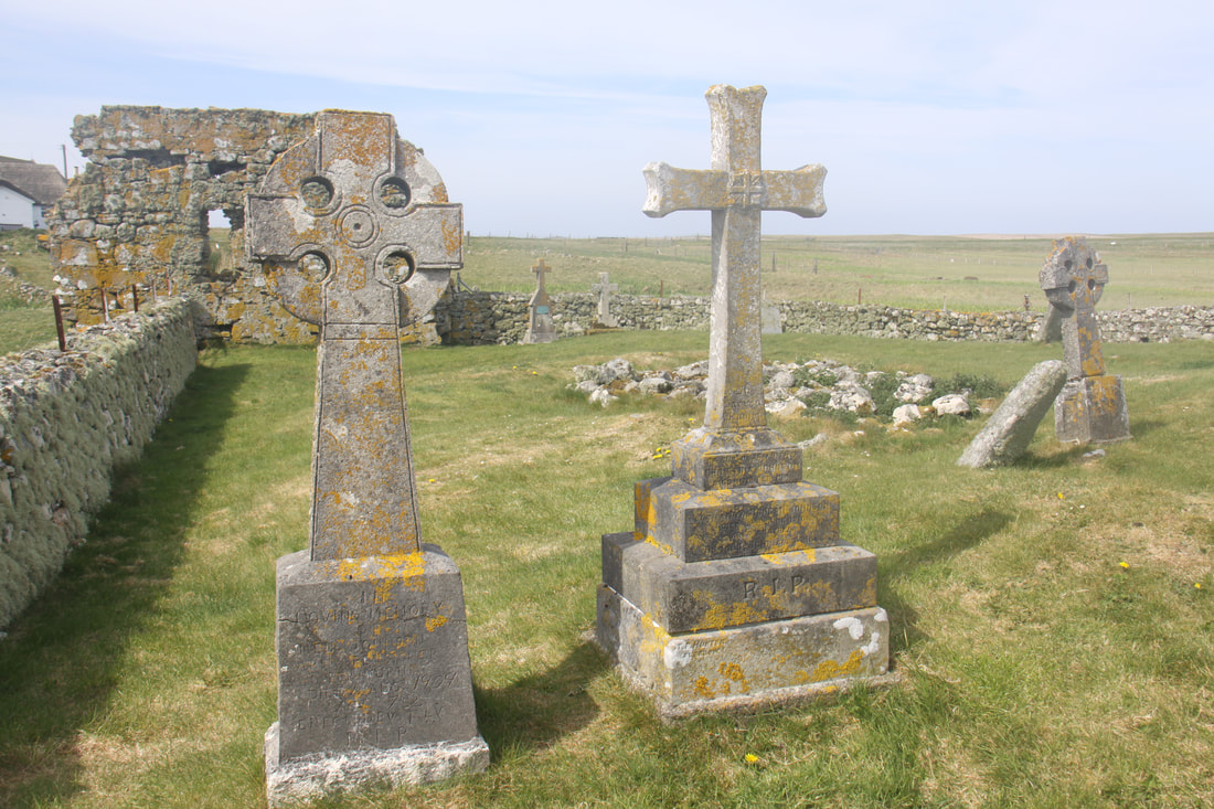
A little further south we turned off the main road on to a narrow track leading to Howmore. The remains of, as well as complete, restored blackhouses, lined the road. A blackhouse was the traditional dwelling of the islanders. The ruins of Howmore are believed to have been an important medieval ecclesiastical centre, possibly dating back as far as the 8th century. A total of four ruined churches or chapels remain along with a number of stone celtic crosses.
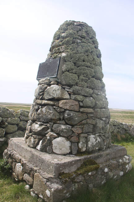
Kildonan Museum was an interesting and well documented place. A fascinating and informative display explained how life was lived on South Uist. Just outside the museum was a reconstructed Pictish square cairn which marked the “supposed” birthplace of Flora MacDonald. Flora is remembered for her role in helping Bonnie Prince Charlie to escape following his army’s defeat at Culloden.
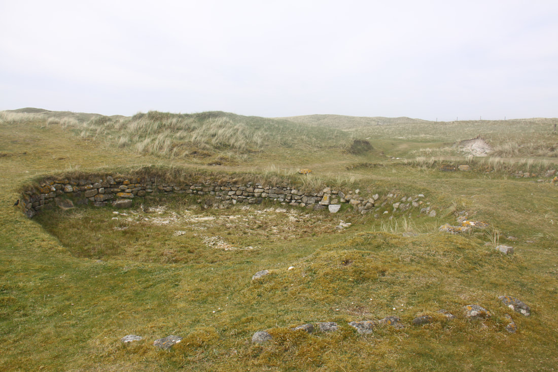
Our final stop and also our night halt was at Cladh Hallan. Here are remains of three Bronze Age round houses. Burials were discovered within the ruined structures. The site lies amongst the sand dunes, archaeologists believe that further structures remain to be discovered.
Kildonan Museum was an interesting and well documented place. A fascinating and informative display explained how life was lived on South Uist. Just outside the museum was a reconstructed Pictish square cairn which marked the “supposed” birthplace of Flora MacDonald. Flora is remembered for her role in helping Bonnie Prince Charlie to escape following his army’s defeat at Culloden.
Our final stop and also our night halt was at Cladh Hallan. Here are remains of three Bronze Age round houses. Burials were discovered within the ruined structures. The site lies amongst the sand dunes, archaeologists believe that further structures remain to be discovered.
|
|
Thursday 16th May
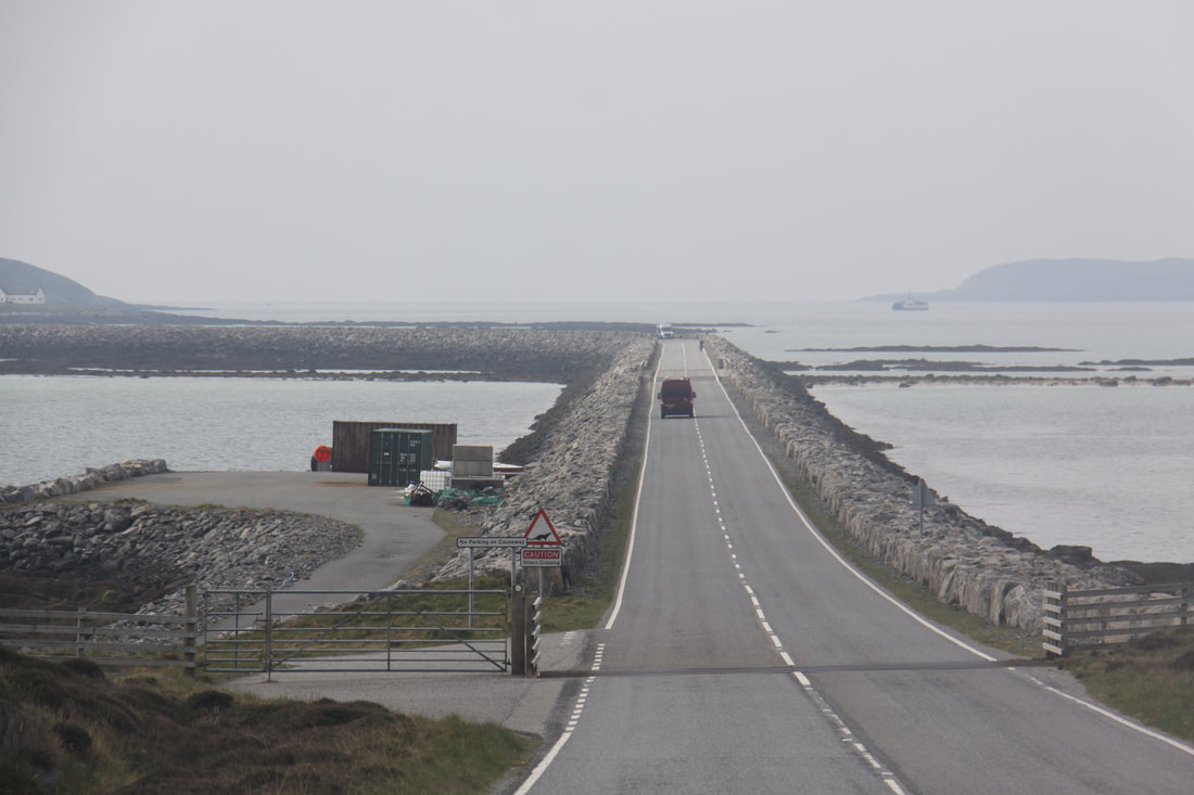
A short drive south took us to the impressive causeway that links South Uist to the tiny 2 mile by 3 mile island of Eriskay. The causeway, when it was built in 2000 – 2001 was the largest civil engineering project of its type in the UK. It was certainly a scenic way to reach Eriskay. In the settlement of Haun we stopped at the extremely well stocked village store which is owned and run by shareholders.
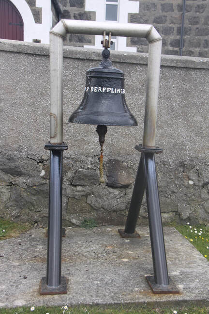
Situated on a hilltop above Haun is St Michael’s Church where the altar is shaped like the prow of a ship. Outside by the gate hangs a ship’s bell rescued from the Derfingerwhich had sunk in Scapa Flow.
As we hadn’t booked the ferry crossing to Barra, we had to phone for a reservation. The early evening crossing still had space but they squeezed us onto an earlier ship and 40 minutes later we were in Barra. The views across to the numerous outer skerries were stunning.
Once on shore we headed to and then past the airport where we had read that there was overnight parking looking over the beach runway. It turned out that this was outdated information as every tiny stopping place had prominent “No Motorhome Overnight Parking” signs!
We headed back to the harbour where we knew we could park for the night.
A short drive south took us to the impressive causeway that links South Uist to the tiny 2 mile by 3 mile island of Eriskay. The causeway, when it was built in 2000 – 2001 was the largest civil engineering project of its type in the UK. It was certainly a scenic way to reach Eriskay. In the settlement of Haun we stopped at the extremely well stocked village store which is owned and run by shareholders.
Situated on a hilltop above Haun is St Michael’s Church where the altar is shaped like the prow of a ship. Outside by the gate hangs a ship’s bell rescued from the Derfingerwhich had sunk in Scapa Flow.
As we hadn’t booked the ferry crossing to Barra, we had to phone for a reservation. The early evening crossing still had space but they squeezed us onto an earlier ship and 40 minutes later we were in Barra. The views across to the numerous outer skerries were stunning.
Once on shore we headed to and then past the airport where we had read that there was overnight parking looking over the beach runway. It turned out that this was outdated information as every tiny stopping place had prominent “No Motorhome Overnight Parking” signs!
We headed back to the harbour where we knew we could park for the night.
|
|
Friday 17th May
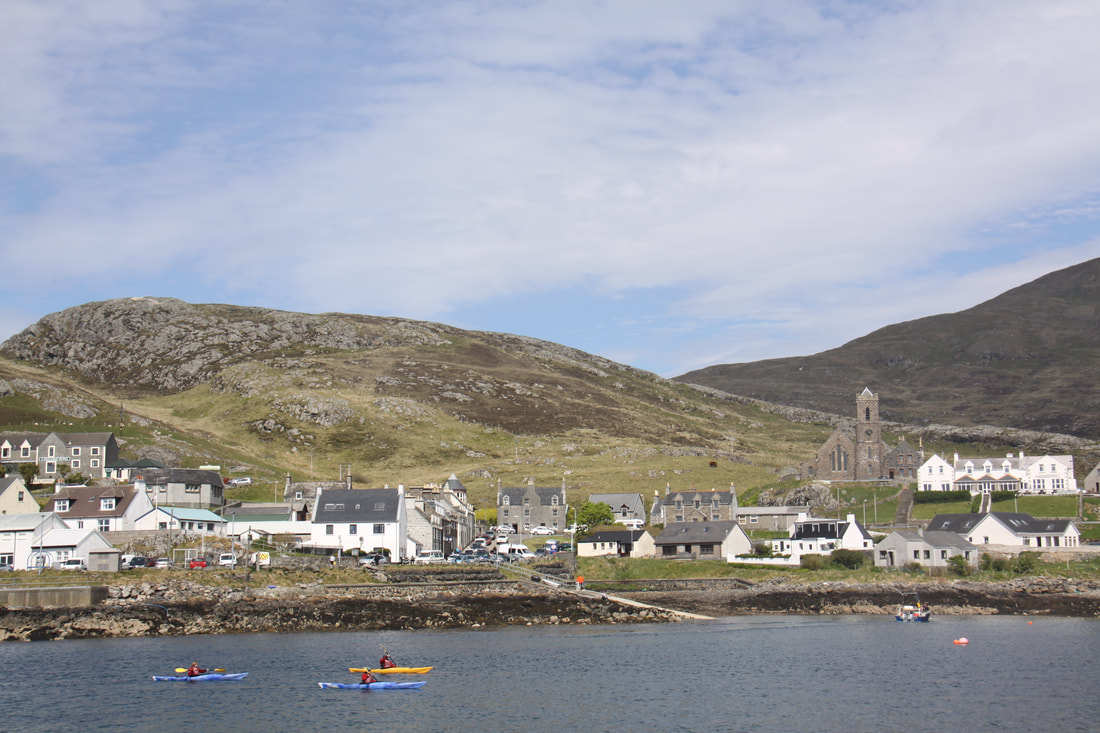
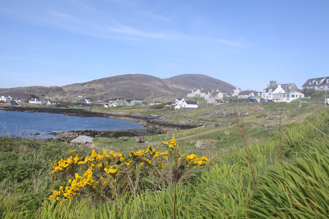
We woke to glorious sunshine which lasted all day. Castlebay, the main settlement on Barra was the focus of our wanderings. There is really only one road that goes round the island – we chose the western route. As with most of the roads on the Outer Hebrides it was a single track with regular passing places. There is little woodland so it is easy to see oncoming traffic.
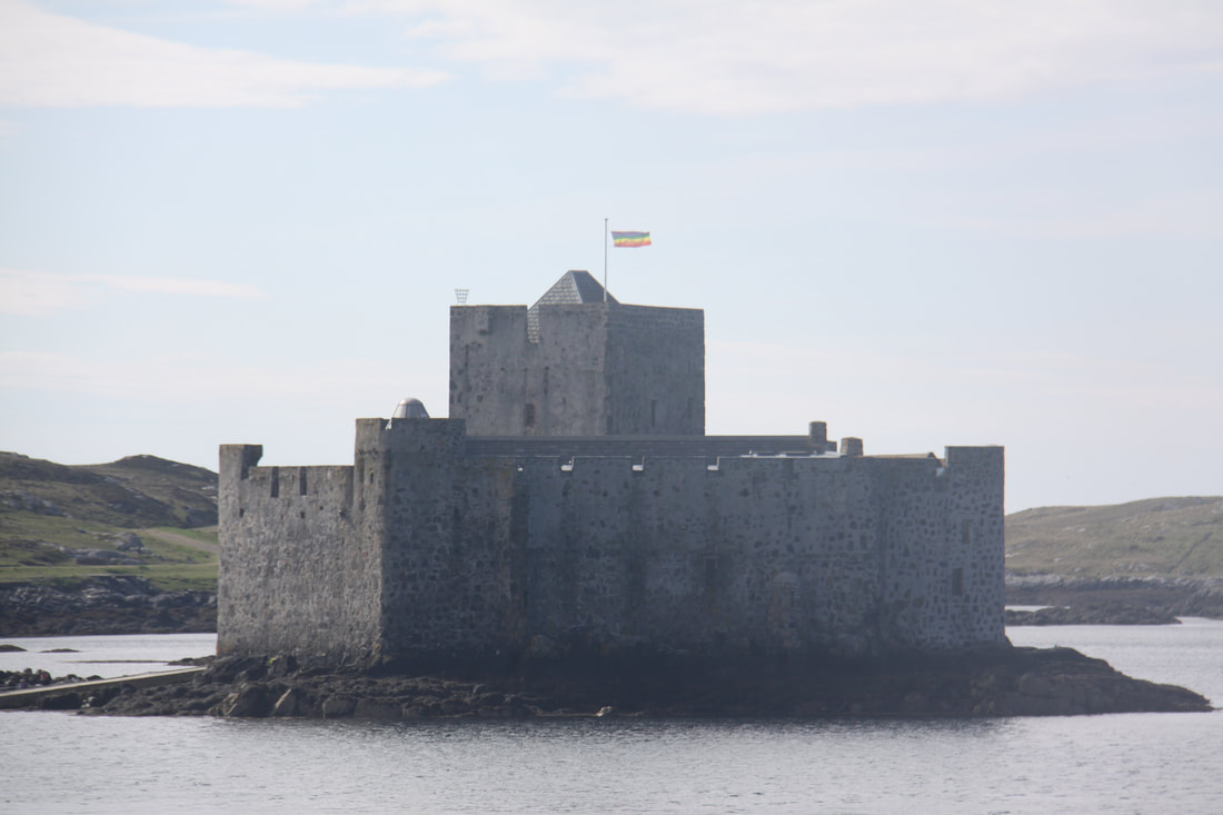
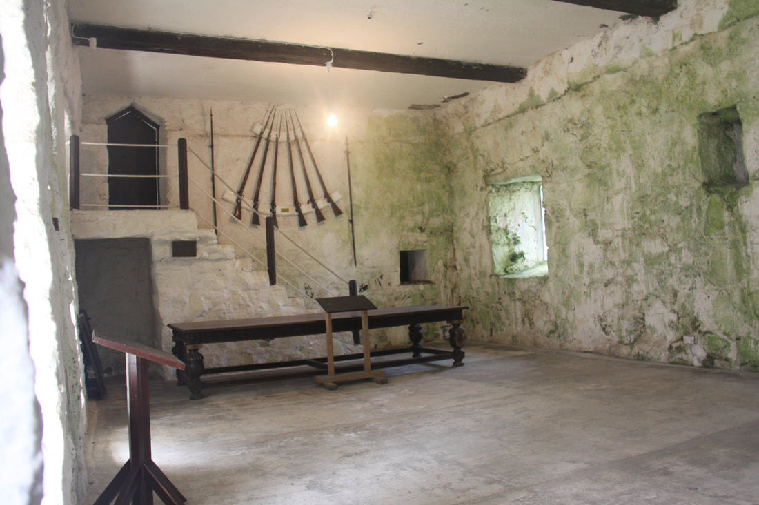
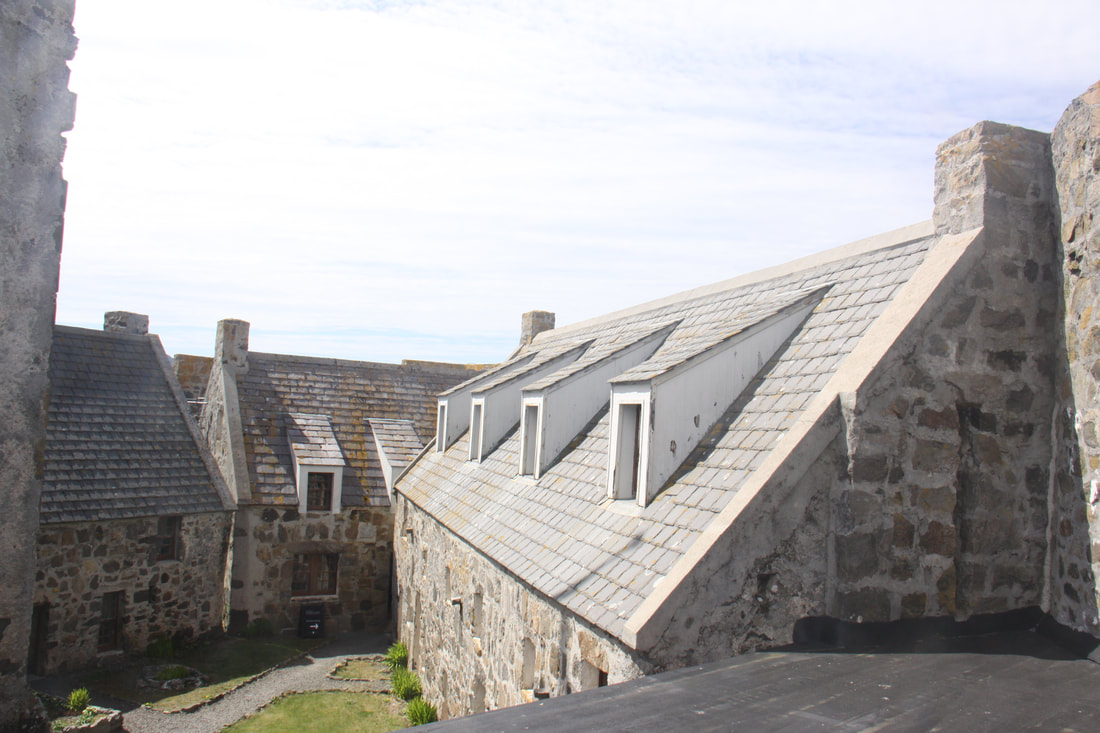
Castlebay is a delightful small town situated on the edge of a large south facing bay. It consists of only two main streets where the amenities are located. Kisimul Castle, which dates back to the Middle Ages, is located on a rocky islet just off shore. It is the ancient seat of the Clan Macniel. A very short boat ride takes us over to the castle where we explored the main rooms which were set around an open courtyard. From the Tower House there were excellent views of Castlebay.
We woke to glorious sunshine which lasted all day. Castlebay, the main settlement on Barra was the focus of our wanderings. There is really only one road that goes round the island – we chose the western route. As with most of the roads on the Outer Hebrides it was a single track with regular passing places. There is little woodland so it is easy to see oncoming traffic.
Castlebay is a delightful small town situated on the edge of a large south facing bay. It consists of only two main streets where the amenities are located. Kisimul Castle, which dates back to the Middle Ages, is located on a rocky islet just off shore. It is the ancient seat of the Clan Macniel. A very short boat ride takes us over to the castle where we explored the main rooms which were set around an open courtyard. From the Tower House there were excellent views of Castlebay.
|
|
|
|
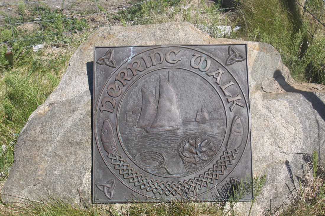
A short walk along the “Herring Walk”, a path along the edge of the bay, took us to the Heritage Centre. Here, the importance of the Herring Trade to the town soon became apparent, providing employment for a large proportion of the population.
Tonight was spent on a car park above the sandy Traigh Tuath and Traigh Hamara beaches. The promise of a beautiful sunset faltered at the last minute when a low bank of cloud appeared on the distant horizon!
Tonight was spent on a car park above the sandy Traigh Tuath and Traigh Hamara beaches. The promise of a beautiful sunset faltered at the last minute when a low bank of cloud appeared on the distant horizon!
|
|
Saturday 18th May
We awoke to rain and a very different day from yesterday’s almost wall to wall sunshine and balmy temperatures.
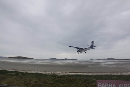
As the tide was going out we headed to Barra’s unique airport where the wide, flat beach serves as the island’s only runway. The airport markets itself as “the world’s only commercial airport that has runways washed daily by the tide”. It was a wonderful sight to watch a plane land only metres away from the spot where you had just parked, quite legally, your motorhome. It flew so low directly over our motorhome that John was convinced it was going to hit us!
Anything else we did today, even though we were on a beautiful island, would feel like a real let down so, after driving round the very sparsely populated eastern side of Barra, with only a stop to buy provisions at Castlebay’s Co-op, we headed back to our parking with a view spot for the rest of the day.
We awoke to rain and a very different day from yesterday’s almost wall to wall sunshine and balmy temperatures.
As the tide was going out we headed to Barra’s unique airport where the wide, flat beach serves as the island’s only runway. The airport markets itself as “the world’s only commercial airport that has runways washed daily by the tide”. It was a wonderful sight to watch a plane land only metres away from the spot where you had just parked, quite legally, your motorhome. It flew so low directly over our motorhome that John was convinced it was going to hit us!
Anything else we did today, even though we were on a beautiful island, would feel like a real let down so, after driving round the very sparsely populated eastern side of Barra, with only a stop to buy provisions at Castlebay’s Co-op, we headed back to our parking with a view spot for the rest of the day.
Sunday 19th May
First thing this morning we drove back towards Castlebay to the turning for Vatersay. This island is the most southerly of the Outer Hebrides that can be reached by road, all five miles of it, thanks to the opening of a causeway in 1898.
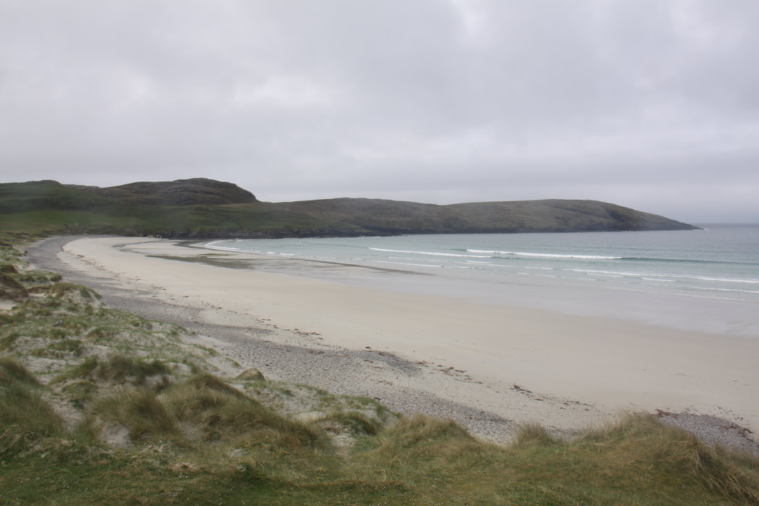
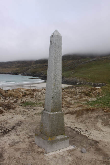
Just before a cluster of houses which is the actual village, we parked to view the stunning beaches – Traigh Siar on one side of the narrow neck of land between them is infamous as the final resting place of the “Annie Jane”. A simple concrete plinth commemorates the hundreds of mainly local islanders who were emigrating to Canada but got no further than near here when their ship was wrecked on the rocks.
First thing this morning we drove back towards Castlebay to the turning for Vatersay. This island is the most southerly of the Outer Hebrides that can be reached by road, all five miles of it, thanks to the opening of a causeway in 1898.
Just before a cluster of houses which is the actual village, we parked to view the stunning beaches – Traigh Siar on one side of the narrow neck of land between them is infamous as the final resting place of the “Annie Jane”. A simple concrete plinth commemorates the hundreds of mainly local islanders who were emigrating to Canada but got no further than near here when their ship was wrecked on the rocks.
|
|
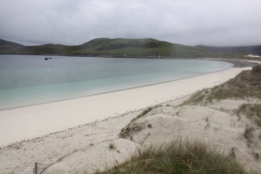
The second bay, named Vatersay Bay, is stunningly beautiful with pale sands consisting mainly of fragments of shells lining the aquamarine waters.
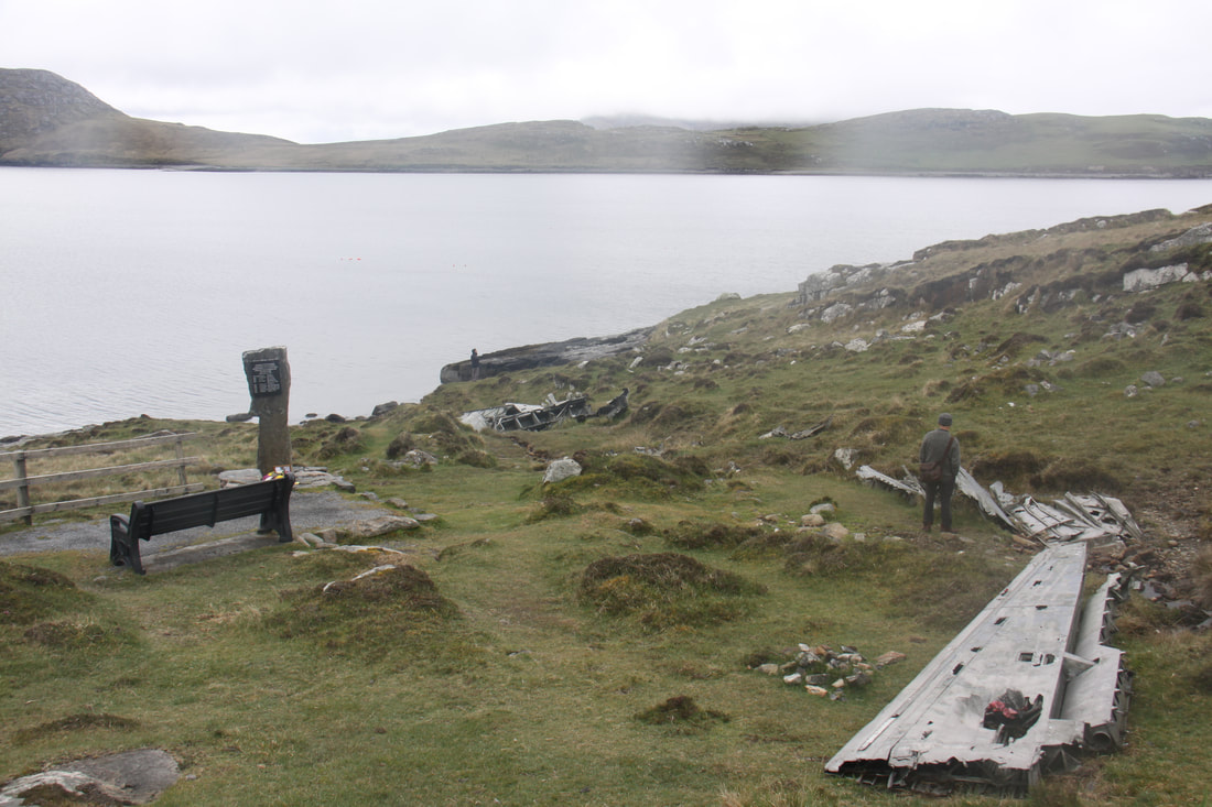
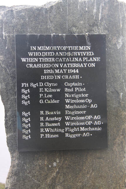
In 1944 Vatersay was also the scene of the loss of the Catalina flying boat. Wreckage is scattered across the slopes above the shoreline and it is a miracle that six of the nine man crew survived.
In 1944 Vatersay was also the scene of the loss of the Catalina flying boat. Wreckage is scattered across the slopes above the shoreline and it is a miracle that six of the nine man crew survived.
|
|
After leaving Vatersay we returned to Barra Airport and were just in time to see a plane take off across the bay.
We left Barra mid-afternoon heading back on the ferry to Eriskay. From here we headed back onto South Uist and stopped for the night back at Cladh Hallan.
We left Barra mid-afternoon heading back on the ferry to Eriskay. From here we headed back onto South Uist and stopped for the night back at Cladh Hallan.
|
|
Monday 20th May
Today we continued to retrace our steps back to North Uist. We made a brief stop at the Hebridean Smokehouse but there was nothing happening there today. For most of our route round North Uist, the road was single track with passing places. Much of the land here was peat bog interspersed with lochs, some sea water, others fresh. The low lying Monach Islands and both the main St. Kilda group islands were clearly visible.
Soon we left the desolated scenery of North Uist behind and crossed the short causeway on to the tiny island of Berneray where there is only some three miles of paved road. We stopped to look at some blackhouses before accessing wifi in the former Nurses’ cottage now a Tourist Information Centre.
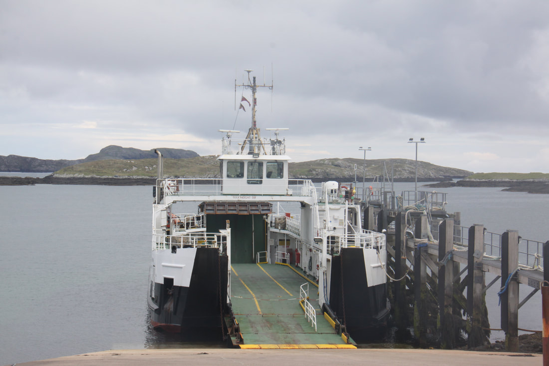
The ferry to Harris leaves from the slipway at Ardmaree.
Our tickets were for tomorrow's 7am crossing but as there was space on the ferry we were able to cross today. It was a very scenic crossing through the skerries and islands of the Sound of Harris. Tonight we parked at the port of Leverburgh.
[click] to continue our trip to Harris and Lewis
[click] to return to Home page