Dempster Highway
Saturday 16th June
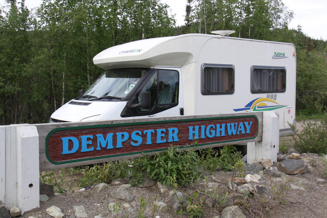
From Dawson City we drove down the Klondike Highway to start of the Dempster Highway. We took photos at the start of the road by the junction with the Klondike Highway. The dirt highway is 457 miles all the way to Inuvik with no roads turning off it. I wasn’t keen to drive it but John was insistent! We plan to go only as far as mile 289, the border of Yukon and the North West Territories.
In places the road was smooth and hard but for the most we could only manage 25mph due to pot holes and/or corrugated surface. The stretch from Red Creek to the top of 7 mile hill, some 55 miles, was particularly bad. Speeding passing traffic threw up clouds of dust and often stones.
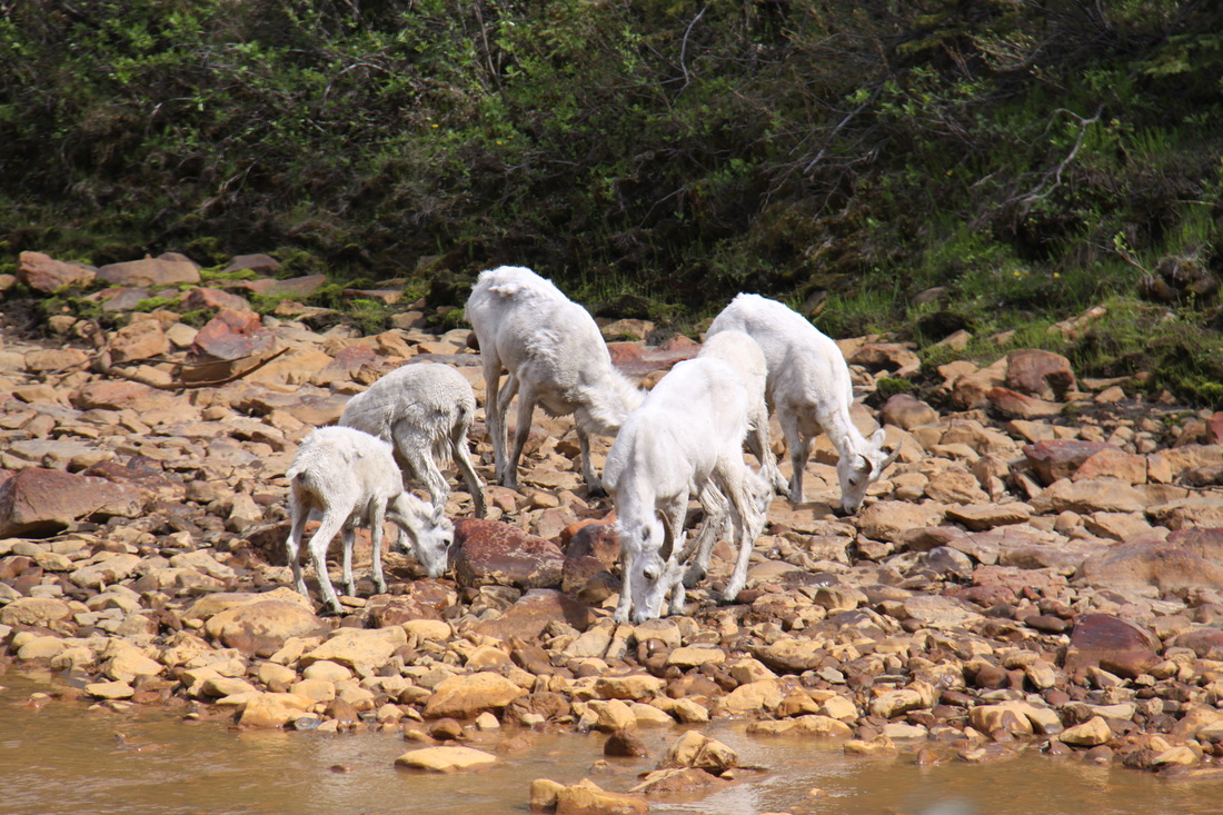
The scenery was magnificent. We skirted Tombstone Territorial Park, the Blackstone Plateau, Taiga Valley, Taiga Ranges and followed the Ogilvie River. Red Creek was high in mineral content and in places both the water and river banks were orange/red in colour. Dall sheep were licking the rocks alongside Engineer Creek – calcium and magnesium.
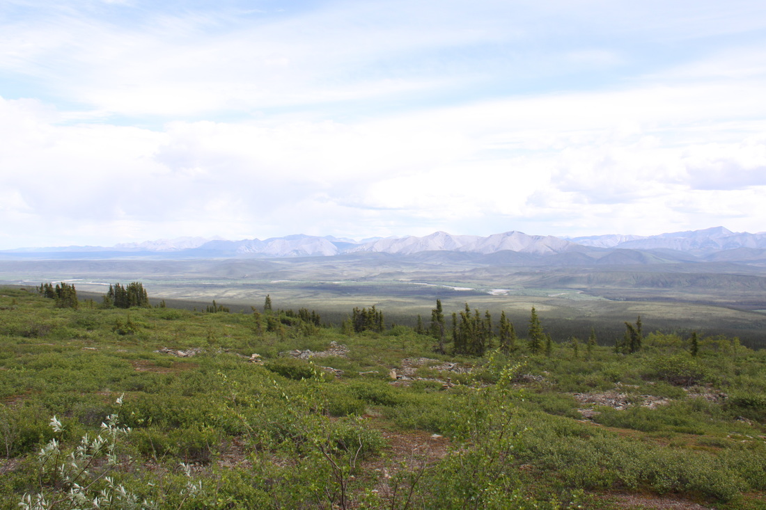
The final part of the day’s drive was across the Eagle Plain Plateau – a high road with magnificent views.
Overnight just off the road some 20 miles short of the settlement at Eagle Plains.
|

|
Sunday 17th June
Fathers’ Day but no mobile reception or wifi. Fiona and Alison had both given me cards and gifts for John before we left home.
The whole day could be summed up as dirt and dust – the Dempster highway certainly lived up to its reputation.
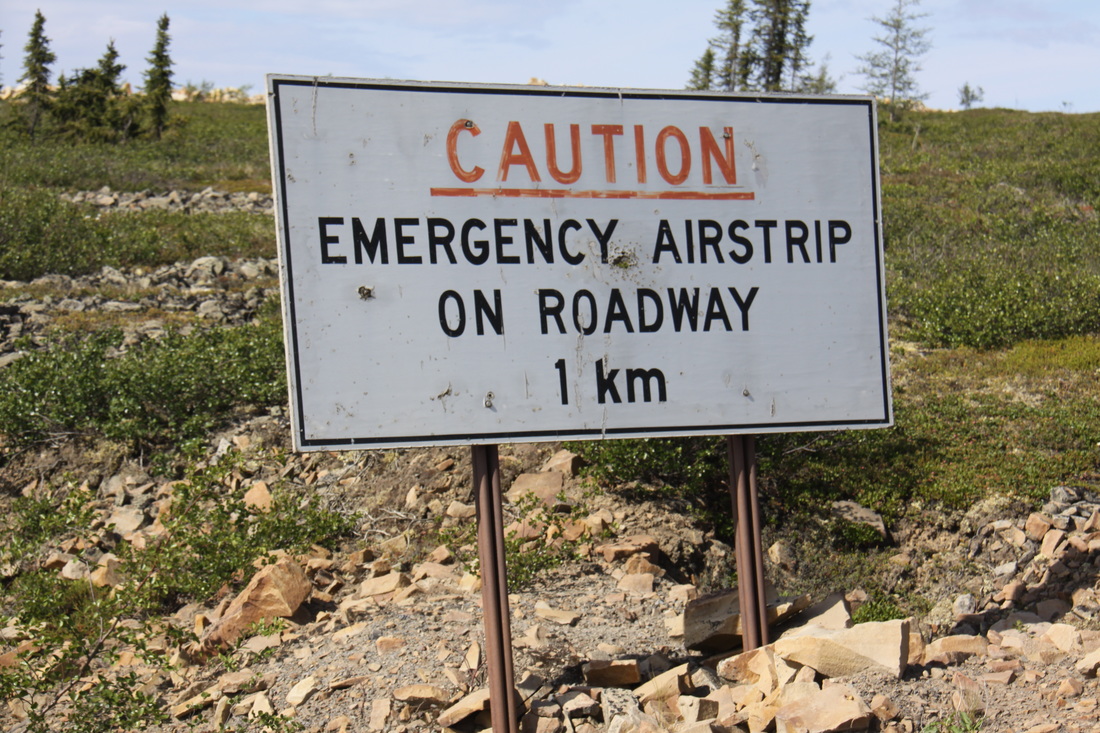
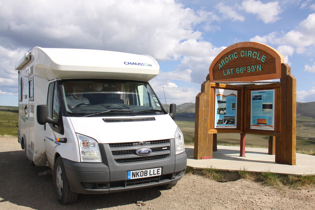
We reached Eagle Plains midmorning – a section of the road was also an emergency runway! We filled up with diesel before heading north to the Arctic Circle. From there we continued until the border of Yukon and the North West Territories.
|
|
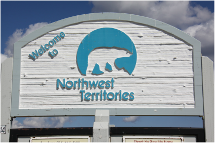
Initially we had said that we would turn back at this point but instead we decided to carry on towards Inuvik – BIG MISTAKE.
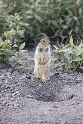
Firstly we were in scattered, spindly forests but then on a beautiful tundra plateau – saw marmots and a wonderful array of arctic flowers.
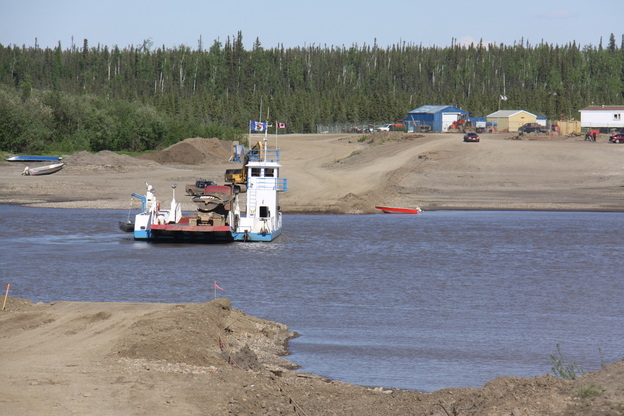
The ferry across the Peel River went smoothly but when we reached the Mackenzie, it was in flood and floating tree trunks being swept downstream had closed down the ferry for the past 24 hours. No-one knew when it would re-open, certainly not before the river level dropped. Evidently there had been torrential rain in the mountains north of the Watson Lake area and the Alaska Highway was flooded. This water had now worked its way downstream!
|
|
We decided to turn back at this point. We retraced our route back to the Peel ferry only to discover that rough water was causing problems and the ferry cable across the river, was working loose! We were fortunate to be able to cross.
It was gone 9 pm before we found a layby for the night – it was really too near the dusty road but there was nowhere else. We had to clean every surface inside Nicolle before we could eat – she is filthy. Later that evening a brown bear paid us a visit, jumping up against the side of the van and wandering around us for a while before heading off!
Monday 18th June
We retraced our steps back along the Dempster Highway for the entire day. At Eagle Plains we learned that the Mackenzie ferry was still closed due to high water on the river – there were quite a few vehicles waiting there until the ferry was running again.
There was noticeably less traffic on the road today. Despite this Nicolle was as dirty inside and out, as ever, so an hour’s cleaning was needed before we could prepare a meal.
Overnight in a large stony area in Tombstone Territorial Park.
Tuesday 19th June
For the first hour of the day we completed our return journey back to mile zero of the Dempster Highway.
We spent the remainder of the morning at a truck stop cleaning Nicolle, inside and out – will take time to get rid of all the dust and grime. Whilst waiting for the jet wash, John got into conversation with a Swiss couple who owned a very large elderly RV – back home they had an E-type Jaguar and an Austin Healey 3000. John was more than a little envious!
We showered and then after lunch at the diner began our journey along the Klondike Highway back towards Whitehorse. The highway is bounded by forests, lakes, rivers and mountains with virtually no settlements.
Overnight in a layby north of Pelly Crossing.
[click] to return to the Yukon
[click] to return to Home page