National Parks
[click] to return to Home page
Monday 2nd April
Managed with great difficulty to drag John away from Route 66 so that we could visit the National Parks. Reached the Grand Canyon by mid- morning and booked onto the Mathers Campground for 2 nights. Visited the Visitor Centre and watched an introductory film about the Grand Canyon.
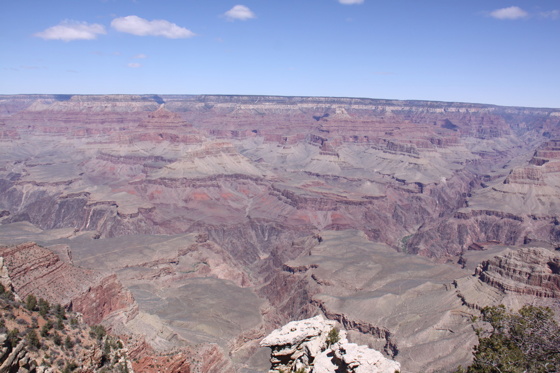
Walked to the canyon rim – awesome.
Walked from Mather Point to Grand Canyon Village along the Rim Trail – views incredible.
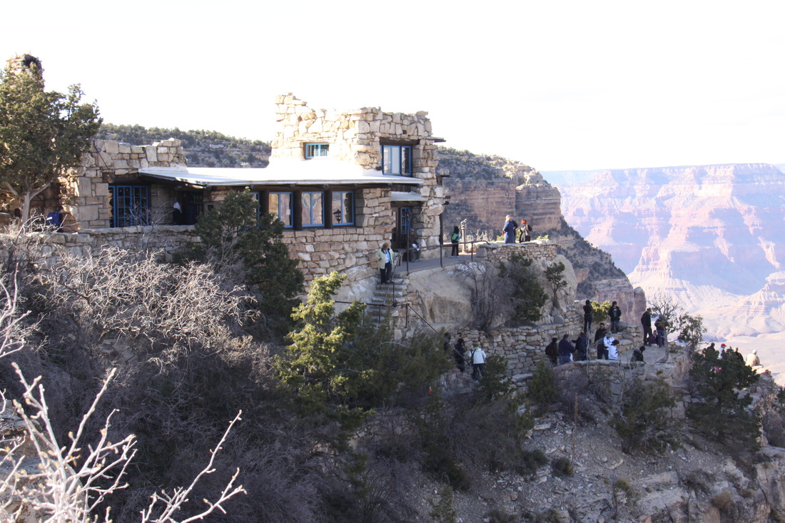
Explored the buildings of Grand Canyon Village – Verkamp’s Visitor Centre, Hopi House, Lookout Studio.
Returned to the Visitor Centre on the free shuttle bus.
Monday 2nd April
Managed with great difficulty to drag John away from Route 66 so that we could visit the National Parks. Reached the Grand Canyon by mid- morning and booked onto the Mathers Campground for 2 nights. Visited the Visitor Centre and watched an introductory film about the Grand Canyon.
Walked to the canyon rim – awesome.
Walked from Mather Point to Grand Canyon Village along the Rim Trail – views incredible.
Explored the buildings of Grand Canyon Village – Verkamp’s Visitor Centre, Hopi House, Lookout Studio.
Returned to the Visitor Centre on the free shuttle bus.
|
|
Tuesday 3rd April
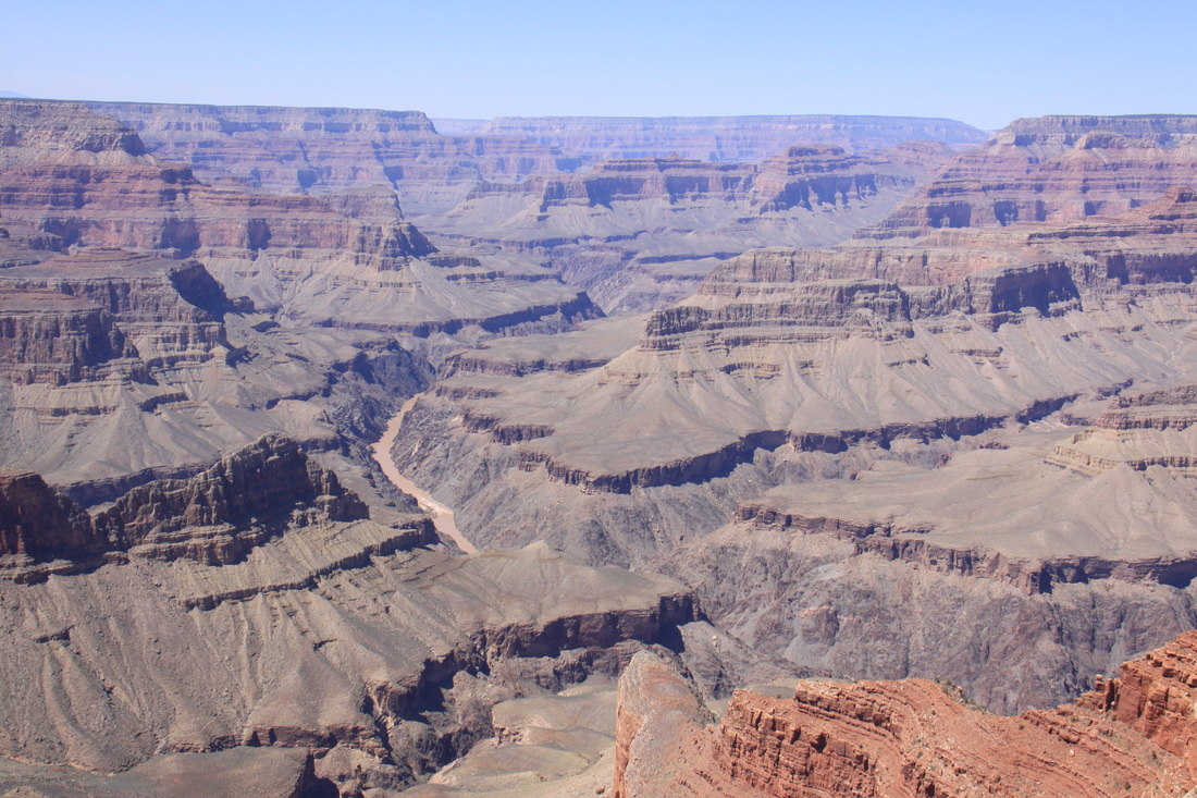
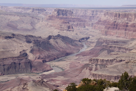
Took the shuttle bus to the western rim walk. Walked from Monument Creek Vista to Hermits Rest – 2.8 miles. Used the shuttle bus back to Mohave Point and walked from there back to Grand Canyon Village – 3 miles. In places the path was scarily close to the canyon edge. The Colorado River and some of the rapids were visible. The clarity of the air meant that you could see mountains up to 70 miles away.
Overnight at Mathers Campground.
Wednesday 4th April
Spent the morning taking a 1 mile walk and then driving along the eastern southern rim drive, having first taken the shuttle bus to Yaki Point. We stopped at each view point to see the ever changing vistas of the Grand Canyon.
We also stopped to see the Tusayan Ruins and Museum.
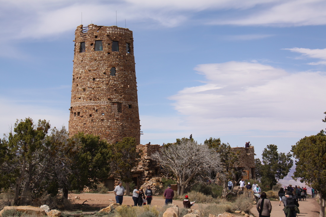
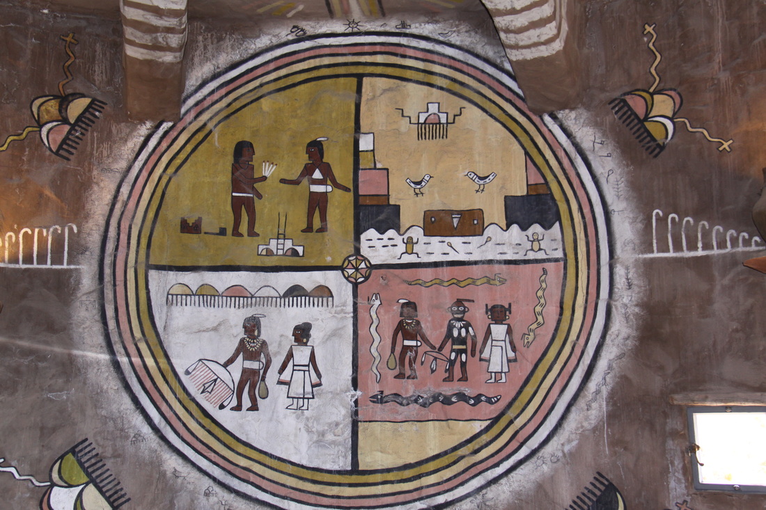
At Desert View we climbed The Watchtower built in 1932. From there you could see across to the Painted Desert. Inside the tower were some fascinating examples of Indian art.
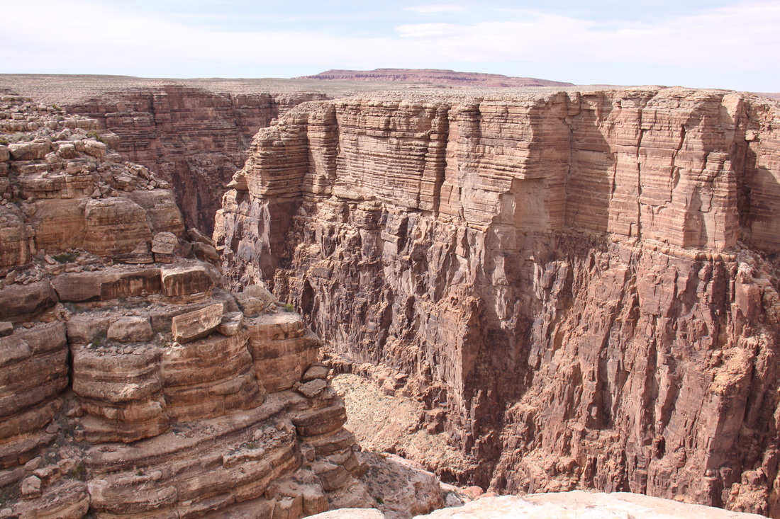
After lunch we left Grand Canyon National Park and drove to Cameron. There were fine views of the deeply incised Little Colorado River.
We parked overnight at the Indian Trading Post in Cameron.
Spent the morning taking a 1 mile walk and then driving along the eastern southern rim drive, having first taken the shuttle bus to Yaki Point. We stopped at each view point to see the ever changing vistas of the Grand Canyon.
We also stopped to see the Tusayan Ruins and Museum.
At Desert View we climbed The Watchtower built in 1932. From there you could see across to the Painted Desert. Inside the tower were some fascinating examples of Indian art.
After lunch we left Grand Canyon National Park and drove to Cameron. There were fine views of the deeply incised Little Colorado River.
We parked overnight at the Indian Trading Post in Cameron.
|
|
|
|
Thursday 5th April
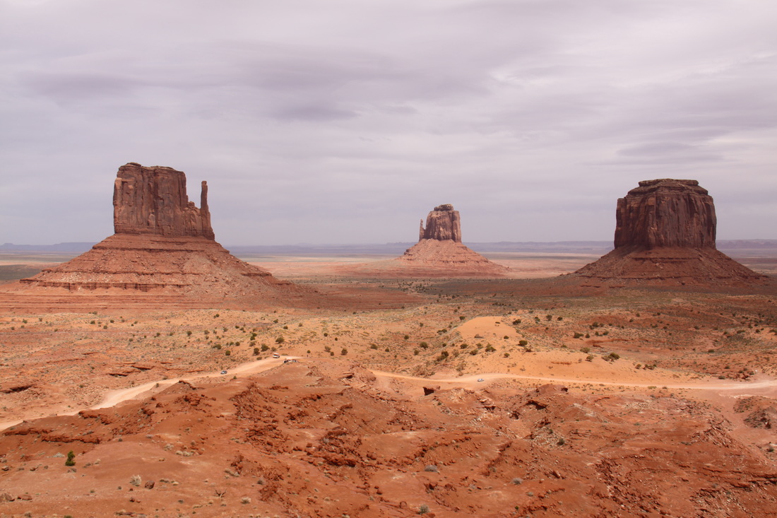
We drove from Cameron through Kayenta (where we stopped for lunch at McDonalds so that we could access wifi) and then on to Monument Valley.
The red sandstone scenery is incredibly beautiful but a strong wind and an overcast sky didn’t do it full justice. We drove the 17 mile dirt Valley Road that circles the better known scenic areas. The road was either rough rock or loose sand which made driving difficult.
Overnight on a windswept primitive campground within Monument Valley Tribal Park.
Friday 6th April
Woke up to find that it was still windy. A layer of red dust seemed to engulf Monument Valley.
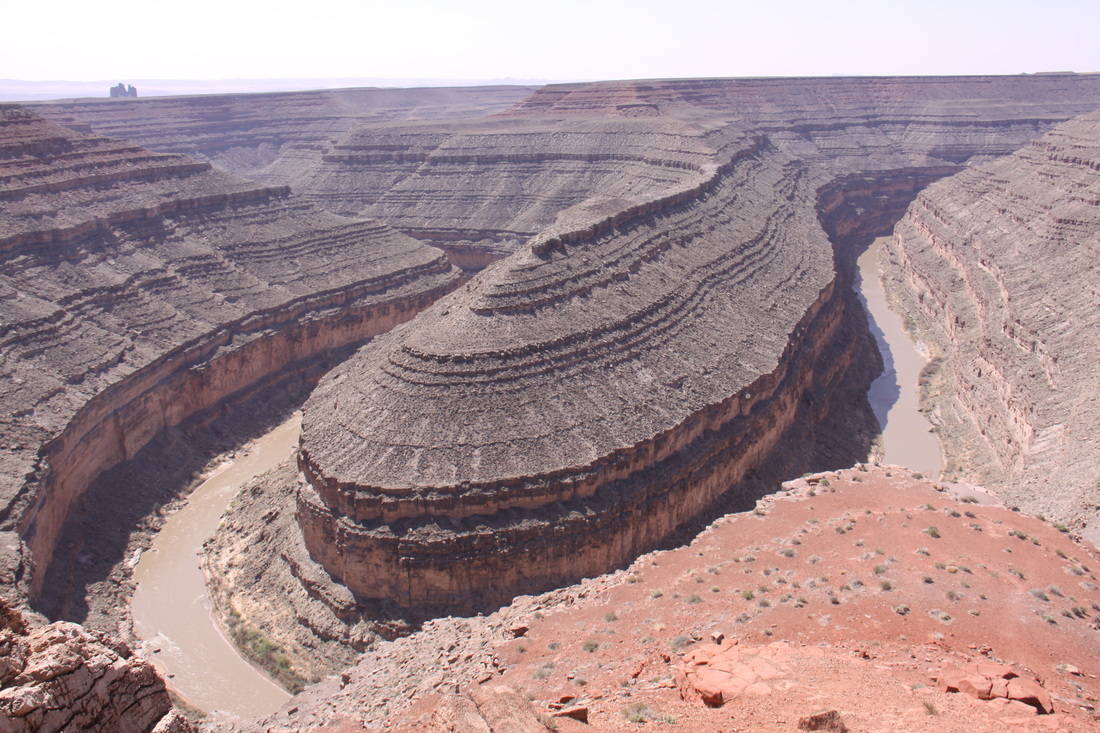
Drove through stunning scenery to the San Juan River at Mexican Hat – river in a deep canyon. Visited Goosenecks State Parks to view the incised meanders of the river.
Took Route 261 north – this road climbs to the top of the high canyon walls in a series of dirt track switchbacks –terrifying and steep but incredible views if you dared to look!
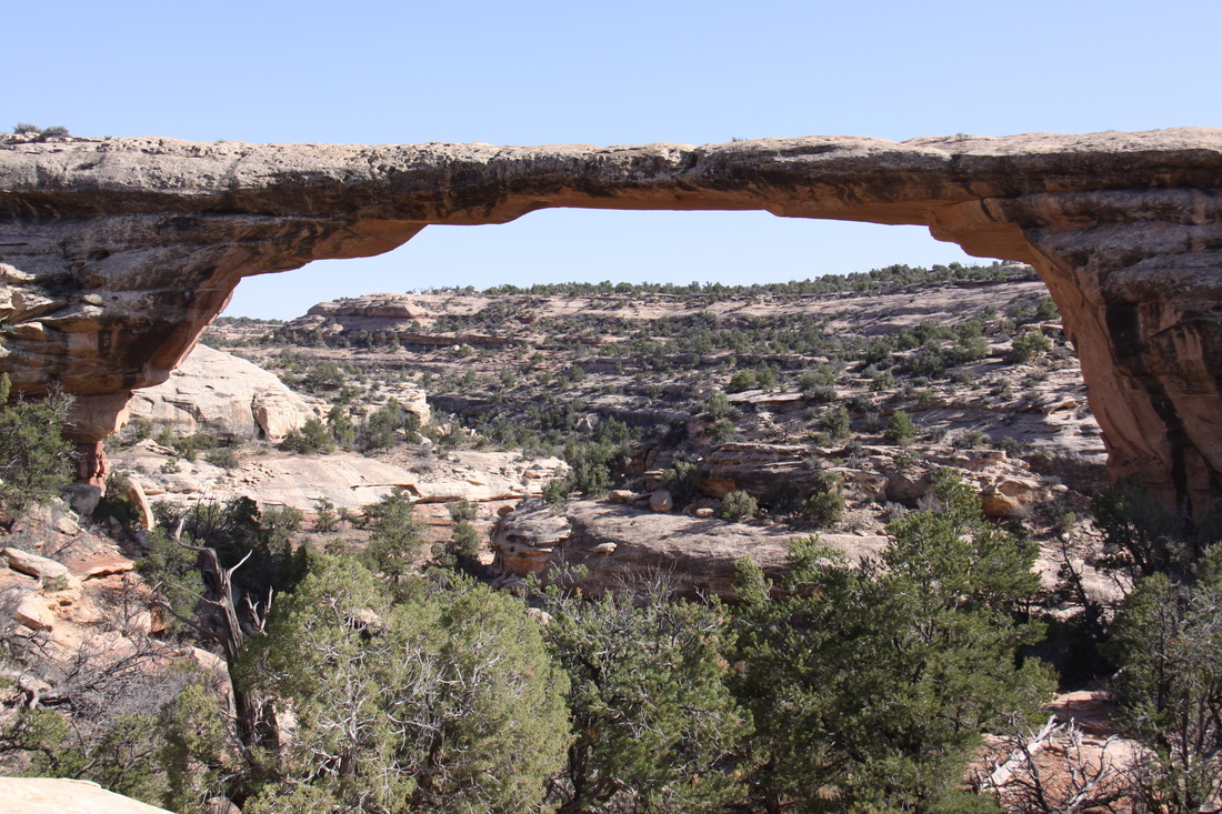
Visited Natural Bridges National Park. A loop road passes the three natural bridges and the remains of an ancient pueblo. Walked down to Owachomo Bridge.
Overnight in the National Park Campground – small and pretty.
Saturday 7th April
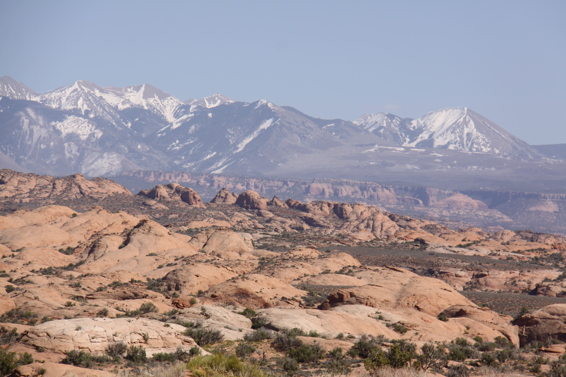
Spent the morning driving through spectacular scenery passing Blanding and Monticello before reaching Moab. Moab was a sprawling tourist centre full of jeeps. It was Jeep Fest week in the town so the National Park campground and all the RV parks in town were full! A traffic cop directed us to the Ministry of Land Management campground which was quite a long way out of town. They only had a few spaces left. |
|
Sunday 8th April
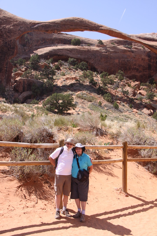
Got up at 6 am so that we had a full day to explore Arches National Park – many people around as it was Easter Sunday. We followed the Park’s drive from the Visitor Centre through to its end at Devils Garden.
Trails walked:
● North and South Window and Turret ~ 1 mile
● Double Arch ~ ½ mile
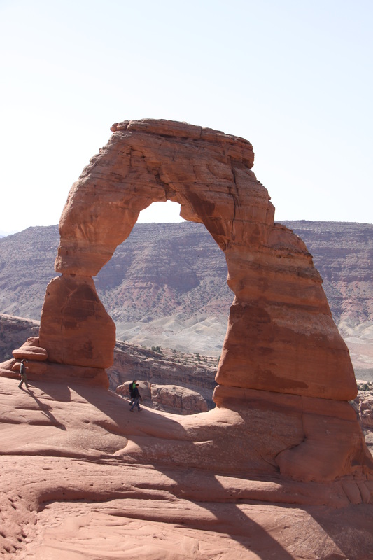
● Delicate Arch ~ 3 miles ~strenuous!
● Landscape Arch ~1.6 miles
● John also did Sand Dune Arch (0.3 miles) and Broken Arch (1.3 miles) on his own.
We stopped at most of the view points – incredible views over the surreal landscape of the park and to the La Sal Mountain.
Overnight at a primitive campground beside the Colorado River near Moab.
Monday 9th April A hot, mainly driving day. Our route took us north to Green River, then along Interstate 70. This road traversed some superb scenery and there were rest areas with information boards explaining the various geological features. Overnight in Richfield. |
|
Tuesday 10th April
Set off early in the morning so that we would reach Bryce Canyon early enough to get a pitch on the campground – successful.
Drive to Bryce was through high valleys with sparse population – mainly cattle rearing.
At Bryce Canyon we
● visited the Visitor Centre and watched an introductory film
● drove the 18 mile scenic road stopping at most of the view points
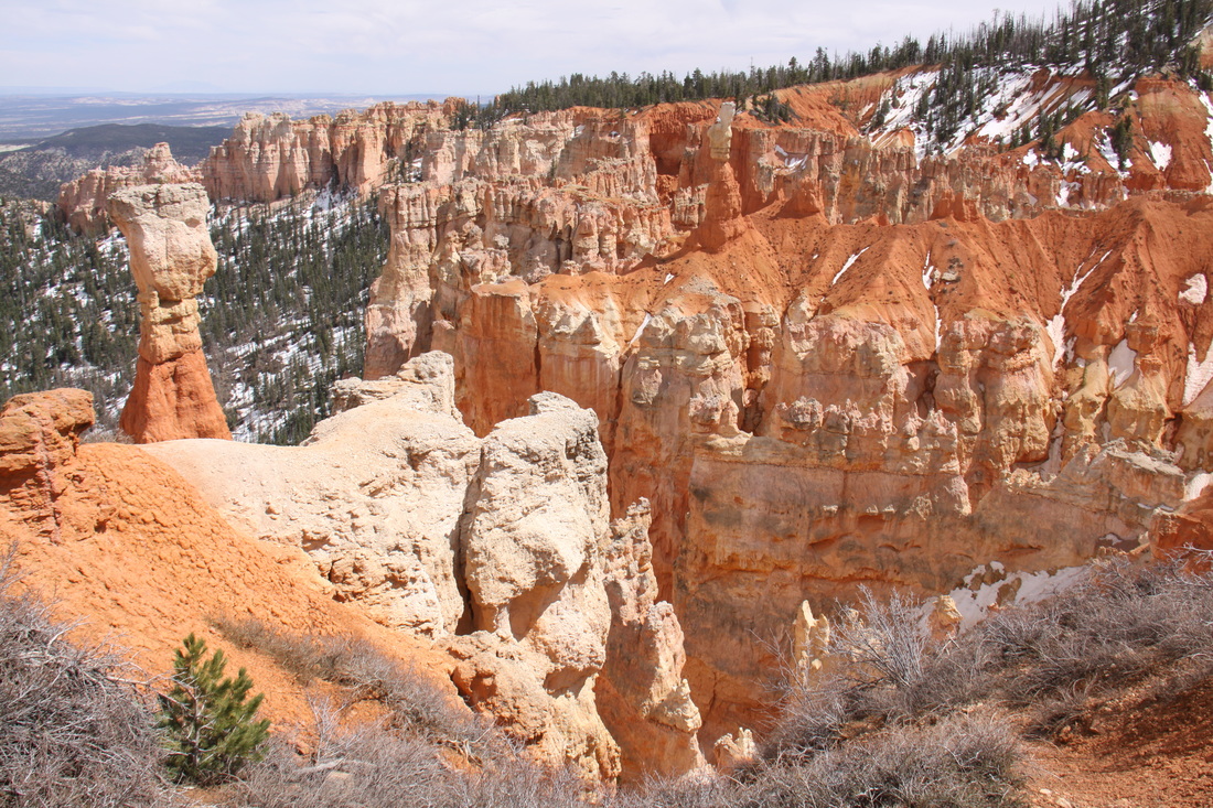
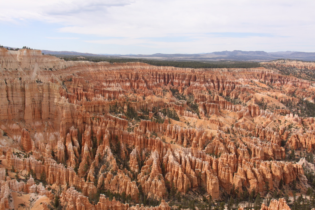
● admired the Amphitheatre with its maze of hoodoos, fins and spires – colouring of the rocks was amazing.
Overnight at the North Campground within Bryce National Park.
|
|
Wednesday 11th April
A get clean and rest day ! Showers and four loads of washing at the laundromat. Weather has taken a turn for the worst – much colder with rain and sleet. Snow forecast for over-night.
Overnight at Bryce National Park.
Thursday 12th April
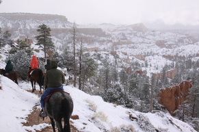
John not too well today – suspected tooth infection. Woke up to 2 inches of snow – walked up to Sunrise Point to see how the amphitheatre looked with a covering of snow – a little disappointed with the view into the amphitheatre.
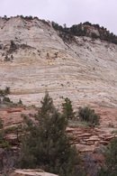
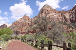
Drove to Zion Canyon in the morning. Entered Zion Canyon National Park along the Zion Mount Carmel Highway – an extremely scenic route through a deep canyon with checkerboard mesa to either side – one mile of narrow and low tunnel to negotiate followed by hairpin bends – not easy driving. Booked into Zion National Park South Campground then walked to both the Visitor Centre and the Zion Human History Museum – watched an introductory film about the park.
Discovered that the hot water tank was leaking so had to dump all our water.
|
|
|
Friday 13th April
Not a good day! Used wrong card to obtain cash, then had to drive to Hurricane in search of a dentist for John – none in town as they were all at a convention. Instead we went to a medical centre and were charged $140 for a consultation. Doctor prescribed antibiotics and recommended that John should see a dentist! Bought a jubilee clip for one of the hot water tank pipes – put a little water in the tank but still leaking. We are back to using water containers. John really poorly – feverish, headache and not eating.
Saturday 14th April
John had had a much better night and seemed more like himself this morning. It had rained most of the night and by morning it was wet snow which settled for a while – rained most of the day and the mist was down, virtually no visibility. We decided to stay put for the day so that John could get really better – read, dozed etc. Our third night at Zion but we still haven’t seen the canyon!
Sunday 15th April
No rain but overcast and clouds down over the hills –almost zero
visibility. Decided to leave Zion National Park rather than wait
another day to see if the weather improved.
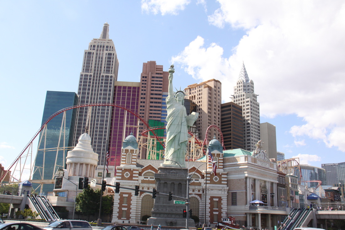
Drove to Las Vegas through canyons and desert plateau – much
warmer.
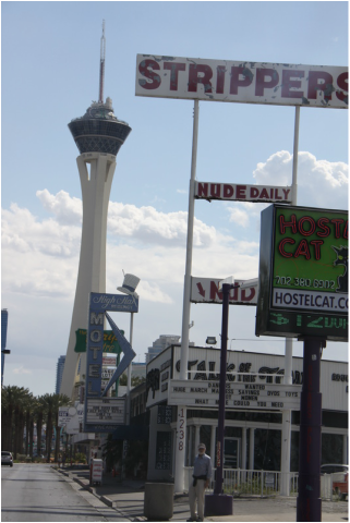
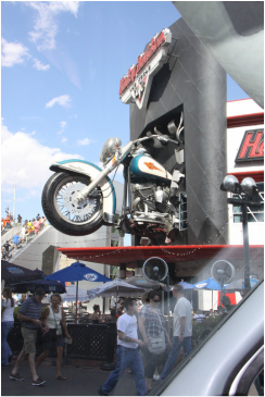
Drove up and down The Strip to see the various hotel facades,
casinos and wedding parlours – all very tacky!
Overnight on Walmart car park in Downtown Las Vegas.
A pair of hookers visited and politely offered their services –
you don’t get that at Tescos!
No rain but overcast and clouds down over the hills –almost zero
visibility. Decided to leave Zion National Park rather than wait
another day to see if the weather improved.
Drove to Las Vegas through canyons and desert plateau – much
warmer.
Drove up and down The Strip to see the various hotel facades,
casinos and wedding parlours – all very tacky!
Overnight on Walmart car park in Downtown Las Vegas.
A pair of hookers visited and politely offered their services –
you don’t get that at Tescos!
|
|
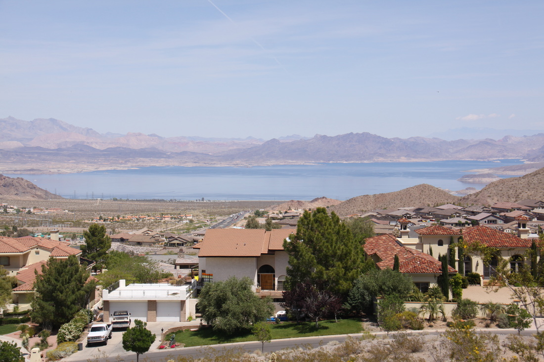
Monday 16th April
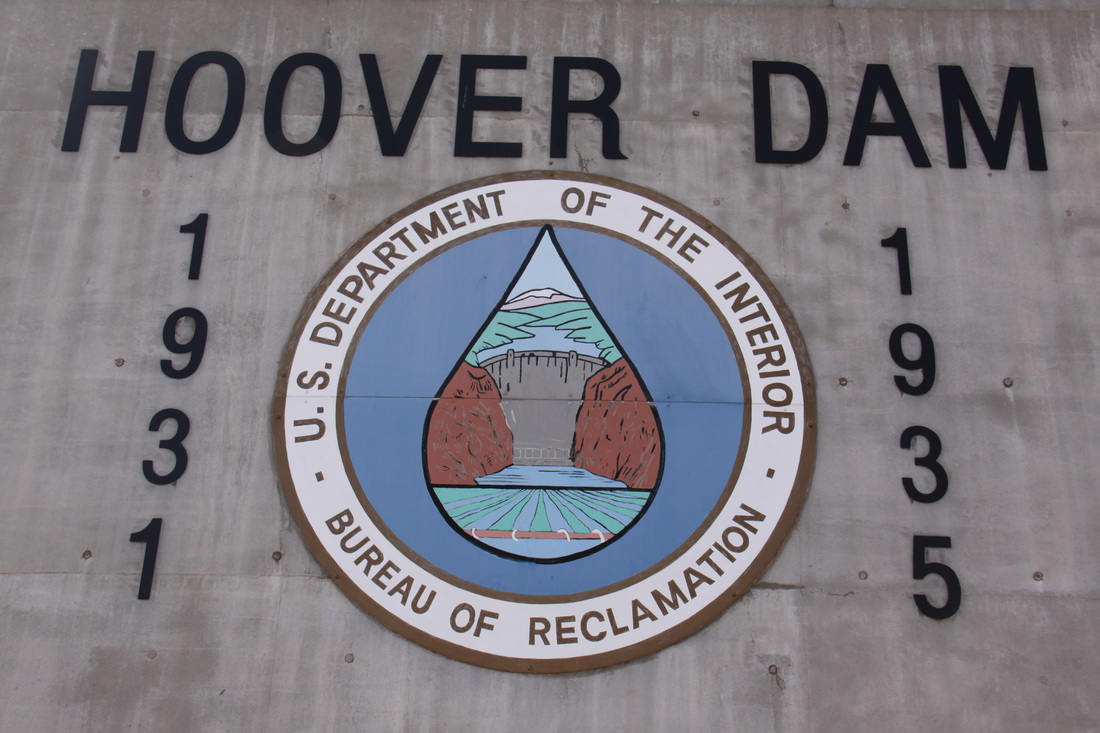
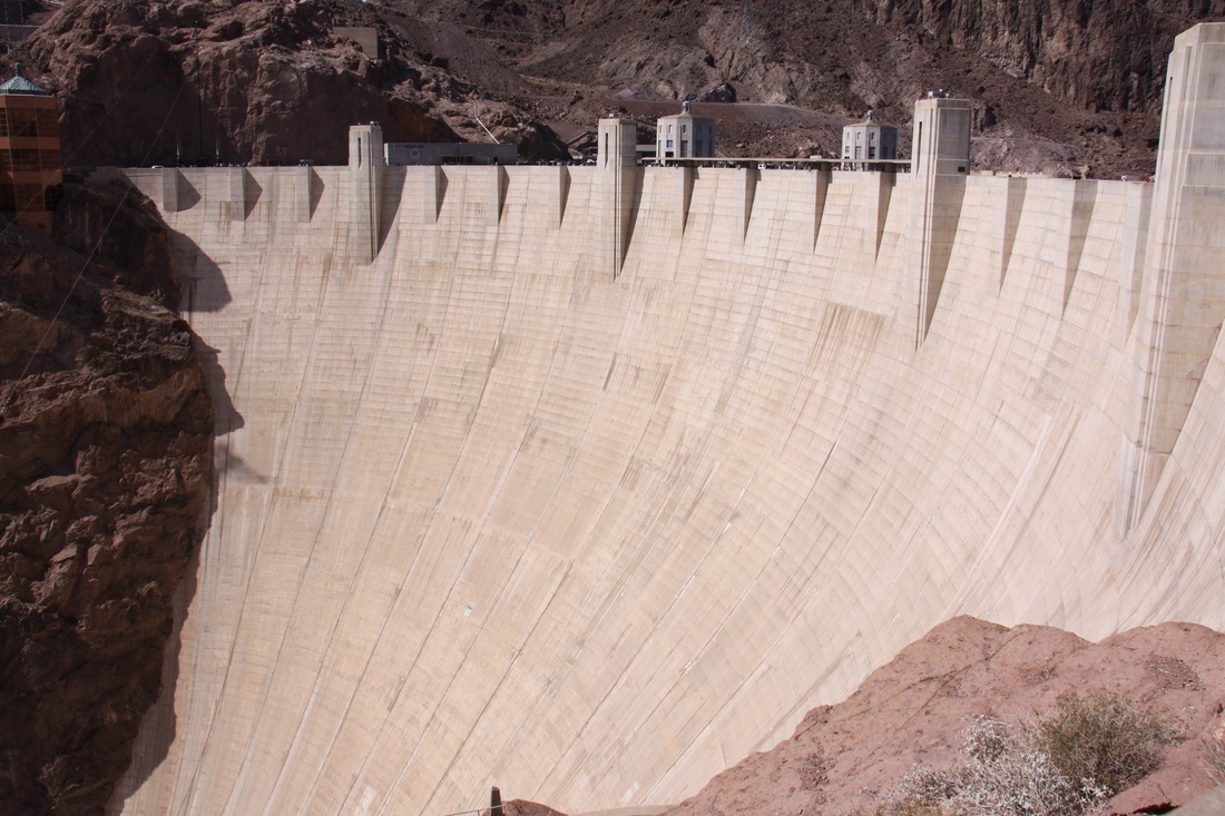
Drove to Boulder City and visited the Hoover Dam Museum – good archive film of building the dam as well as exhibits depicting the human aspect of the dam’s construction. Museum was located in the historic Boulder Dam Hotel in Boulder City. Walked across the new Memorial Bridge constructed over the Colorada River just south of the Hoover Dam – view to the dam and Lake Mead was excellent. Walked across the Hoover Dam and explored the surrounds. Water level in Lake Mead was low – view points explained its features and construction.
Overnight at Boulder Beach Campground on the shores of Lake Mead – a beautiful setting.
|
|

|
|
Tuesday 17th April
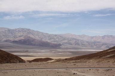
Retraced our steps to Las Vegas via road along Lake Mead then headed north west via Pahrump to the eastern entrance of Death Valley. The scenery was more rugged and lacking in vegetation the nearer we approached Death Valley. On entering the National Park we started dropping quickly down to sea level and below.
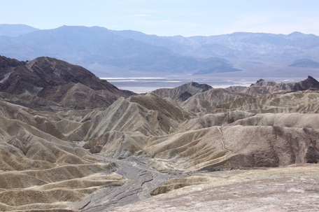
From Zabriskie Point we had an excellent view across the badlands. Furnace Creek campground was closed so we had to take a pitch on Sunset site – dusty with no shade. We visited the Visitor Centre – still being developed so no exhibition or introductory film. Furnace Creek Resort offers swimming and showers – a treat for tomorrow.
A hot and uncomfortable evening.
A hot and uncomfortable evening.
Wednesday 18th April
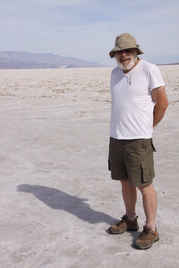
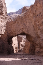
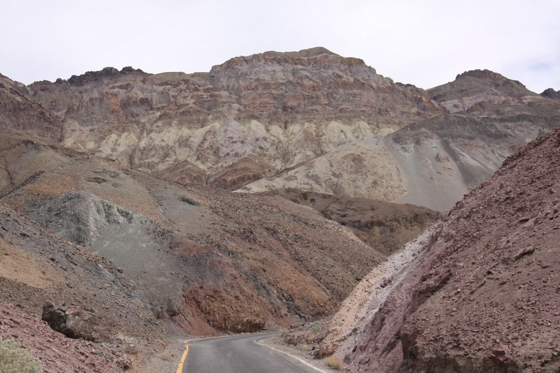
Woke early so we could explore part of Death Valley before the heat of the day. Visited – Badwater Basin, Natural Bridge, Devil’s Golf Course and Artists Palette. Lowest point was 282 feet below sea level. Colours of rocks were amazing.
Had a delicious buffet lunch at the Furnace Creek Ranch followed by an afternoon beside the pool.
Overnight at Texas Spring campground, much nicer than the camp at Sunset.
|
|
|
|
|
Thursday 19th April
Another hot and uncomfortable night. Retraced our route back to Las Vegas then headed for Kingman and the remainder of Route 66[click] – a rather boring drive through desert scrub for most of the journey.
Tuesday 1st May
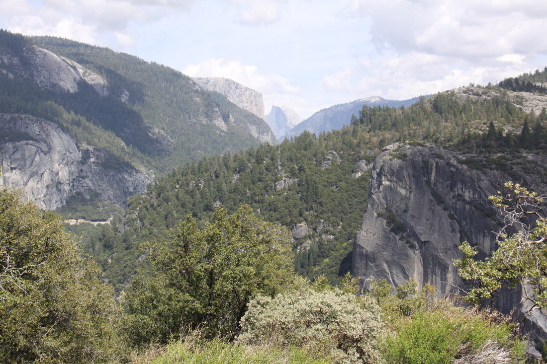
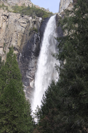
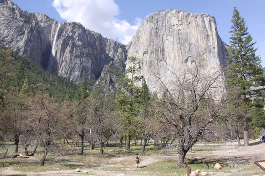
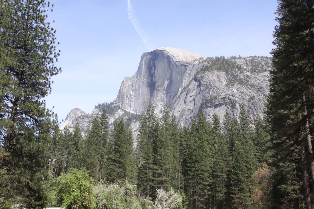
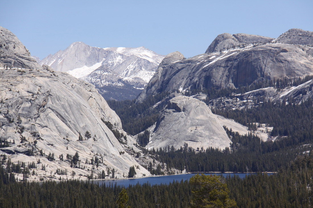
Drove eastwards from San Francisco to Yosemite National Park – orchards then cattle ranching scenery. The views, especially in Stanislaus National Forest were fine. Once into Yosemite, the scenery became quite dramatic – a deep glacial valley with almost vertical valley sides thousands of feet high. The waterfalls were impressive as the high winter snows melt.
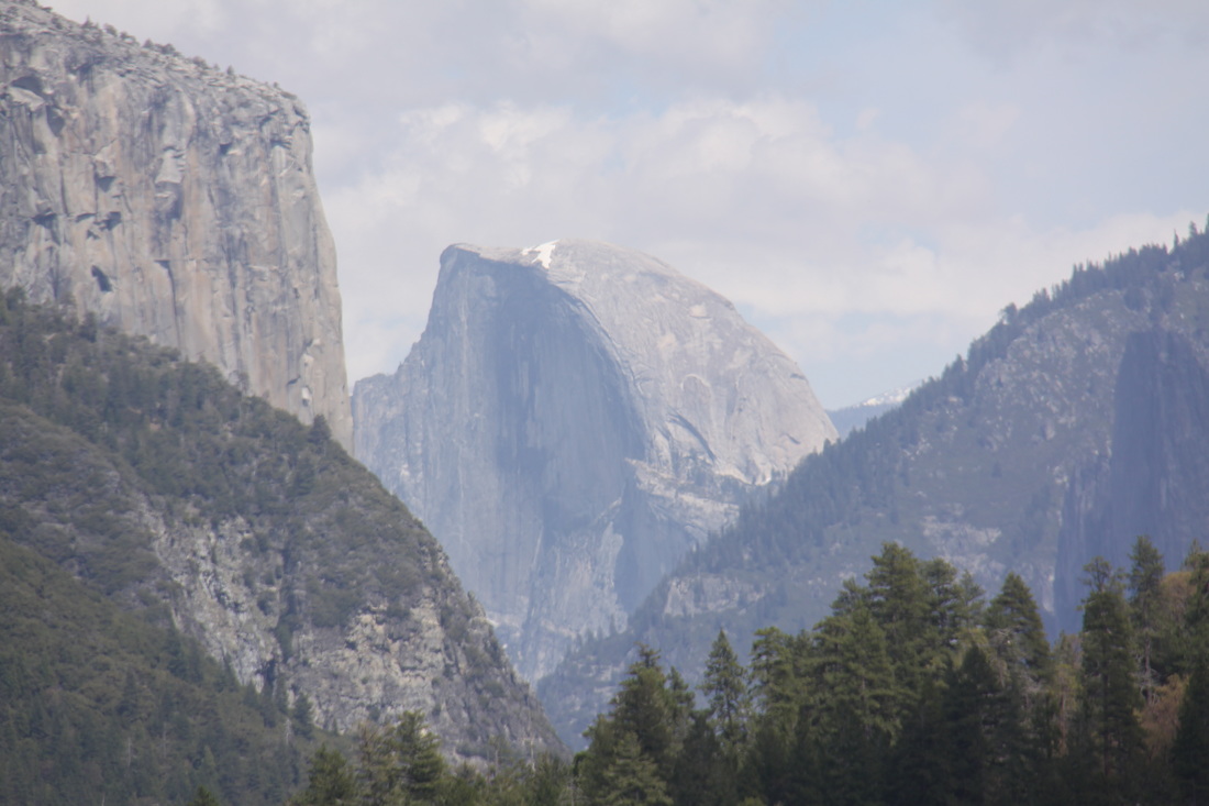
On our drive down to and through Yosemite Valley we stopped at the main viewpoints – Half Dome Vista, Bridalveil Falls (too wet to take close up photographs) and El Capitan Mountain. The film “The Spirit of Yosemite” was rather boring but we did watch it last thing in the afternoon.
We were fortunate to get one of the last places on the North Pines Campground in Yosemite Valley. It is set amongst tall pine trees in the shadow of Half Dome Mountain.
Drove eastwards from San Francisco to Yosemite National Park – orchards then cattle ranching scenery. The views, especially in Stanislaus National Forest were fine. Once into Yosemite, the scenery became quite dramatic – a deep glacial valley with almost vertical valley sides thousands of feet high. The waterfalls were impressive as the high winter snows melt.
On our drive down to and through Yosemite Valley we stopped at the main viewpoints – Half Dome Vista, Bridalveil Falls (too wet to take close up photographs) and El Capitan Mountain. The film “The Spirit of Yosemite” was rather boring but we did watch it last thing in the afternoon.
We were fortunate to get one of the last places on the North Pines Campground in Yosemite Valley. It is set amongst tall pine trees in the shadow of Half Dome Mountain.
|
|
Wednesday 2nd May
Woke up rather late so weren’t ready to leave until 11 am!
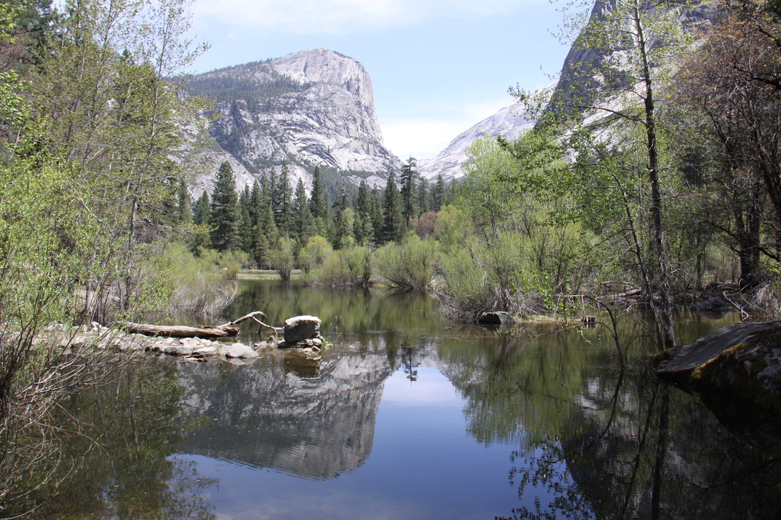
Walked from our campground up a hiking trail to Mirror Lake – beautiful setting at the base of Half Dome Mountain. From there we walked back along the historic old carriage trail. We explored Curry Village amenity centre then took the shuttle bus to Yosemite Lodge. From the lodge we walked across the meadows to Sentinel Bridge and the famous view down the Merced River to Half Dome Mountain.
Had a shower at Curry Village then went to eat at the buffet bar.
Overnight at North Pines Campground.
|
|
Thursday 3rd May
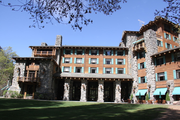
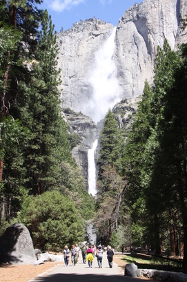
Walked from our campground to “The Ahwahnee” hotel – very elegant with many period features. We then followed the track along the edge of the valley to the Yosemite Lower Falls. Watched rock climbers whilst eating a picnic lunch – excellent views of the falls. Walked back to explore Yosemite village.
Had a second lunch! Local school were fund raising – wrap filled with chicken, rice, beans, cheese, guacamalo, sour cream & salsa + biscuits and a can of drink – a tasty $10 worth.
Visited the Indian Museum and recreated village. Visited the visitor centre information exhibits.
Took shuttle bus back to the campground. Driver provided a very amusing commentary. He pointed out the rock climbing walk were lessons were taking place - said he was tempted to have a go but "the law of gravity is rigidly enforced in the National Park!"
Returned to Curry Village for a shower before heading back to the campground.
Weather once again good.
|
|
Friday 4th May
Reluctantly left Yosemite Valley and headed out via the southern entrance of the park.
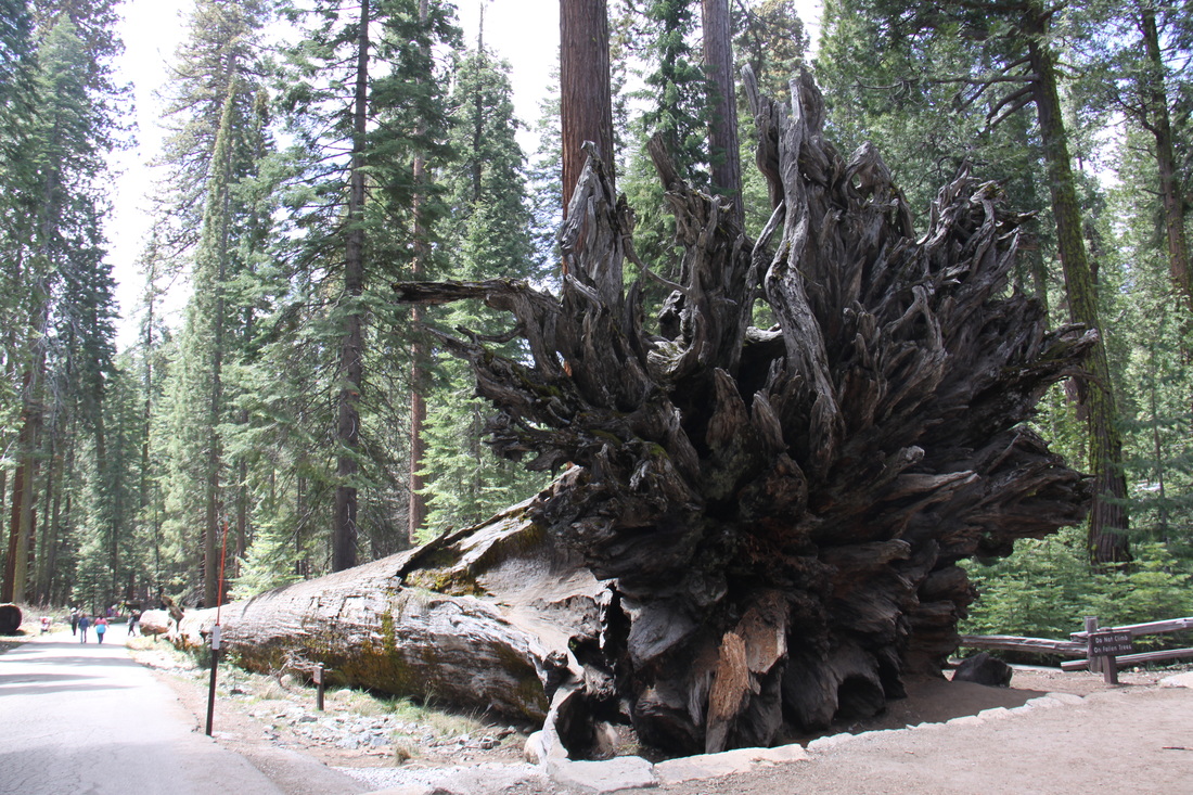
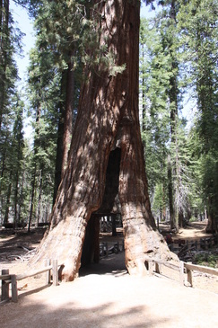
Visited the Mariposa Grove of giant redwood trees and walked to see a number of the groves.
Drove south to Fresno and on to Visalia where we stayed overnight on a Walmart car park.
|
|
Saturday 5th May
Had a lovely drive through orchards and on into the foothills of the Sierra Nevada. The hills appeared laid out in rows ahead, each ridge higher than the next. As the road climbed so it became twistier and narrower – in just 16 miles there were 130 curves and 12 hairpin bends. At one point the road was a single, narrow lane due to road works.
We drove along the Generals Highway to the campground at Lodgepole. After all campgrounds at Yosemite being full, we were surprised to find this one almost empty!
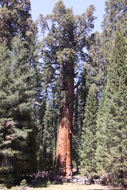
We watched a film on bears at the Visitor Centre then drove to the General Sherman Tree – the largest tree in the world – the path to it was steep. The tree didn’t appear that large (we were sure we’d seen larger ones in New Zealand) but could definitely be described as old – over 2,200 years.
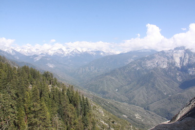
Next we drove to Moro Rock and walked part of the way up to get a wonderful view of the higher peaks of the Sierra Nevada and also down towards the foothills and our twisty approach road to the park.
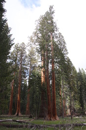
Our final walk was the Big Tree Trail that circled Round Meadow and featured many sequoia trees – all part of the Giant Forest area.
Overnight at Lodgepole campground.
|
|
|
Sunday 6th May
Drove from Sequoia National Park along the Generals Highway to Grant Grove Village. We booked into the campground, again almost empty, before visiting the General Grant Tree and grove of giant sequoia trees – a paved trail led past many of these giants.
We then walked the North Grove Loop through more giant sequoia groves. Many of these trees showed signs of fire damage.
Evening meal was taken in the restaurant at Grant Grove Village and overnight in Azalea campground.
Monday 7th May
A lazy start to the day followed by a visit to the Visitor Centre – an enthralling film about the Kings Canyon National Park and the sequoia groves.
Drove back into the Californian central valley – full of orchards and vineyards. Stopped to purchase some fruit.
Cleaned “Nicolle” at a car wash in Fresno then drove to Merecd, the nearest town to overnight in before the Tioga Pass across the Sierra Nevada.
Overnight on Walmart car park.
Tuesday 8th May
A very noisy night – train whistles and then early morning cleaning of the car park. Left earlier than usual.
Drove back to Yosemite to reach the road over the Tioga Pass – it is normally closed at this time of year but because of less snow than usual, the pass opened early.
The approach road to the pass was through forests with views to domed mountains – bare of trees and covered with many glacial erratic boulders. We stopped at a view point high above the main Yosemite Valley – views to Half Dome Mountain from Olmsted Point. We stopped for lunch on the shore of Lake Tenaya, surrounded by high peaks. The visitor centre at Tuolumne Meadows was closed.
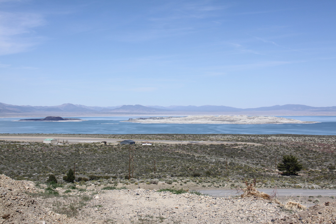
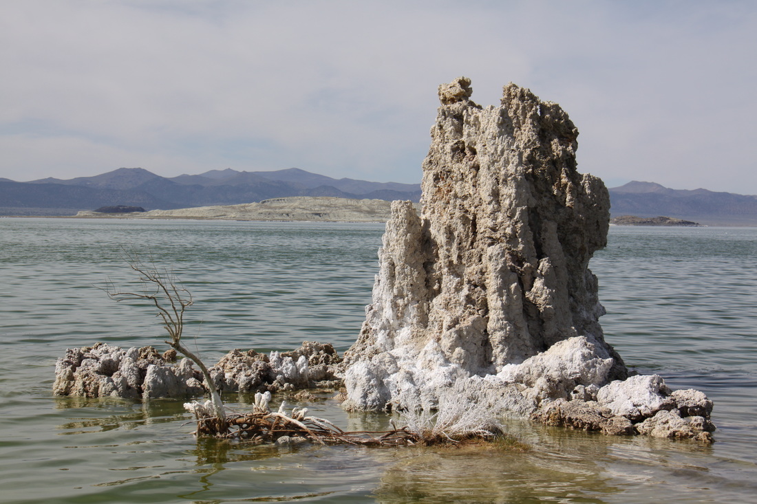
After reaching the top of the Tioga Pass we descended rapidly through the Lee Vining Canyon – barren and tree less – to reach Mono Lake. The contrast of scenery either side of the pass was total – high alpine one side, semi desert the other. Mono Lake Visitor Centre was closed so we headed to the south tufa area where we followed a trail down to the lake shore through tufa. Mono Lake is similar to the Dead Sea. The level of the lake is gradually rising with the aim to bring it back its pre 1941 level when water was drained from it. No campsites were open along the Tioga Pass road or in the Mono Lake Basin area so we had to drive further north.
Overnight at Chris Flat National Forest Campground – situated above a small valley but with no fresh water or dump and only a pit toilet, we felt that it was greatly overpriced at $20 per night.
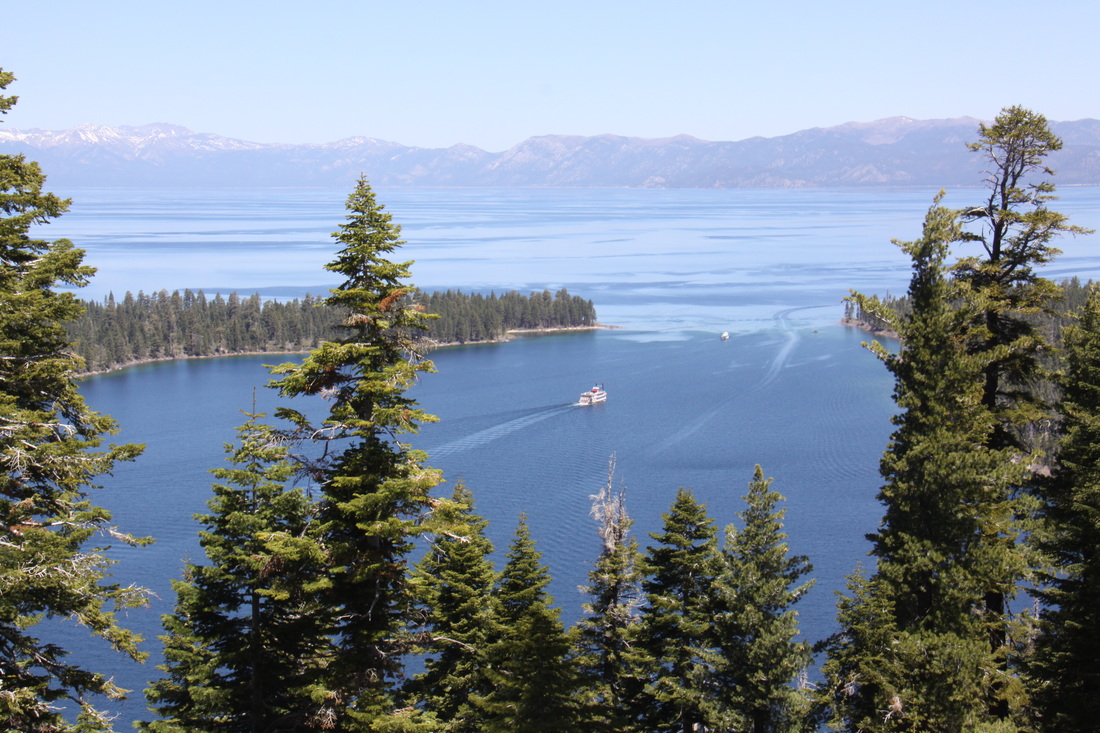
Wednesday 9th May
Headed north, travelling briefly through a corner of Nevada, before crossing over a ridge of the Sierra Nevada mountains to reach Lake Tahoe. The lake was a beautiful turquoise blue and was surrounded by forests and mountains. Unfortunately the views across the lake were limited to one vista point – Emerald Bay, and a few pull-ins along the lake shore. Forest and holiday homes lined the lake. We headed away from the lake towards the Interstate, passing Squaw Valley en route – site of the 1960 Winter Olympics. We stopped at Reno (a mini Las Vegas) for shopping before heading to my town, Susanville. The scenery was semi-desert and two large lakes were dry. Overnight at Walmart, Susanville – a quiet spot. Thursday 10th May
|

Drove through forested, volcanic countryside to Lassen Volcanic National Park. Stopped enroute at a vista point from which a number of ice-covered volcanoes were visible. Mount LassenVolcanic National Park was basically closed until the snow had melted. We were able to drive only 10 miles into the Park to an interpretive trail with fine views to Mount Lassen. Overnight at Walmart in Red Bluff. |
Friday 11th May
A driving day!
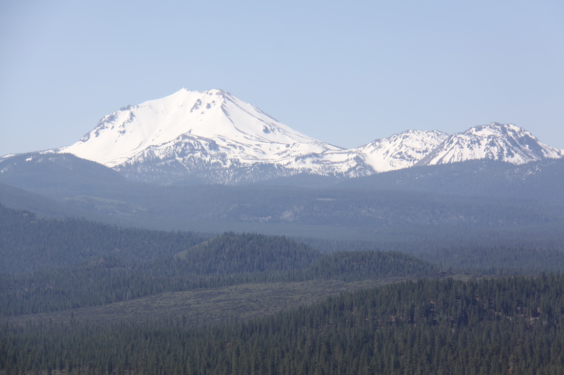
Headed north up Interstate 5 initially through an area of forests and lakes with stunning views to snow capped Mount Shasta and other volcanic peaks.
At Weed we turned off the highway towards Klamath Falls, The scenery was more arid until we reached the Basin – arable and pastoral lands with evidence of dry/semi-dried up lakes.
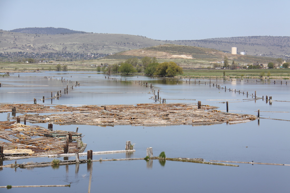
On entering the state of Oregon, lumbering activities were evident and we saw timber floating in the river.
Overnight at Walmart, Klamath Falls.

|
|
Saturday 12th May
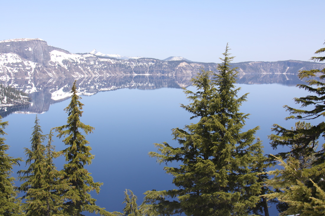
Headed towards the southern entrance to Crater Lake National Park (all other entrances were still closed due to snow). The journey took us along the shores of Klamath Lake then through the Klamath National Forest – as we approached the park entrance, the depth of snow increased dramatically. We visited the Steel Visitor Centre then drove the short distance up to Rim Village – much of this was still buried under deep snow but paths had been cleared to the Gift Shop and Lodge. The views across Crater Lake were amazing – turquoise blue water, snow covered ground and the green tops of coniferous trees, all reflected in the waters of the lake.
A small section of the rim road was open so we drove along it to Discovery Point. We returned to the Visitor Centre and watched two short films – one on snow clearance, the other about the area’s human history.
On leaving the park we followed the scenic Umpqua River byway to Roseburg – dense forests and a rushing river.
Overnight at Walmart, Roseburg.
|
|
Sunday 13th May
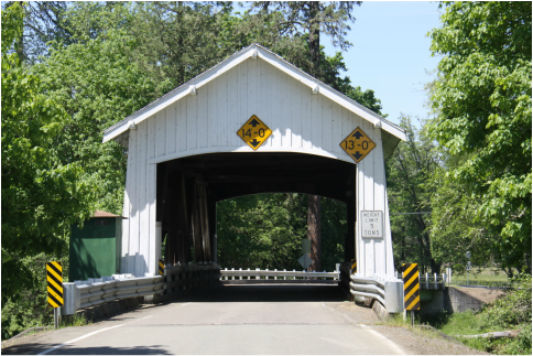
Spent the morning at a laundrette before heading along the
lower Umpqua river valley to the coast. We stopped at a
covered bridge in Rochester and had lunch overlooking
the river.
The coast between Reedsport and Florence is part of
the Oregon Dunes National Recreation Area.
Overnight at Harbour Vista Park at Florence – lovely
views out to sea and across the harbour – azalias &
rhododendrons in full bloom.
Monday 14th May
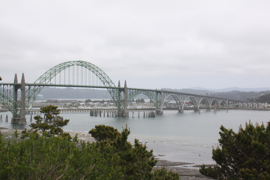
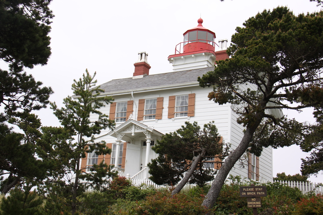
Drove northwards along the Oregon Coast Scenic Route 101, having first explored the historic harbour old town – no RV parking so could not park. Stopped at a view point to see Heceta Head Lighthouse but it was covered over for repairs! The coast became more rugged around Cape Perpetua and Cape Foulweather. Historic bridges and lighthouses – we visited the one at Yatquina Bay – a true lighthouse as the original light was in the attic of the house! We followed the coast northwards as far as Lincoln City, then turned inland.
Overnight at Walmart, McMinnville.
|
|
Tuesday 15th May
Headed north to Portland and the end of Oregon.
Visited a shopping mall but no luck with Ali’s clothes wish list. Lunch at Ikea – same goods on sale as in Europe – television tables/units were much larger as were the kitchen ovens etc. Stopped to pick up information on the state of Washington.
Overnight at Walmart, Longview. Wifi access from the Home Depot!
Wednesday 16th May
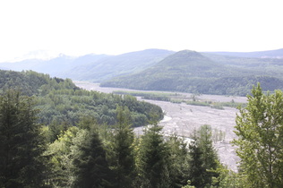
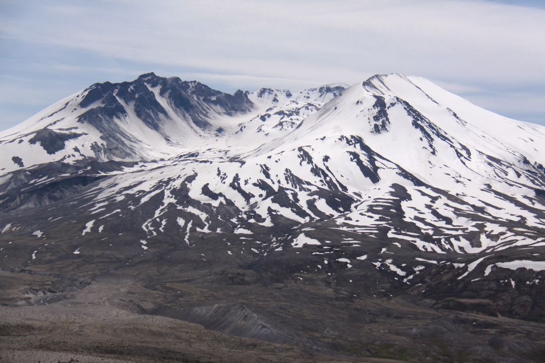
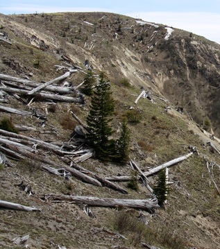
Drove a short distance to the start of the scenic route to Mount St. Helens. The route followed the valley of the North Toutle River through forestry land plantations.
Soon evidence of the eruption began – blast zone where trees were literally blown over and stripped of their leaves and vegetation.
We stopped at the Mount St. Helens Visitor Centre to learn more about the 1980 eruption – excellent video and interactive displays.
As we climbed closer to the eruption site we had excellent views of the devastation caused by the avalanche of snow and mud that poured down the mountain blocking lakes and rivers. The Toutle River is now gradually carving a new course through the ash and lava from the pyroclastic flows.
At the Johnstone Ridge Observatory we watched two more videos that dealt with various stages of the eruption.
Overnight at Walmart, Chehalis.
|
|
A long detour from this point, as we head towards Canada and the Alaska Highway[click]. Our journey round the national parks continues a month and a half later.
Wednesday 4th July
American Independence Day.
We spent the morning and early afternoon driving to Yellowstone National Park. For much of the journey we followed the Madison River – wide views through high prairie countryside.
All but two campgrounds were full in Yellowstone so we had to drive some distance before we found a place at Indian Creek – a tranquil spot.
Thursday 5th July
As Yellowstone is very crowded, we got up early.
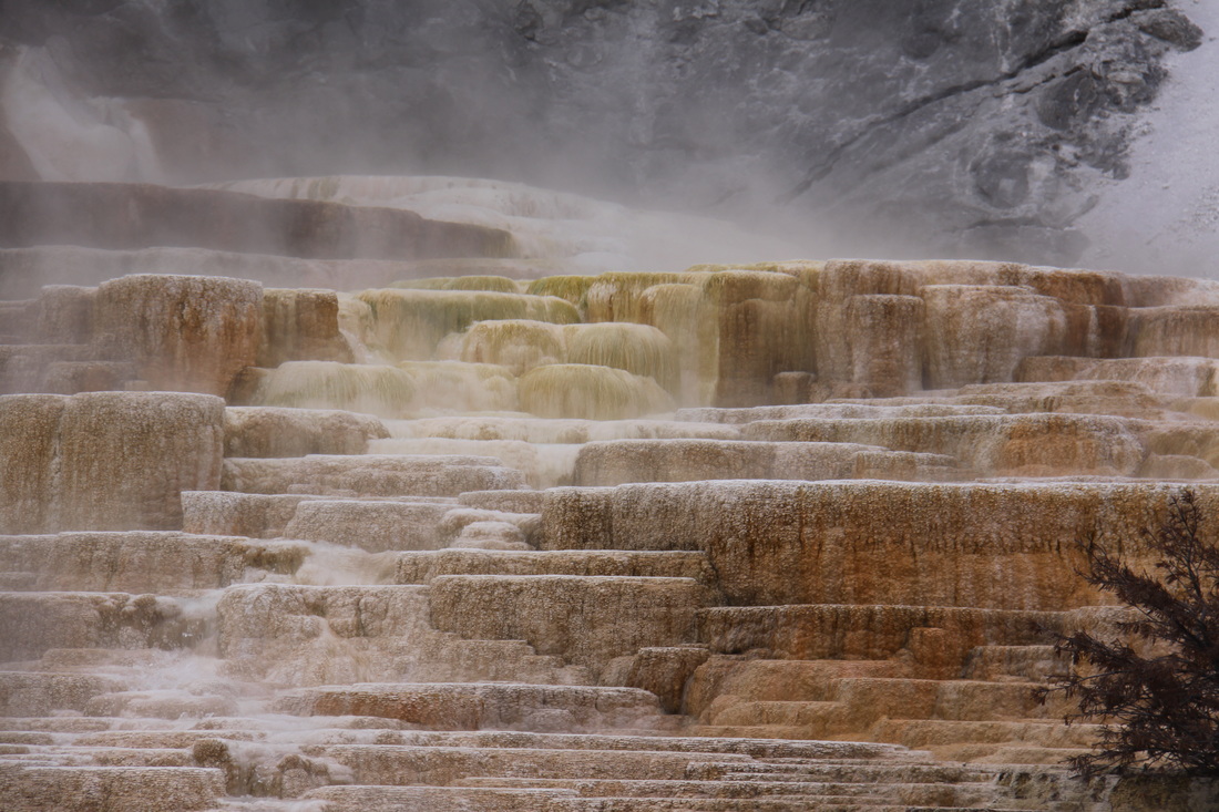
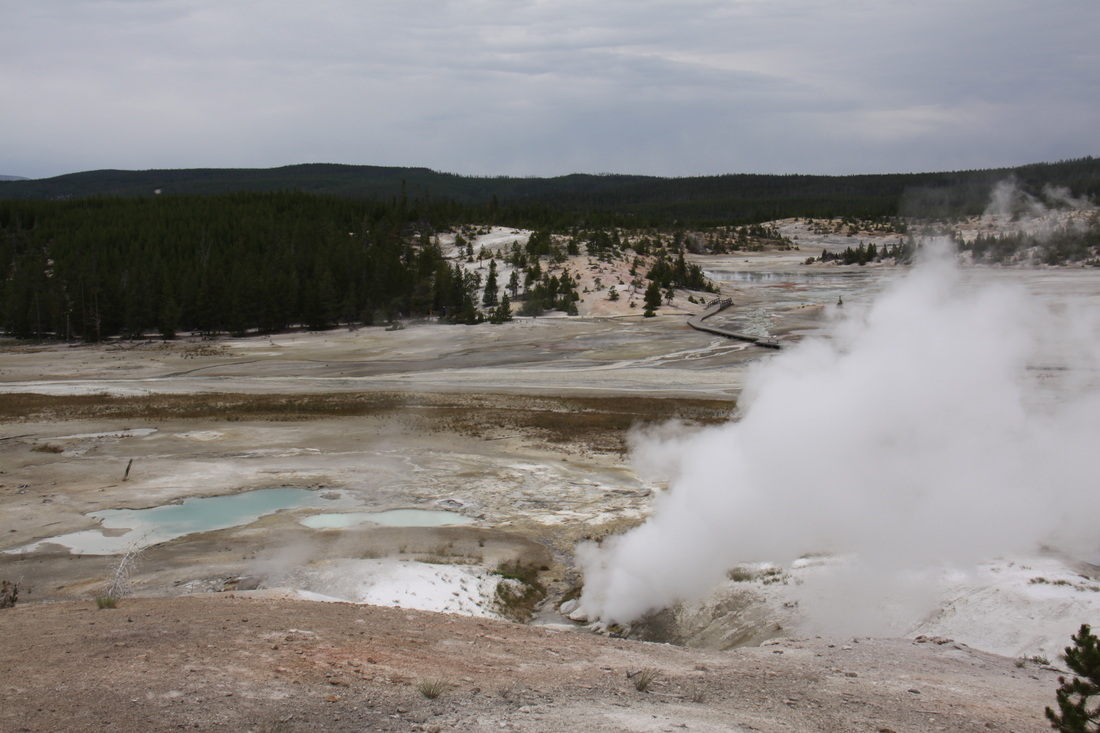
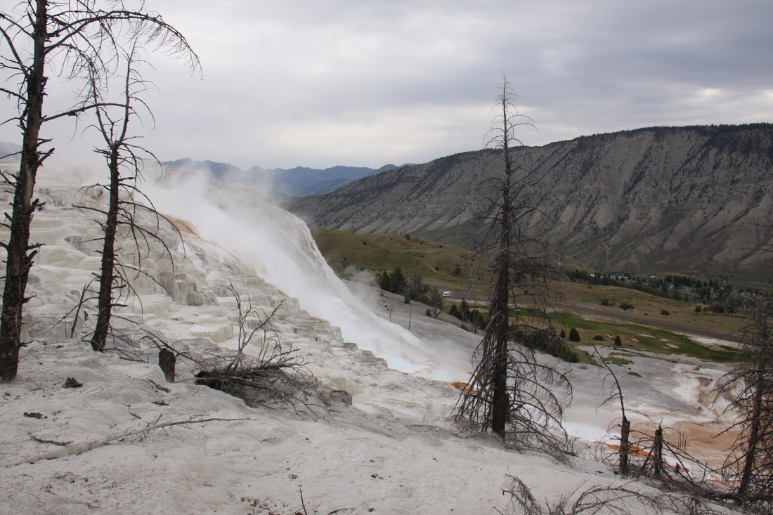
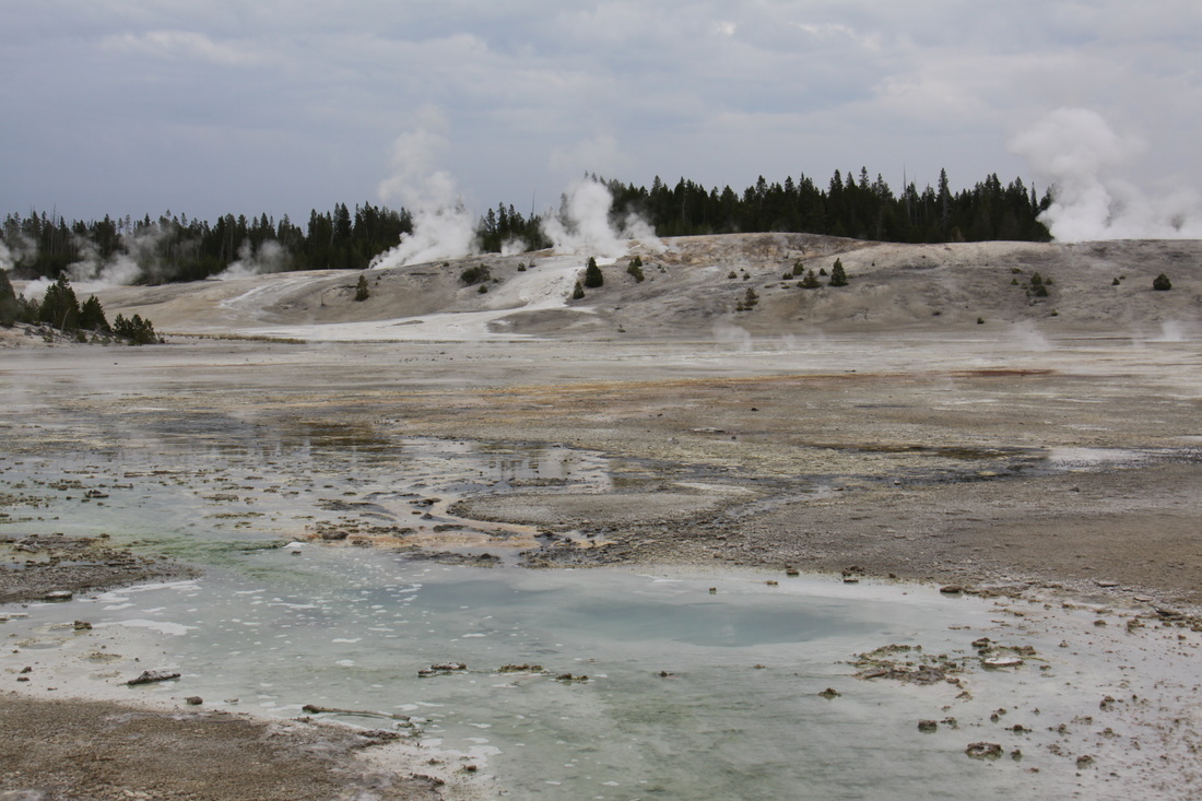
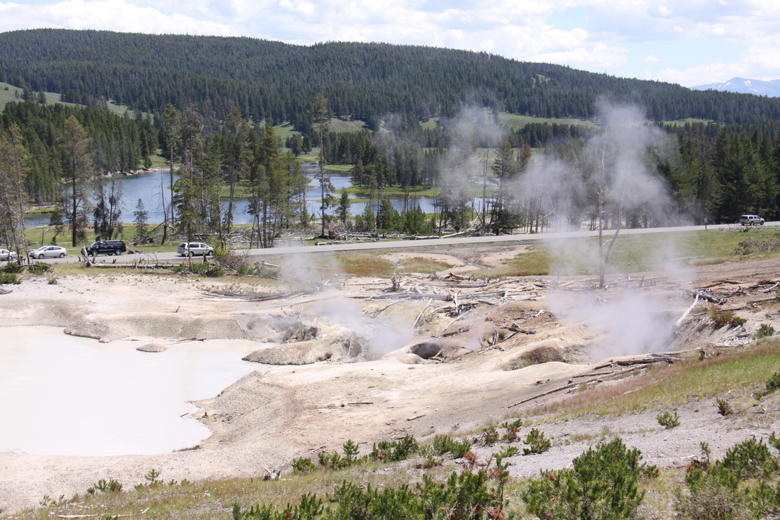
We visited Mammoth Hot Springs area and followed a number of trails through the traventines – Canary Spring was by far the most active and dramatic of the main areas of activity. Next we visited the Norris geyser basin and took the trail around Porcelain Basin – this was an area of bubbling pools and small steaming geysers. This whole area was choked with traffic and leaving the parking area was quite a challenge.
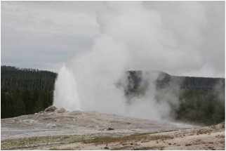
It was a slow journey down to see Old Faithful – too much traffic and hold-ups where vehicles had stopped to view wildlife. It was impossible to park near to Old Faithful so we drove back to Biscuit Basin car park for our lunch. We then returned to the area around Old Faithful and managed to park near to the General Store. We watched an eruption of Old Faithful geyser, then saw two short films about Yellowstone N P and the volcanic activity in the area.
Overnight at Norris Campground – rainy.
Overnight at Norris Campground – rainy.
|
|
Friday 6th July
Woke up to mist but this soon cleared to a beautiful, warm and sunny day.
Our first Yellowstone “site/sight” of the day was at Sulphur Caldron and Mud Volcano where we followed the self-guided tour. This whole area was very beautiful with wide open meadows grazed by herds of bison. Two even walked through the car park and stopped to have a good sniff at Nicolle.
After lunch we continued along the south loop road which followed the shore line of Yellowstone Lake.
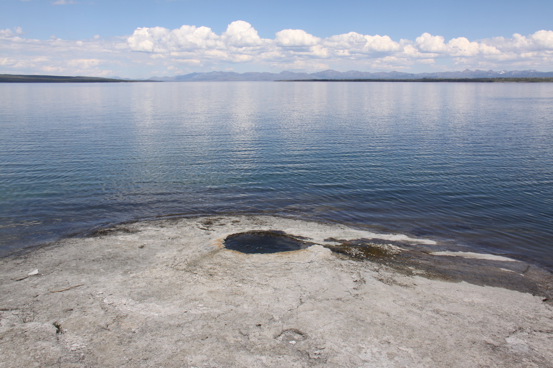
We stopped at the West Thumb Geyser Basin and as before, followed the self-guided tour through the thermal features – the most impressive were the geysers submerged under the lake.
Overnight at Lewis Lake campground near the southern entrance to the National Park.
|
|
Saturday 7th July
Had a disturbed night’s sleep thanks to our “neighbours” arriving back late and subsequent banging of car doors – they then started again very early in the morning!
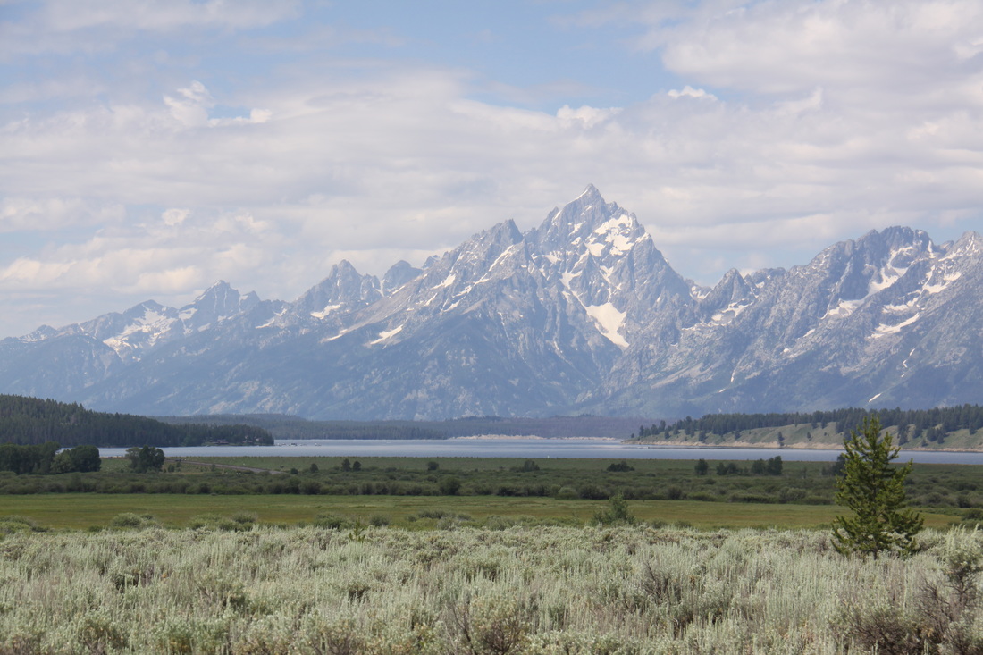
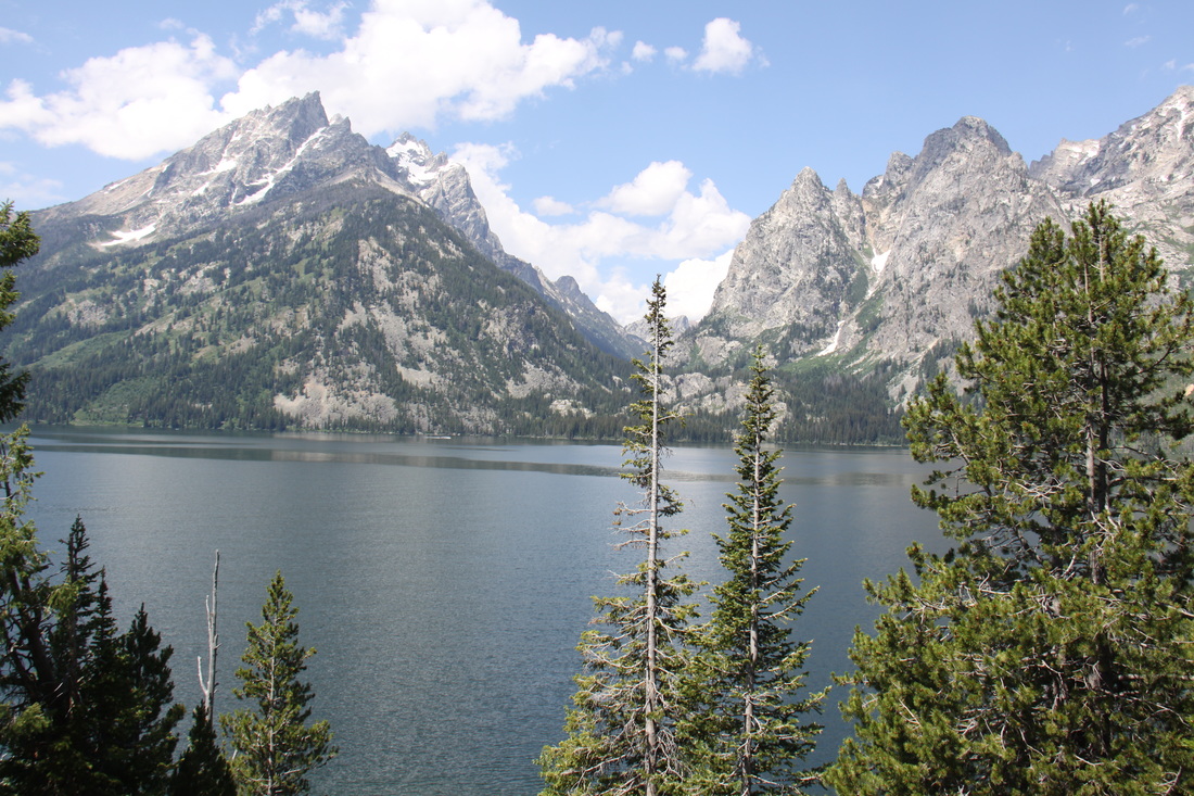
Left Yellowstone N P and drove along the John D Rockefeller, Jr. Memorial Parkway to Grand Teton National Park. The views to the Grand Teton Mountain Range were beautiful especially when viewed from across Jackson Lake. We also drove the scenic Jenny Lake Loop – awesome views of Grand Teton Mountain.
|
|
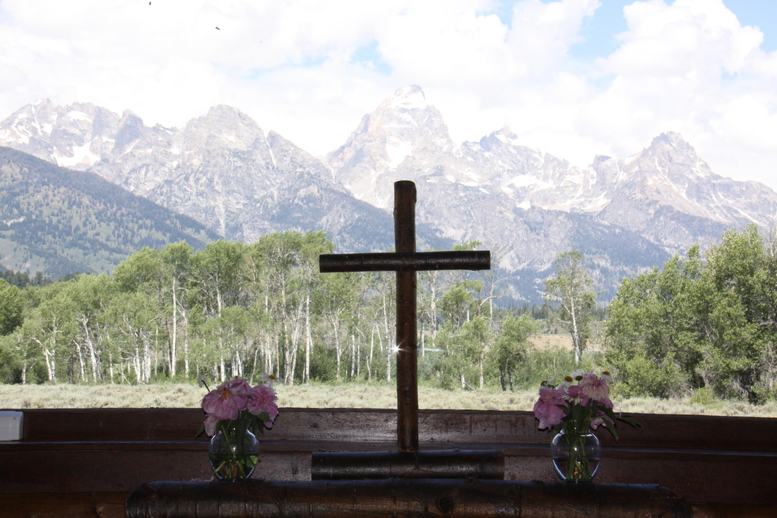
We explored the historic Menor Ferry district – homestead and outbuildings, ferry, carriages, cottage and the wooden Chapel of the Transfiguration with the view to the mountains from the altar windows.
|
|
We next headed west and gradually entered the high Badland country with colourful rocks, buttes and mesas. The vegetation was very sparse and arid.
Overnight at Walmart in Riverton.
Sunday 8th July
A driving day through the amazing scenery of south west Wyoming – high rocky desert, prairie, scrub land, mesas and cattle ranches.
We went through Laramie of wild west fame and a small abandoned settlement of Virginia which was once an important stopover on the overland trail west, a safer route than the Oregon trail to the north.
Overnight at Walmart, Loveland.
Monday 9th July
We had a prompt start to another driving day.
We headed back north to Cheyenne then east and into Nebraska. We then headed north through cattle rearing country with outcrops of sandstone buttes and enormous skies.
Obviously we had to stop at the Agate Fossil Beds National Memorial – an area of fossil remains from 19-20 million years ago. We watched an interpretive video and explored the museum.
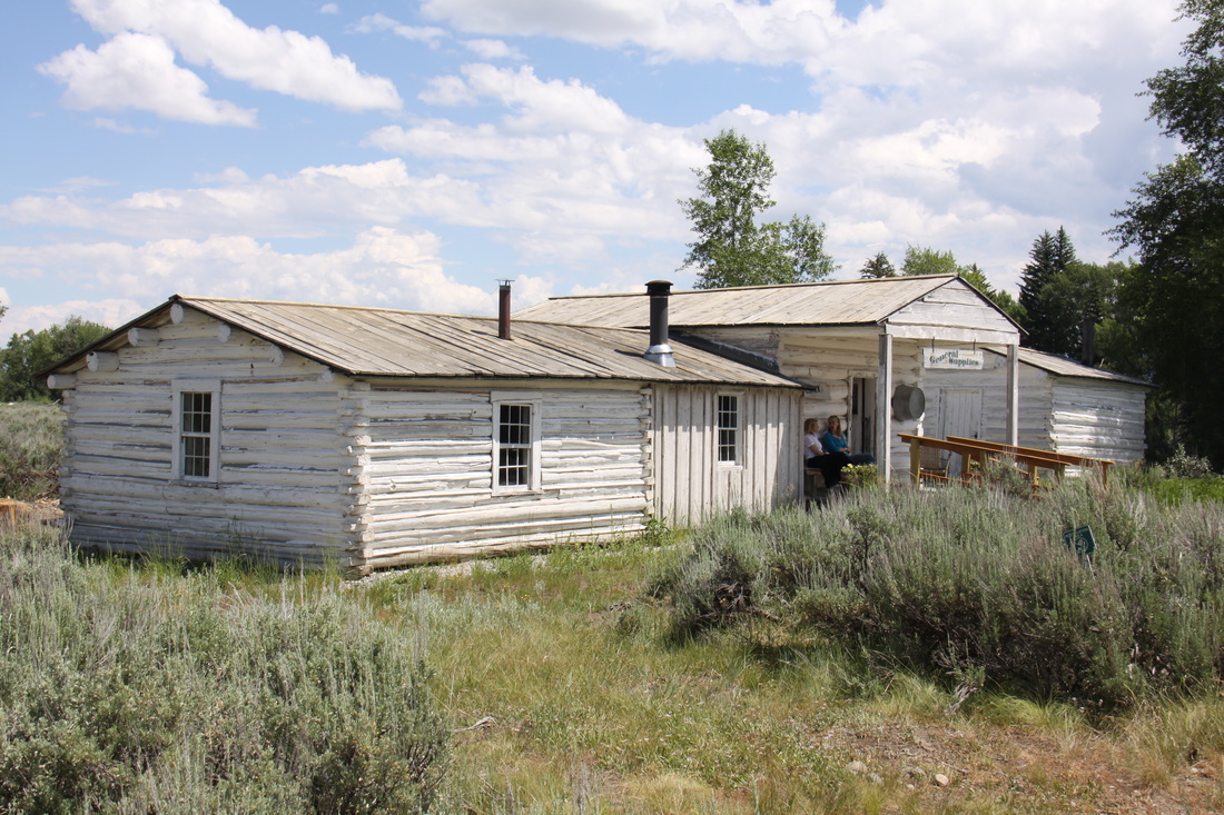
On our way towards our overnight stop at Walmart, Chadron, we passed through the small town of Harrison – old wild west buildings; and Fort Robinson, a preserved fort, parade ground and buildings from 1874.
On our way towards our overnight stop at Walmart, Chadron, we passed through the small town of Harrison – old wild west buildings; and Fort Robinson, a preserved fort, parade ground and buildings from 1874.
Tuesday 10th July
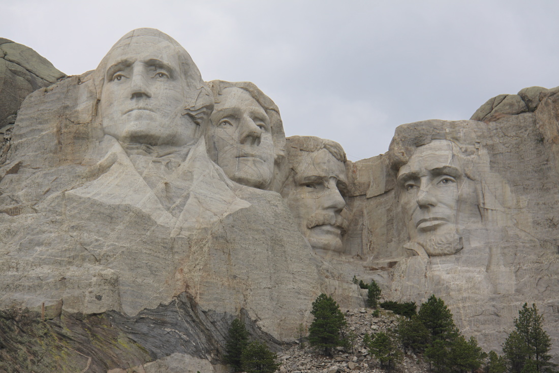
We had a short drive across prairie land to reach the Black Hills of Dakota.
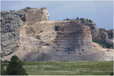
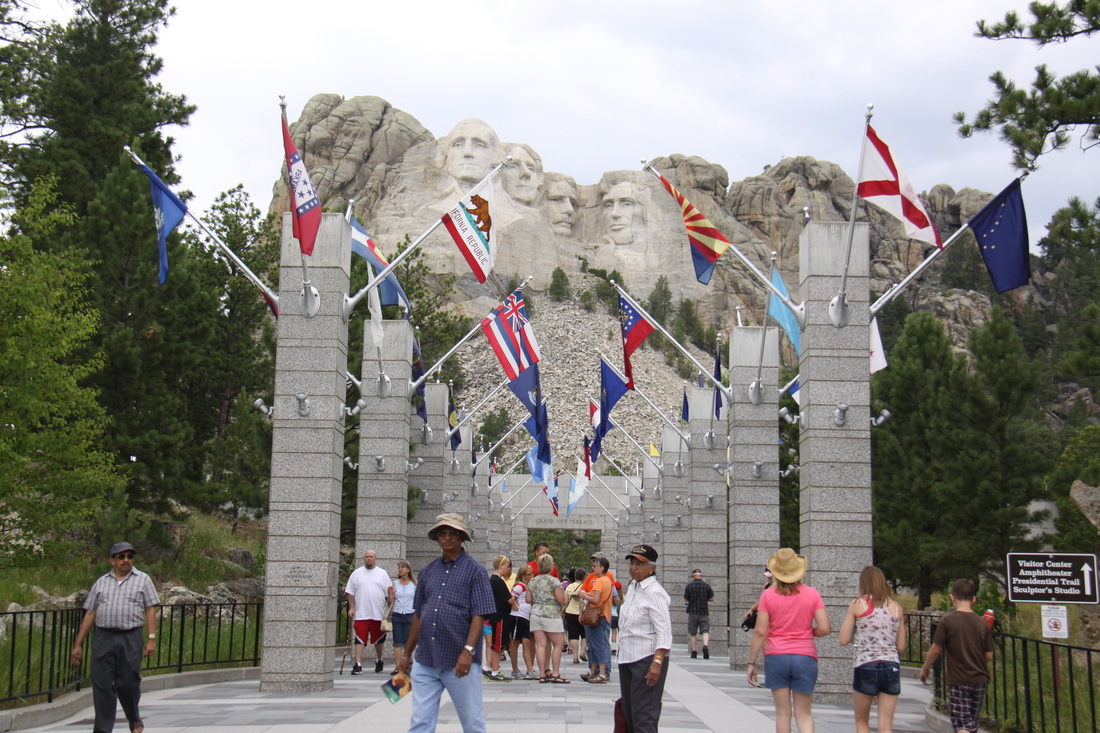
We drove through part of Wind Cove National Park, an area of rolling grasslands, before reaching the view point of the Crazy Horse Memorial. This is a giant carving in the hillside, as yet unfinished, of an Indian Chief. Our next stop was at Mount Rushmore National Monument. The four presidential heads – Washington, Jefferson, Roosevelt and Lincoln are first seen through an avenue of flags, one for each of the 50 states. We watched a movie showing the planning behind and construction of the carvings, then walked the short Presidential Way to see the memorial closer up.
We had a short drive across prairie land to reach the Black Hills of Dakota.
We drove through part of Wind Cove National Park, an area of rolling grasslands, before reaching the view point of the Crazy Horse Memorial. This is a giant carving in the hillside, as yet unfinished, of an Indian Chief. Our next stop was at Mount Rushmore National Monument. The four presidential heads – Washington, Jefferson, Roosevelt and Lincoln are first seen through an avenue of flags, one for each of the 50 states. We watched a movie showing the planning behind and construction of the carvings, then walked the short Presidential Way to see the memorial closer up.
|
|
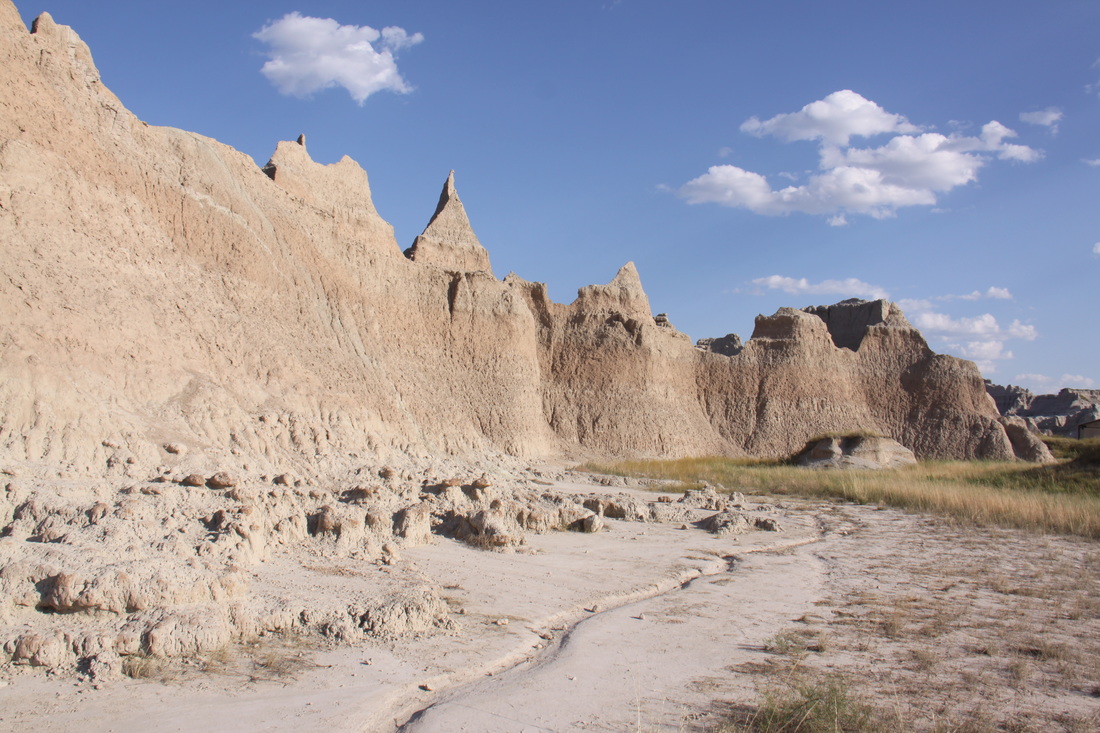
A two hour drive almost due east took us to the Badlands National Park. We made a couple of quick stops at various points before booking into Cedar Creek Campground for the night.
Wednesday 11th July
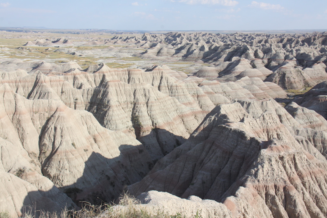
We spent the morning in and around Cedar Creek Lodge and the Badlands Visitor Centre where we watched a video about the National Park.
We then drove the loop road through the park – fascinating scenery of pillars, pinnacles, buttes and grasslands.
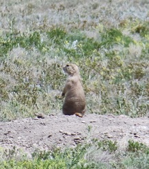
We saw prairie dogs who disappeared into their burrows if you got too close; and big horn sheep who blended into the natural rocks and canyons.
We had lunch at Wall Drug, a real touristy, tatty complex of mock western style buildings. The lunch was enormous but good.
Next we drove to Pierre, the state capitol of South Dakota where we stayed overnight on Walmart carpark.
We spent the morning in and around Cedar Creek Lodge and the Badlands Visitor Centre where we watched a video about the National Park.
We then drove the loop road through the park – fascinating scenery of pillars, pinnacles, buttes and grasslands.
We saw prairie dogs who disappeared into their burrows if you got too close; and big horn sheep who blended into the natural rocks and canyons.
We had lunch at Wall Drug, a real touristy, tatty complex of mock western style buildings. The lunch was enormous but good.
Next we drove to Pierre, the state capitol of South Dakota where we stayed overnight on Walmart carpark.
|
|